Search This Blog

Thursday, January 27, 2022

Mine Mountain Ridge(West Cornwall, Connecticut-Litchfield Hills)

Headed down to the beautiful Litchfield Hills in the NW corner of Connecticut this afternoon to do a little exploring along the north ridge of Mine Mountain.  Mine Mountain is actually a long north-south ridge with multiple summit knobs sitting high above the east banks of the Housatonic River.  To access the mountain, I utilized the Trinity Riverside Trail, which can be found at the very end of Lower River Road, and begins on Trinity Retreat Center Property before entering the Housatonic State Forest.(Elevation at the Trailhead is just a touch over 500 feet).  With the sun shining bright and the trail well used I threw my spikes on and headed south, closely hugging the Housatonic.

(FYI-The public is welcome on Trinity Retreat Center property)

The Housatonic River is just steps away from the trail, which heads south for 1.4 miles.
After about a half mile on the trail, I turned left and began my bushwhack, crossing over the Housatonic Railroad tracks.
The woods are very, very steep but manageable if you pick out a good route.  It was actually quite fun and challenging, gaining over 500 feet in less than a quarter mile. 
The snow actually helped me gain traction in steeper parts, and I was able to enjoy some pretty good views back west on the way up. 
Instead of going straight up, I contoured my way south towards an area of ledges.  From a small perch I was able to enjoy a spectacular view south over the deep River valley, with Mine's true summit(left) as well as Breadloaf Mountain and Silver Mountain in the distance.   To the far right, and almost out of frame is Pine Knob.
After taking in the views, I headed north along the ridge on a blue marked trail, which apparently doesn't see much use, as there were no tracks in the snow at all.
From the very end of the north ridge, and directly above the Trinity Retreat Center, I found amazing NW facing views across the River towards Pine Swamp Hill's multiple summits.
West views with the Housatonic River directly below.
The toughest part of the entire hike was trying to find a route down, as the slopes are quite steep both north and west.  The easiest descent appeared to be on the east slopes, so that is the way I went, carefully weaving my way down.  Once off the steepest slopes, I circled around to the north, leaving the State Forest and heading across Trinity property back to my car.  A fun little adventure on a cool, but pleasant mid winter day.  2.7 miles RT, with 800 feet of climbing.  

 Red P=Parking    Black X=Ledge


Tuesday, January 25, 2022

Palmer Road Preserve(Town of Schodack, Rensselaer County)

Did a short, local walk in Schodack this afternoon at the 57 acre Palmer Road Preserve, which is now owned and managed by the Rensselaer Land Trust.  Parked at the end of Thoroughbred Drive and set out under clearing skies and temps hovering around freezing, with about an inch of crunchy snow on the ground.

Explored various official and unofficial trails through the quiet woods. 

The highlight of the preserve is an unnamed tributary of the Moordener Kill, which flows through the woods here.  With our recent cold snap, it was looking very wintry today.

Walked a nice and easy 1.5 miles total.  Felt good to get out and shake off some cabin fever.


Wednesday, January 19, 2022

Former Beartown Ski Area(Beartown Mountain State Forest-Berkshires)

Decided to take advantage of the last "mild" day for the foreseeable future by checking out an abandoned ski area on the northern slopes of Beartown State Forest in the Berkshires.  Unfortunately, the ski slopes are no longer visible from below but were located on Burgoyne Ridge, which itself is easily visible directly above the Onyx Paper Factory on Route 102 in South Lee. The Ski Area ran from the mid 1930's until the mid 1960's, and was, for a time, one of the largest ski areas in southern New England.  Other regional Ski Resorts, however, began to grow and expand by the 60's, featuring modern lifts and snow guns, which ended up leaving Beartown out in the cold after three decades.

My goal today was to check out some of the remnants of the old Ski Area, so I headed onto the backroads of South Lee, parking at Gate 4 on Beartown Road, just past its intersection with Pine Street and Willow Ave.(Elevation 960 feet)

From the gate I headed west on an unmarked but obvious wide, old woods road. There was only about 3 inches of snow on the ground to start so I decided to carry my snowshoes and wear only if needed up higher.  In less than 3/4 mile of easy hiking, I arrived at Twin Chimneys, which were erected back in 1939 and were part of the CCC Lodge.  

Another angle of the Twin Chimneys, still standing strong after all of these years. 

From the Twin Chimneys, I headed up onto the Polar Trail, which was the main ski slope at Beartown.  Although there are no trail blazes, it is pretty easy to follow the old slopes, as they ascent quite steeply up through open woods.  I turned around several times on my way up, enjoying some very good, filtered views to the north. 

The climb was fairly aggressive, gaining over 650 feet in less than half a mile.  The snow drifted a bit in spots as well, but was never more than 5 or 6 inches at its deepest.

After a good, thigh burning climb, I hit a dark conifer forest and the yellow blazed Ridge Trail, which I briefly followed up to the high spot on Burgoyne Ridge at 1703 feet Elevation. 
After hitting the nondescript high spot, I turned back east, following the Ridge Trail past some more rusted, old, ski resort remnants.
I took the Ridge Trail over to the Kodiak Trail, which was another old ski slope, but even steeper than the Polar Trail.  This trail, at the time of operation, was rated as "Expert" level, and is indeed quite vertical in spots.  I can only imagine how challenging this terrain must have been on a pair of skis.  
A bit lower down on the Kodiak Trail, with the woods seemingly dropping north into the abyss below.
From a small opening in the trees, a look NW towards Yokun Ridge.

I descended steeply back down to the woods road I started on, eventually making my way east back to the car.  Turned out to be a pretty nice day out, with clearing skies and temps in the mid to upper 30's.  Hiked just under 2.5 miles RT, with 800 feet of total ascent for the afternoon. 

For further reading on this and other former Ski Areas in New England, please refer to one of the these amazing sites!

 https://www.nelsap.org/ma/beartown.html

 https://www.newenglandskihistory.com/Massachusetts/beartownmtn.php


Tuesday, January 18, 2022

Cohotate Preserve & Willows at Brandow Point(Greene County-Hudson Valley)

Headed down to the west shores of the Hudson River in Greene County today to do some winter hiking at the Cohotate Preserve as well as neighboring Willows at Brandow Point.  Following yesterday's winter storm, I wasn't sure if the parking lot would be plowed out, but to my luck it was! I was the only car in the lot, and I was also the first to set foot in the fresh blanket of new snow.  There was only about 2 inches of crusty, crunchy snow to walk through so I bare booted it, soon dropping down to the Hudson. A cold wind and temps in the 20's made for brisk conditions, but bluebird skies more than made up for that as I enjoyed an icy view of the Rip Van Winkle Bridge to the south.


A view north up the Hudson River towards Coxsackie.

The trails in the preserve closely follow the Hudson River through the woods, weaving their way through small ravines over several foot bridges along the way.

The Cohotate Preserve is connected to the Willows at Brandow Point by an orange connector trail, which I utiliized to access both trail systems.  Found some informative signage along the way as well.

From Brandow Point, the view south towards the Rip Van Winkle Bridge is similar to the one earlier, although a bit further away.
An old shack near the Point. 
I explored the various trails at both preserves, only seeing a couple other people out all day.  Back near the trailhead at the Cohotate Preserve, I made one side pit stop at a small, frozen over, man made pond.

Hiked about 2.8 miles total altogether with a surprising 500 feet of ascent due to all the small ups and downs along the way.


Thursday, January 13, 2022

Taconic Trail State Park Loop(Northern Berkshires/ Taconics)

Headed just over the state line into Massachusetts this afternoon to do a loop hike up the Taconic slopes north of Route 2 and then back down south of Route 2, utilizing the Taconic Trail State Park trails as well as the Taconic Crest Trail.  I parked at the trailhead for the Sara Tenney Trail in a large pull off along Route 2(Elevation 1560 feet) approximately 1.5 miles east of the NY state line.  After carefully crossing the road, I turned left onto the RRR Brooks Trail, which basically parallels Route 2 climbing steadily northwest.  I decided to bare boot the hike because there was only a light coating of fluffy snow atop 2 inches of crunchy frozen snow.

There were more animal tracks than hiker footprints in the fresh snow, as I made a very pleasant ascent up to the Shepherds Well Trail.  Once on the Shepherds Well Trail, and passing over the 2000 foot mark, fresh snow seemed to coat every single branch on every single tree.

Emerging into a large clearing at about 2260 feet, ice now began to replace snow on the exposed bushes.

The views from this clearing are nothing short of spectacular.  The view east encompasses the valley of rural South Williamstown, as well as the massive Greylock Range. Brodie Mountain is visible to the south and the eastern flanks of the neighboring Taconic Range to the far right.

From the same clearing, the south view takes in Mount Raimer in the foreground and Berlin Mountain beyond.
To the west/ southwest Route 2 at Petersburg Pass can be seen just below Mount Raimer, which towers above.  The old ski slopes of Petersburg Pass can still be seen with the leaves off the trees.

After enjoying the wonderful views, I pressed on, continuing my way along the Shepherds Well Trail, soon coming to a large meadow just below the summit of White Rocks. 

The trail meanders north after the meadow, dropping slightly, before climbing up and meeting the Taconic Crest Trail.  This was the only spot I saw other hikers all day, as a small group was heading north on the Taconic Crest Trail.
Once on the TCT, I headed south, losing some more elevation, before climbing briefly back up to a great west facing view point into New York State. 

From the viewpoint, it is a short but steep drop down to Route 2, which I crossed over and into the large parking lot for Petersburg Pass.  At the far SE corner of the lot, the Sara Tenney Trail, barely noticeable, drops into the woods.

The Sara Tenney Trail descends sharply SE, crossing the small North Branch of Hemlock Brook and continuing down the east slopes of Mount Raimer through a large, picturesque stand of paper birch.
A nice benefit of hiking in the winter, is that you can see many things through the bare trees that you wouldn't spot otherwise.  Across the deep valley of Treadwell Hollow, a keen eye can pick out Route 2.

The Sara Tenney Trail continues its descent into Treadwell Hollow, where there are still many remnants of past human use, such as this old, abandoned car.

Crossing over wintry Hemlock Brook.
The trail bottomed out at 1240 feet, nearly 800 feet below Petersburg Pass!  As I climbed up and out of Treadwell Hollow nearing the car, I emerged into clearing skies and bright, welcome sunshine.

A very pleasant 4.5 miles RT with over 1100 feet of total ascent.  Thankfully got out and enjoyed the brief sun and mid to upper 30 degree temps before a blast of arctic air hits us this weekend.

Map below.


Monday, January 10, 2022

Rips Rock and Unnamed North Mountain Ledges(Winter Clove Property/ Windham-Blackhead Range Wilderness-Catskills)

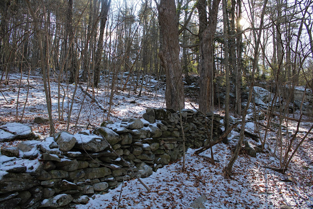
Headed down into the Catskills today to check out some well known ledges(Rips Rock) and some lesser known ledges(unnamed 2400 foot ledges) on a cold winter day.  I parked at the Winter Clove Inn (Elevation 915 feet) and set out on their trail system, with wind chills in the single digits.  The trails are much better marked than my last visit here, as they meander past small streams and old stone walls.  I threw my spikes in my pack, but bare booted it the entire day, as there was only about a coating to an inch of crusty snow.


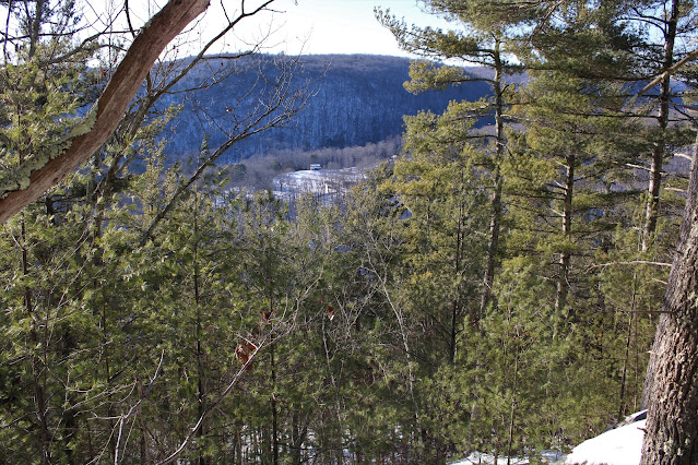
There a maze of seldom used trails that spread out from the Inn, with many different options available to hike.  As I slowly gained elevation, I saw a small clearing and Lean To, so I made a quick pit stop to check it out. Although it is much smaller than a typical Lean To, and with a dirt floor, I still found it quaint.


From the Lean To, I basically followed the Webster Pass Trail, ascending gradually, making one side trip to check out frozen Lost Pond.


The Webster Pass Trail meets up with Rips Rock Trail, which climbs much more steeply, criss-crossing a small stream several times along the way.


As I began to ascend more steadily, I thankfully began to warm up, soon coming to the spot known as Indian Lookout.  From here, there is a nice view east over the Hudson Valley from a small opening in the trees. Just left(out of frame)and barely visible from here, is Cairo Round Top.


The climbing continues west into a draw, with enormous cliff bands emerging above to the right.  The red blazes turn left and circle around an impressive gorge, with North Mountain's ridge suddenly coming into view high above to the right.

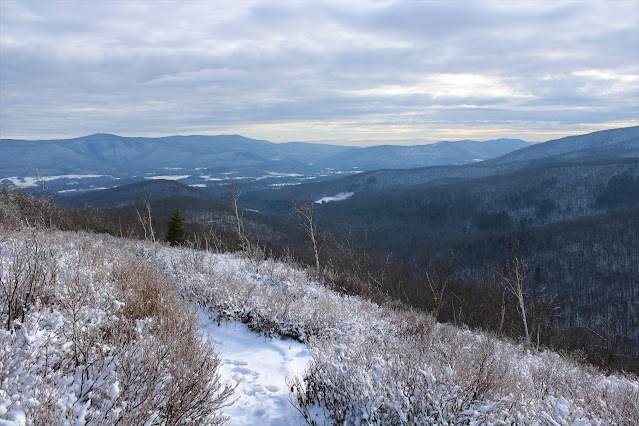
A short distance further, the ledges really begin to open up, now providing a spectacular view over a much of the Hudson River Valley.  At an elevation over 1800 feet, this is the area known as Rips Rock. 

The drop off from these ledges is very steep, with the deep cut of Stony Brook far below.  With the leaves off the trees, Mountain House Turnpike can clearly be seen as well.

From Rips Rock I turned back, retracing my steps down into the deep draw, where I left the trail and began my bushwhack west, climbing steeply up.  There were several large cliff bands I had to contend with, each presenting their own unique challenge. 

After negotiating one such area of cliff bands, I found the open ledges I had been looking for.  At just over 2400 feet, the view east was even broader than the one from Rips Rock.

From this perch, I found a great view south at the next ridge coming down off North Mountain.

Contouring my way south, I found a smaller ledge, but with spectacular views.  The view east from this ledge takes in Rips Rock and Stony Brook clove to the right.  The woods on the left are basically the route I had taken up from Rips Rock.


From the ledge, taking in the up close view of the next ridge south.

From the open ledges, I pushed on, continuing a very steep climb up through more rugged cliff bands.


I circled over to the steep, east facing escarpment wall, checking out some screened views north towards Stoppel Point and the Blackheads.

I carefully made my way along the escarpment wall, finding a couple very good views east. It was tough to find a lot of leg room, but I was able to find one good ledge at about 2500 feet, with views northeast.  Afternoon shadows began to encroach in the valley directly below.  A careful eye can pick out the lake effect snow bands off in the distance too.
North views along the Wall of Manitou towards Acra Point.
I carefully made my way down off the steep ledges up high, working my way back down to the trail, which I followed back to the car.  Once back down low at the Inn, I made one last short walk over to Artist Falls, which is one of the most picturesque spots in the Catskills. 
I hiked about 6 miles RT, with nearly 2000 feet of total ascent for the day.  Didn't see another person all day on this cold mid winter day.