Search This Blog

Monday, November 29, 2021

Hannacroix Creek Preserve(New Baltimore Conservancy-Greene County)

Headed down to the 113 acre Hannacroix Creek Preserve, located at the Albany/ Greene County line along the west shore of the Hudson River on a somber, overcast day.  Have hiked here several times in the past, but been a while so it was nice to pay it another visit. Was a bit surprised to be the only car in the lot when I arrived in the early afternoon, but the dreary, mid-week weather probably kept most folks away.   

Got started on the Irving Trail, which climbs steadily uphill before then descending down to the Hannacroix Creek.  There are two trail options to get down to the water, with one dropping steeply, while the other a bit more mellow, but either way will get you there.  Once down near the creek, I checked out the historical remains of the 19th century Crowsel-Parson Paper Mill, which sit just off the trail.

The blue blazed trail eventually dead ends at the picturesque falls on the Hannacroix Creek.  This a very nice spot to stop and relax for a few moments, soaking in the serenity.  
Looping back on the wide, old cart road, which climbs steadily back up and away from the creek.
From a trail junction, I took the yellow blazed North Trail back to the parking area and then across Route 144 to the Hudson River trail, which passes through a wetland area on a long boardwalk. 
Nearing the river, an old brick chimney from many years ago can be seen sitting back in the woods.
After passing through a tidal area, the trail continues a short distance east, emerging from the woods with a glimpse of the Hudson River ahead. 
From the trail's end, a view across the mighty Hudson River, with a barge coming downstream.
Zoom view of the barge, presumably heading south from the Port of Albany with supplies.
After a few minutes, I headed back from the river to the parking area, not seeing another person the entire time.  A pleasant little 2.2 mile local hike at a local gem. 
 

Saturday, November 27, 2021

Van Rensselaer Forest and Wildlife Preserve(Town of Bethlehem, Albany County)

Decided to check out the Van Rensselaer Forest and Wildlife Preserve in Glenmont, a somewhat obscure open space that is owned and managed by the First Reformed Church of Bethlehem.  The main trailhead is located off of Route 9W just south of Elmwood Cemetery, but being such a busy road, I decided to use the alternate entrance from the nearby church itself.  Cold and breezy, winter like conditions greeted me as I set out on Ted Luidens Trail to start.

The trails are in need of TLC, as most of them have fallen into a bad state of despair.  Even the several small wooden footbridges have began to rot and some appear unsafe.  This bridge was actually probably the nicest of them all.
If prickers are your cup of tea, then this preserve is for you! 
Emerging at the clearing near the Route 9W entrance, with rushing traffic on a busy holiday weekend rushing by.
A badly eroded picnic table sitting sadly beside the trail.  I saw a few wooden bird houses that looked to be in rough shape as well.
I ventured down to the pond, which I'm sure at one point was a nice, pleasant spot to visit.  Prickers and thick bushes have completely overgrown the entire perimeter of the pond, however, making it all but impossible to get a clear view of the water now.  Even the wooden viewing bench has been nearly reclaimed by nature.
I'm not really sure what has happened here, but it looks like there is basically no maintenance of any kind in these woods.  It's sad to see because it looks as though this was a nice place to visit some time ago, but those days are long gone.  I took most of the trails here, and bushwhacked where trails disappeared altogether for a total of about 1.5 miles of wandering around.
 

Wednesday, November 24, 2021

Tekoa Mountain(Tekoa Mountain Wildlife Management Area, Massachusetts)

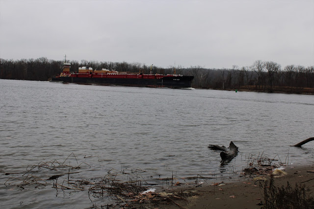
If you have ever driven the Massachusetts Turnpike(I-90) eastbound, you've probably noticed a large, rocky peak perched high above the interstate a few miles before Exit 3 in the town of Russell.  That impressive area of cliffs and open rock had always intrigued me, and after doing some digging I discovered that the peak is 1121 foot Tekoa Mountain and it is open to the public.  I decided to pay a visit today, starting from a Mass Wildlife Management Area informal parking area near train tracks and an old, abandoned factory off of what is marked as Pochassic Road(Elevation 250 feet). 

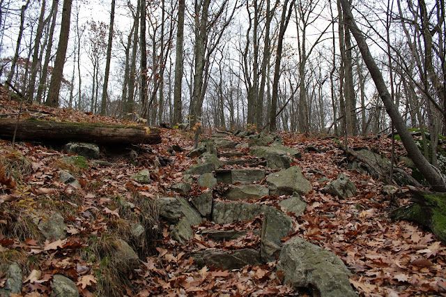
Beyond the Wildlife Management Area sign, a good woods road heads uphill, climbing steadily east/northeast.  Fallen leaves cover the ground, making for a bit of a slick go in spots.  On again-off again red paint blazes help guide the way.

A short distance in, the woods road peters out, quickly being replaced by a foot path and still marked with red paint but a bit less obvious.  The ascent becomes increasingly steep, soon passing over open rock slab with some pretty decent views.  The rocky spine of the nearby ridge makes for quite an impressive backdrop.

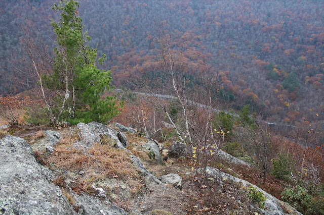
As the elevation and open rock areas both increase, the views to the south really begin to open up, providing a nice glimpse of the Westfield River and Mass Pike below.

As the foot path levels out, it emerges into a large clearing.  From there, two herd paths drop down to a set of south facing ledges and incredible vistas.  Traffic can easily be seen traveling along the Mass Pike as it crosses over the Westfield River with the hills of Connecticut on the horizon.

The ledges here are truly incredible and well worth the effort of exploring them.  There are many solid vantage points to enjoy the surrounding countryside.  Here is a view SW towards Russell Mountain, with the Westfield River again snaking below.

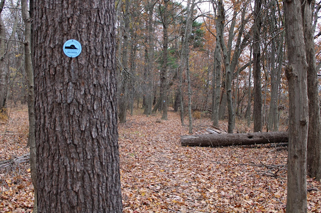
After enjoying the open ledges, I headed back up to the large clearing, where the red blazes continue north on a wide woods road again.  After a very short distance on that, I took a left turn onto a faint foot path, blazed with occasional white paint.  With just a little searching off that path, I was able to find a view towards another large area of nearby rock ledges.
As luck would have it, the white blazed path lead me directly over to the open rock and its amazing views.
To the SW, I found this great view towards Woronco, a small village along the Westfield, as well as the rolling hills of Hampden County.

Continuing along, I seemed to find one good clearing after another, each providing spectacular views. 

The path leads close to the 1121 foot summit, which is fairly nondescript, and marked with a small rock cairn.
After hitting the top, I decided to continue north along the ridge for just a bit, descending down ever so slightly to some more views.  The nearby hills to the NW were now visible from this part of the ridge.
After the trail began to drop a bit more steadily into the woods, I decided to turn back, heading back south towards the first large clearing I had come to.  Instead of going all the way back though, I decided to turn SE onto another foot path which heads off onto another arm of the peak.  From this arm, I was able to locate additional views, this time stretching to the east. 
From an open ledge off trail, I enjoyed this view of the unnamed ridge to the east, which looked like it may have views to offer as well.

A small clearing on the SE arm provided this great view of the first set of ledges I had been on earlier. 

Back on the main trail, I found some more SE views. 

After finally dragging myself away from the many awesome views atop Tekoa's ledges, I headed back down the red blazed path and woods road to the car.  Back near the bottom of the mountain, I passed by two bow hunters who nodded and then continued into the woods.

A lot of bang for the buck on this beauty, with 3.3 miles RT and 1300 feet of combined ascent.  There is still a lot of exploring to be had on this mountain that I didn't get to today.  What a fun little hike this proved to be.  The only downfall from today was that I didn't have more time available.


Friday, November 19, 2021

Shenandoah Mountain to Canopus Lake Overlook(Appalachian Trail/ Fahnestock State Park, Putnum County, NY)

On the heels of a tough week in my personal life, it felt good to be back out in the woods this afternoon, hiking a small section of the Appalachian Trail near the Dutchess County/ Putnum County line.  With mostly overcast conditions and lake effect snow squalls around, I wasn't really sure what to expect, but just hoped for the best.  To get there, I took the Taconic State Parkway south to Exit 35, where I then followed Miller Hill Road to Long Hill Road.  Long Hill Road starts paved but quickly becomes a fairly steep dirt road leading up to a small, unmarked parking area where the Appalachian Trail crosses(Elevation 1017 feet). 

One of the nice things about this time of year and especially on cloudy days, is that you tend to see a lot less hikers out.  This was the case today, as there were no other cars there when I arrived, so it looked like I would have the woods to myself.  Heading south from the car, I followed the familiar white blazes of the AT, climbing gradually up on a carpet of fallen leaves.  There is some very beautiful stonework laid out through this section of the woods which I took a moment to admire.


Barely feeling like I had broken a sweat, only 4/10 of a mile from the car and after roughly 250 feet of climbing, I arrived atop the bare rock 1282 foot summit of Shenandoah.  A benchmark with the writing "Looking 1933" can be found at the top of the mountain. 

The summit is very open and quite nice, with some pretty decent views to enjoy too.  A 9/11 tribute painted on the open rock is just steps away from the summit benchmark. 
While the summit is open-and the views are nice- it is not quite high enough to offer sweeping views.  The overcast conditions didn't help much either, but I did enjoy the views of the surrounding hills.  This view SE, looks out over nearby powerline cut and the Taconic Parkway as well as the hills of northern Putnum County.

While at the summit, I was hoping for the skies to clear out, but the best I got was a slight clearing north into Dutchess County.  On a clear day, I'm sure the views are very nice up here.

The trail continues south off the summit, where an easy descent drops you back into the woods, passing by a multitude of stone walls. 

The very last of fall's foliage, barely hanging on. While it wasn't a great year for fall colors, it was a long and drawn out foliage season, with colors hanging on well into November in many areas. 
The trail meanders along with some very small ups and downs and passing by a blue blazed trail that drops off to the east.  Beyond that, about 6/10 of a mile further south and up on top of the next ridge, there is a small, unmarked path that offers up some nice west facing views towards Round Mountain and the other nearby ridgelines.  

Just over 1/10 of a mile past the west facing view, the trail drops down to a sweet viewpoint out over Canopus Lake.  This view was actually better than I anticipated, with the lake sprawling out below at the foot of the slopes.  After a couple of minutes enjoying the view, I turned back, retracing my steps north.

On the return hike, I decided to leave the trail and head over to some east facing ledges, which offered up somewhat obscured east views.

Headed back over to the trail and followed it back north over Shenandoah and then down to the car, barely beating the fleeting daylight.  These early sunsets sure can be frustrating!  Hiked about 4.7 miles total with 700 feet of ascent.  Pleasantly surprised that I didn't see another person all day.


Thursday, November 11, 2021

Bender Melon Farm Preserve(Town of New Scotland, Albany County)

With a small window of time after work today, I decided to check out 175 acre Bender Melon Farm Preserv, the Mohawk Hudson Land Conservancy's newest preserve, located off of Hilton Road in the town of New Scotland. I parked in the lot next to the Hilton Barn, which appears to be in some form of rehabilitation and headed east into the woods.

There are two, wide easy to follow stone covered trails
Arriving at a kiosk for the preserve, where the last of fall's colors are still lingering at the start of David's Trail.
Just steps beyond the kiosk is a nice view southwest across an open meadow towards the Albany County hills.
The trail enters the woods heading SE for a short distance, soon coming to a loop option.  I turned left here, where the trail head south, skirting the edge of the meadow.
David's Trail forms a 7/10 of a mile loop through the woods, with the unfortunate sounds of nearby traffic on Route 85a easily audible.
Completed all three trails for a total of just under a mile and a half and surprisingly didn't see anyone else in the woods(although there were many others on the neighboring bike path).  The Conservancy has plans of building more trails here in the future, and I look forward to checking them out.  Another wonderful job by the MHLC of preserving this historic, natural resource for public use.  Many thanks to those who made this happen!
 

Tuesday, November 9, 2021

Negus Mountain(Northern Berkhsires)

Decided to head east into the rugged highlands of the northern Berkshires today to re-hike 1775 foot Negus Mountain, a small but memorable peak I had climbed a few years ago.  A mix of clouds and fleeting sun, as well as temps near 60 degrees greeted me as I arrived at the unmarked parking area along Zoar Road(Elevation 654 feet), just east of a bridge crossing over the Deerfield River.  From the parking area, I entered the woods for a few yards to a railroad crossing and then picked up the marked trail, heading northeast.

The ascent NE begins almost immediately and becomes increasingly steeper through open hardwoods..  Fallen, slick leaves made footing a bit difficult on the steeper stretches but taking my time I had no issues.  Within just a few minutes, the woods give way to open grassy areas mixed with bare rock.

An early peek at the false summit cone poking out high above.
South view towards Todd Mountain in the Mohawk Trail State Forest.

The trail is quite steep and very exposed meaning that good views can be enjoyed almost throughout.  This was a nice view SE a few steps off trail towards Berkshire East Ski Area.

As the elevation increases, the views get better as well!  The view NW is especially nice, taking in the contour of the steep, wooded slopes above the Deerfield River and some kind of quarrying operation.

There are literally views around every bend, with a strong breeze now picking up on the exposed ridge, just before the trail dips into a wooded area at about 1700 feet.

After climbing up and over a small, almost unnoticeable bump, the character of the trail changes dramatically, now passing through a mix of mountain laurel, white birch and beech.

After a few minutes of fairly level hiking, a final short, steep push brings you to a fire pit and overlook just below the summit.  The view west is somewhat obscured but still nice.  From here, it was easy to see the clouds beginning to quickly move in.

The wooded 1775 foot summit sits about 1/10 of a mile off trail to the east of the overlook.  A small cairn marks the high spot.

After hitting the top, I headed back down, stopping briefly once again at the incredible NW view point.  Upper Reservoir Bear Swamp is the body of water to the right, with the Deerfield River way down in the deep valley.  Whitcomb Hill is the high ridge in the distance.
Although the slopes are steep, east facing views are much harder to find due to more tree growth.  With a little bit of exploring off trail, I was able to find one nicely framed view SE over the Deerfield River into the town of Charlemont.

Negus Mountain is a unique hike in that the descent is much harder than the ascent due to the incredible exposure and wide open terrain.  This is literally the view down to the Deerfield River and my waiting car nearly 1000 feet below as I begin my drop.

A bit further down on the descent, being extra careful to steer clear of fallen leaves which can be quite slick.
Took my time on the descent, arriving back at the car safe and sound.  Hiked about 3.3 miles RT, with 1200 feet of ascent and didn't see another person all day.  Ticks, however, remain an annoying issue as I picked several more off of my pants again today.

Map below.

The drive home took me by the nearby Tunnel Road bridge which spans the Deerfield River, and is highly scenic.  Even if you aren't able to hike this area, the drive alone is well worth the effort.