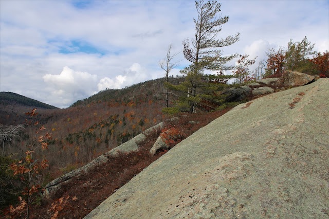
Headed up to the southern Adirondacks again today to visit another area of new state land on a cool, brisk November morning. The area I'd be visiting today was purchased from the Open Space Institute earlier this year and provides access to Huckleberry Mountain, the ridge that sits just north of Crane Mountain. Although Huckleberry sits 800 feet lower than Crane, there are quite a bit of open rock cliffs to explore, but they could only be reached publicly by climbing up and over Crane before. The new acquisition offers public access from South Johnsburg Road to the north of the mountain and while there are no marked trails on this peak, a good woods road can be followed all the way up onto the main ridge.
I parked on the shoulder of South Johnsburg Road, less than half mile north of its junction with Glen Creek Road at a gated woods road(Elevation 1200 feet). There are still Open Space Institute signs posted as of today.
The road is wide and very easy to follow, slowly gaining elevation as it heads generally SW towards Huckleberry.
As the woods road climbs NW, your attention is drawn to the left, where large swaths of open rock just a few yards away implore you to explore.
There is simply no way around it, the views of Crane Mountain are commanding, numerous and spectacular. Early on, just the lower part of its northeast ridge is visible and even that is quite impressive.
I poked around some of the open rock areas in hopes of attaining different views and was impressed with this east facing viewpoint, with squalls moving through in the distance.
Another view towards Crane from a spot a bit further up on the open rock.
The open rock acted as a ramp, providing an easy, fun and scenic ascent.
After enjoying the wonderful views, the open rock is soon replaced by a herd path meandering through the woods, following the ridge west/ northwest. The views from the cliffs on the south facing slopes are never far away and provide ever broadening vistas as you gain elevation.
The climb up between 1900 feet and 2100 feet is where the herd path seems to be the toughest to follow, with scratchy, brushy areas to scrap your way through. Every time I seemed to lose the path, it would emerge just moments later.
SE views from high up on the cliffs.
There was a November chill in the air today with an icy puddle on the summit ridge reminding me that winter is right around the corner.
Checking out more cliff views towards Crane and the valley beyond sprawling to the SE.
Although there are many views to the south and southeast, views in other directions are a bit limited, so I was happy to capture this view east towards Number Twenty Six Mountain(with a little work).
Eventually dropped back off the open rock to the herd path and old road, which I followed uneventfully all the way back to the car. Didn't see another soul all day and hiked 5.5 miles RT, with 1600 feet of ascent.
Map below. Blue P=Parking Red X=High Spot


I can't thank you enough for posting this; I went there today after seeing your post and me and my hiking buddy agreed it was one of our all-time favorites! Especially when the woods trail turned into the exposed rock trail and that part was easy to follow, we just kept following the ridgeline...There was also a beautiful stream just past the right turn up the nose of the mountain, if you keep going straight, we stopped there for a while at the bridge made out of logs, what a great day! Thanks again for the post...
ReplyDeleteGlad you liked it Ned!!! It is a real beauty to say the least! What incredible and unique views of Crane! I just hope it doesn't become too popular!
DeleteThat is a beautiful looking hike! Great photos! Thanks for sharing!
ReplyDelete