On the heels of a tough week in my personal life, it felt good to be back out in the woods this afternoon, hiking a small section of the Appalachian Trail near the Dutchess County/ Putnum County line. With mostly overcast conditions and lake effect snow squalls around, I wasn't really sure what to expect, but just hoped for the best. To get there, I took the Taconic State Parkway south to Exit 35, where I then followed Miller Hill Road to Long Hill Road. Long Hill Road starts paved but quickly becomes a fairly steep dirt road leading up to a small, unmarked parking area where the Appalachian Trail crosses(Elevation 1017 feet).
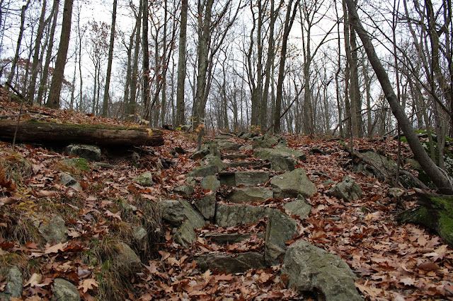
One of the nice things about this time of year and especially on cloudy days, is that you tend to see a lot less hikers out. This was the case today, as there were no other cars there when I arrived, so it looked like I would have the woods to myself. Heading south from the car, I followed the familiar white blazes of the AT, climbing gradually up on a carpet of fallen leaves. There is some very beautiful stonework laid out through this section of the woods which I took a moment to admire.
Barely feeling like I had broken a sweat, only 4/10 of a mile from the car and after roughly 250 feet of climbing, I arrived atop the bare rock 1282 foot summit of Shenandoah. A benchmark with the writing "Looking 1933" can be found at the top of the mountain.
While the summit is open-and the views are nice- it is not quite high enough to offer sweeping views. The overcast conditions didn't help much either, but I did enjoy the views of the surrounding hills. This view SE, looks out over nearby powerline cut and the Taconic Parkway as well as the hills of northern Putnum County.
While at the summit, I was hoping for the skies to clear out, but the best I got was a slight clearing north into Dutchess County. On a clear day, I'm sure the views are very nice up here.
The trail continues south off the summit, where an easy descent drops you back into the woods, passing by a multitude of stone walls.
The trail meanders along with some very small ups and downs and passing by a blue blazed trail that drops off to the east. Beyond that, about 6/10 of a mile further south and up on top of the next ridge, there is a small, unmarked path that offers up some nice west facing views towards Round Mountain and the other nearby ridgelines.
Just over 1/10 of a mile past the west facing view, the trail drops down to a sweet viewpoint out over Canopus Lake. This view was actually better than I anticipated, with the lake sprawling out below at the foot of the slopes. After a couple of minutes enjoying the view, I turned back, retracing my steps north.
On the return hike, I decided to leave the trail and head over to some east facing ledges, which offered up somewhat obscured east views.


Wow, that lake view was great...I hope the woods brought you some comfort at a bad time.
ReplyDeleteThanks Ned. The woods have always been a place of solace for me. They are my favorite place of retreat from the "real world" issues
Delete