Search This Blog

Tuesday, January 28, 2020

Patent Line Mountain(Lake George Wild Forest-Adirondacks)

With an open day I was hoping for decent weather to get some hiking in as I headed north to the southern Adirondacks near Lake George. Although its been a mild winter, there have been many cloudy, overcast days and today would prove to be another.  My goal was to hike the Lake George Rec Park trails to Berry Pond, then bushwhack up to the nearby 1929 foot summit of Patent Line Mountain.  I arrived at the Lake George Rec Park(elevation 670 feet) off of Dump Road and saw only one other car as I arrived. About three inches of crusty snow and ice was on the ground as I set out, so I threw spikes on my boots and headed out. I followed the blue blazed trail through a pretty hemlock forest.
The trail quickly comes down to a lean to shelter that resides beside a picturesque brook.  An informal path leads to nearby waterfalls that were muted by winter conditions today.
There are many, many different trails in the Rec Park but I followed the main blue trail which steadily climbs as it heads north then west.  Much of the this trail follows rugged logging roads.
As I continued west, I soon picked up an orange blazed trail which took me the rest of the way towards Berry Pond.  Just prior to arriving at the pond, I passed over a pretty stream that drains another beaver pond just north of Berry Pond.
The orange trail does a full loop of Berry Pond, so I followed the north shore first, enjoying views to the SW.
From the far west edge of the pond near a beaver dam I left the trail, continuing west.  A short bushwhack from there brought me over to an obvious woods road that climbed up away from the pond and up Patent Line Mountain. 
A small cairn is a good sign that this is a known route.
Approaching the summit, passing through a paper white birch stand.
The 1929 foot summit is fully wooded but sits in an obvious high spot atop a small rocky clearing.
Just a few mere yards away from the summit is a beautiful clearing with great south views.  Looks like a spot well known to locals.
South views towards the valley of Glens Falls(far left)with Darling Mountain rising above Kenyon Mountain(center).
More south views from the summit clearing towards Darling Mountain(L) and Bucktail Mountain(R).
Slightly SW from the clearing is another, slightly treed in view towards Potash Mountain in Lake Luzerne.
After enjoying the summit area it was a nice and easy return route following my footsteps back towards Berry Pond. Once back to the pond, I took the orange trail following the south shore and found a nice view back towards Patent Line Mountain ridge line.
Followed a myriad of trails and wood roads back, taking my time enjoying the woods.  Was really hoping it would clear out at some point but the clouds held on strong.  Hiked about 8 miles total with 1700 feet of ascent for the day.
Today's route.   Red=Trail    Blue=Bushwhack

Thursday, January 23, 2020

Spruce Mountain Fire Tower(Wilcox Lake Wild Forest-Adirondacks)

The days are slowly...and I mean slowly...getting slightly longer....which in turn gives me much more opportunities to get to do some after work hiking.  Headed north to Saratoga County this afternoon on an overcast winter day to hike the Spruce Mountain Fire Tower in Corinth.  Parked in the snowplow turnaround at the end of Spruce Mountain Road and set out, greeting a solo hiker and his dog at the trailhead.  They would be the only folks I saw all day.  There were a few inches of snow but the trail was well matted down so I decided to bare boot it as most others appear to have done.  Elevation to start the hike was about 975 feet, and with a summit elevation of 2009 feet, it would be a good workout to get to the top.
As stated, the trail is pretty well trodden so it was easy going as I made my way initially through a pretty coniferous forest.
 Stone walls and old woods roads lace the slopes of these mountains.
 As the trail climbs, the woods turn predominately deciduous and much brighter.
There are really no steep areas on the hike, just a steady, gradual ascent for about 1.4 miles until you reach the 2009 foot summit and fire tower in a large clearing.
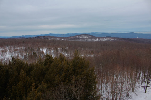
Although the top cab was locked, the views from the top step are very nice.  Luckily there was very little wind, so I was able to enjoy the views without growing icicles on my fingers. From this vantage point, the peaks of Vermont can be seen in the far distance.
Turning slightly SE, the Kayaderosseras Range can be seen stretching south above the valley.  A careful eye can spot part of Saratoga Lake in the hazy distance(upper left).
West/northwest views towards many southern Adirondack peaks on the horzion.
A nice and easy hike down got me back to the car just prior to sunset.  2.8 miles RT with 1040 feet of ascent.

Tuesday, January 21, 2020

Poets Walk Park(Red Hook, Dutchess County)

Got a lot going on lately but took advantage of a small window of free time by getting out for a cold but beautiful hike at Scenic Hudson's Poets Walk Park in Red Hook with my wife and two dogs on Tuesday.  It has been several years since I had paid this spot a visit, so I was really looking forward to returning. 
The 120 acre park is set along the east banks of the Hudson River in rural northern Dutchess County and offers stunning views towards the Catskills and Hudson River.
Rolling fields and several rustic benches beckon you to stop and soak in your surroundings.  From "The Lookout", a  grassy knoll at the far western edge of the trail system, a fine view can be enjoyed towards the Kingston-Rhinecliff Bridge.
The dogs were happy to be out exploring and were very well behaved!
Beyond "The Lookout", the trail drops down into the woods, crossing over a pair of small streams on gorgeous foot bridges. 

"The Summerhouse"-a small gazebo in the woods, provides another stop to relax and take in the Hudson River views stretching down to the Kingston-Rhinecliff Bridge again.
My big boy Bronco and I at "The Summerhouse", checking out the Catskill mountain views across the Hudson to the NW.
We enjoyed a quiet stroll back to the car, relishing the fresh air and serenity.  Hiked about 2.3 miles total and only saw two other people out on this cold January day.
Photo credits-my lovely wife with her i-Phone 11.

Tuesday, January 14, 2020

Moreau Ledges(Moreau Lake State Park, Saratoga County)

With only a limited amount of time today, I was looking to hike something short, steep and sweet...and preferably off trail.  Looking at satellite images there appeared to be a large rocky outcrop on the north side of the Hudson River in the Moreau Lake State Park(w/ no trails) which would certainly fit the bill of what I was looking for!  I parked in an unmarked pull off on the north side of Corinth Road near a bend in the Hudson River.  State Park signage is clearly visible in the pull off and this would be my starting point for the day at an elevation of 370 feet.
I headed north through the woods, ascending a steep spine up the ridge.
 The spine was very skinny with extremely steep slopes falling off each side. 
The elevation gain is pretty constant, gaining over 900 feet in less than 9/10 of a mile.  Soon enough I spotted the rocky ledges that I was aiming for!
The only ice I spotted all day was on some of the jumbled boulders high up on the ridge.
I kind of angled to the east first, where the slopes weren't quite as vertical.  The woods were very open and inviting.
I dropped over to a small opening on the steep SE corner of the ridge, with a view towards the southern slopes of West Mountain and the Hudson River near the Northway.
Wandering over to the west side of the ridge was certainly the highlight of this bushwhack.  A wide open set of rocky ledges provides spectacular views south over the Hudson River towards the Palmertown Range and Moreau Lake State Park.  
I wandered around the open ledges soaking in the great views.  What a wonderful little perch!!
A steep descent brought me back down the skinny spine I had come up on.  Skies looked like they wanted to clear out, but unfortunately never quite did.
Really enjoyed this great, short bushwhack just outside the Adirondack blue line.  Just what the doctor ordered with my limited time available.  Round trip distance was just under 2 miles with 950 feet of ascent.


Monday, January 13, 2020

Anthony's Nose(East Hudson Highlands State Park)

Rising straight up above the Hudson River to the east of Bear Mountain Bridge is the rock fortress called Anthony's Nose.  It has always been on my to do list, but knowing it is an extremely popular hike always kind of pushed it off onto the back radar.  With overcast weather forecast for a weekday in mid January, I figured today would be a great day to give it a go.  There are several different approaches to Anthony's Nose, including a dramatically steep climb up the face, but I wanted to get the most length out of the day, so I opted to hike the Camp Smith Trail(which adds over 4 miles RT).  I parked at the Bear Mountain Bridge Toll House along Highland Ave(Route 6/202) on the east side of the Hudson River.  I was shocked to see no other cars there when I arrived!  Clouds and temps in the mid to upper 30's greeted me as I set out on the blue blazed trail.  Elevation is only about 180 feet to start. 
Side note-The Toll House was opened in 1924 and operated privately by the Harriman family.  They collected tolls from west bound motorists until the state acquired the bridge in 1940.  Today the Toll House serves as a gift shop and visitor center.
The trail is incredibly rocky but highly scenic, as it winds its way along the steep slopes of Manitou Mountain.  There are abundant screened views through the bare trees, and even several wide open ledges with very fine river views.  To the west are some of the impressive peaks in Harriman State Park.
Although the woods looked incredibly inviting, signage makes it very clear that bushwhacking is not allowed here.  Your life may depend on it!
The rugged trail continues north meandering up and down along the rocky slopes of Manitou Mountain before arriving at a neat little viewpoint known as "Two Pines".  A pleasant vista opens here with several pitch pines accompanying you.
Just a few yards further along is a fantastic north view towards Bear Mountain across the Hudson.  A sliver of Route 6/202 can be seen at the steep foot of Anthony's Nose far southern slopes.
At a spot where the trail juts out towards the river, a nice view to the south allows you to see the rocky ridge that you had just come from. 
A typical stretch of trail.  Conditions were nearly perfect with zero mud, ice or snow to contend with. 
Continuing north, a first view of Bear Mountain Bridge becomes visible, peaking out behind a nearby ridge.
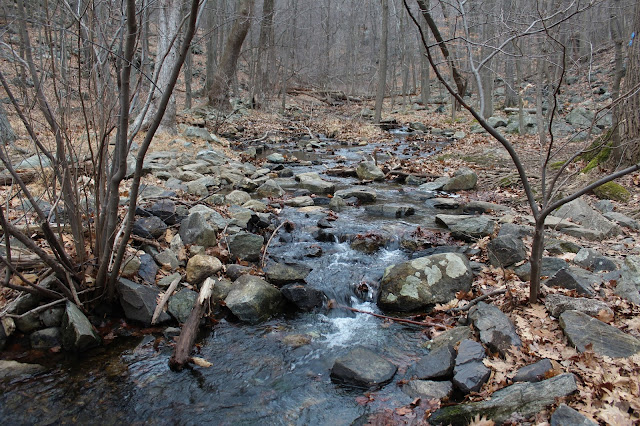
The Camp Smith Trail soon drops steeply down to a parking area known as the "U-Bend", and marks the halfway point of the hike.  Just past a kiosk and trail map is a rock hop crossing over pretty Broccy Creek. 
Once across the creek, the trail begins to ascend again, with more view points opening up.  From a small clearing, I enjoyed one of the better views of Bear Mountain, which was almost directly west of me now.  Low clouds and mist were hovering over the summit and approaching quickly. 
With the low clouds and mist approaching, I picked up my pace.  Was pleasantly surprised to arrive at what I think was some kind of vernal pond sitting at the foot of the steep summit ascent ahead.
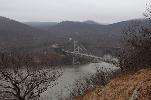
The climb is rocky and steep but the trail carefully eases its way up towards the summit, offering several more spectacular views.  From a shoulder of the steep slopes, I found this great view of the Bear Mountain Bridge.
A final steep push up got me to the 899 foot summit area with limited views to the south and west.  A very short drop from there though, quickly brought me over to the money spot.  After 3.2 miles of tough climbing I had made it. The 270 degree view from the bare rock face here is one of the very best in the Hudson Highlands, and that's really saying something.  Obviously the Bear Mountain Bridge across the Hudson demands the most attention, but Bear Mountain(shrouded in fog) to the left is quite impressive as well.  To the right the Popolopen Bridge carries traffic on Route 9W across the Popolopen Creek.  Oh yeah...and I had the summit to myself!  
One of the most recognized things about Anthony's Nose is the American Flag, which stands proudly from the view spot, blowing in the wind.  Off in the distance the sounds of helicopters could be heard from nearby West Point.
Although under 900 feet in elevation, the sheer drop off from this height is certainly imposing.
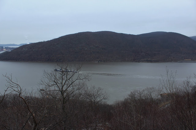
To the south, a large ship can be seen making its way north up the river with Iona Island and the peaks of Harriman Park just beyond.
One last view as the fog continues to descend down Bear Mountain. 
 Descending off the summit I came across this perfectly framed view down towards Iona Island and the railroad tracks across the river.
 
Retraced my steps south back to the car as a very light drizzle began to fall overhead.  By the time I reached one of the earlier viewpoints again, the fog had nearly completely enveloped the bridge. 
A quiet hike out got me back to car after 6.4 miles RT and nearly 2300 feet of ascent.  Spectacular scenery as expected!  Not to hard to understand why this area is so popular among hikers.