Side note-The Toll House was opened in 1924 and operated privately by the Harriman family. They collected tolls from west bound motorists until the state acquired the bridge in 1940. Today the Toll House serves as a gift shop and visitor center.
The trail is incredibly rocky but highly scenic, as it winds its way along the steep slopes of Manitou Mountain. There are abundant screened views through the bare trees, and even several wide open ledges with very fine river views. To the west are some of the impressive peaks in Harriman State Park.
Although the woods looked incredibly inviting, signage makes it very clear that bushwhacking is not allowed here. Your life may depend on it!
The rugged trail continues north meandering up and down along the rocky slopes of Manitou Mountain before arriving at a neat little viewpoint known as "Two Pines". A pleasant vista opens here with several pitch pines accompanying you.
Just a few yards further along is a fantastic north view towards Bear Mountain across the Hudson. A sliver of Route 6/202 can be seen at the steep foot of Anthony's Nose far southern slopes.
At a spot where the trail juts out towards the river, a nice view to the south allows you to see the rocky ridge that you had just come from.
A typical stretch of trail. Conditions were nearly perfect with zero mud, ice or snow to contend with.
Continuing north, a first view of Bear Mountain Bridge becomes visible, peaking out behind a nearby ridge.
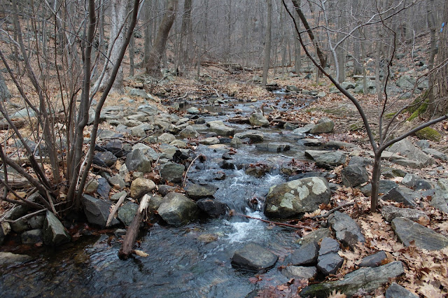
The Camp Smith Trail soon drops steeply down to a parking area known as the "U-Bend", and marks the halfway point of the hike. Just past a kiosk and trail map is a rock hop crossing over pretty Broccy Creek.
Once across the creek, the trail begins to ascend again, with more view points opening up. From a small clearing, I enjoyed one of the better views of Bear Mountain, which was almost directly west of me now. Low clouds and mist were hovering over the summit and approaching quickly.
With the low clouds and mist approaching, I picked up my pace. Was pleasantly surprised to arrive at what I think was some kind of vernal pond sitting at the foot of the steep summit ascent ahead.
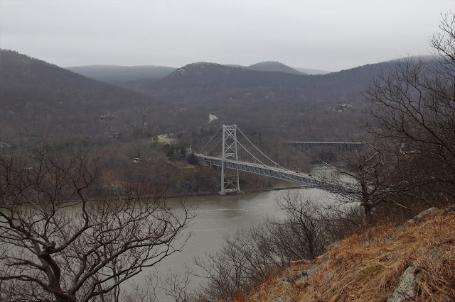
The climb is rocky and steep but the trail carefully eases its way up towards the summit, offering several more spectacular views. From a shoulder of the steep slopes, I found this great view of the Bear Mountain Bridge.
A final steep push up got me to the 899 foot summit area with limited views to the south and west. A very short drop from there though, quickly brought me over to the money spot. After 3.2 miles of tough climbing I had made it. The 270 degree view from the bare rock face here is one of the very best in the Hudson Highlands, and that's really saying something. Obviously the Bear Mountain Bridge across the Hudson demands the most attention, but Bear Mountain(shrouded in fog) to the left is quite impressive as well. To the right the Popolopen Bridge carries traffic on Route 9W across the Popolopen Creek. Oh yeah...and I had the summit to myself!
One of the most recognized things about Anthony's Nose is the American Flag, which stands proudly from the view spot, blowing in the wind. Off in the distance the sounds of helicopters could be heard from nearby West Point.
Although under 900 feet in elevation, the sheer drop off from this height is certainly imposing.
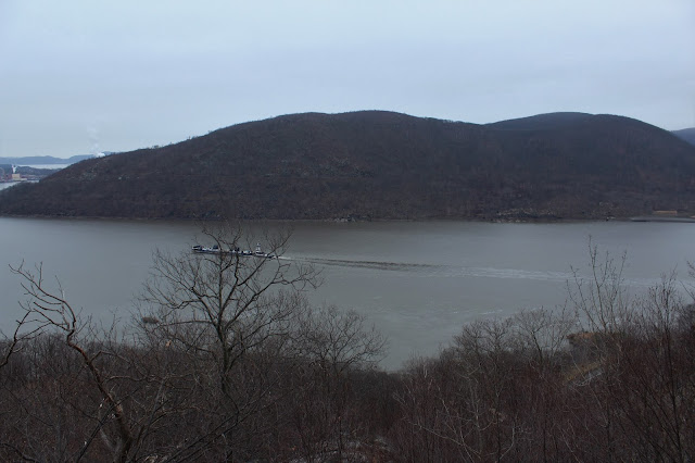
To the south, a large ship can be seen making its way north up the river with Iona Island and the peaks of Harriman Park just beyond.
One last view as the fog continues to descend down Bear Mountain.
Descending off the summit I came across this perfectly framed view down towards Iona Island and the railroad tracks across the river.
Retraced my steps south back to the car as a very light drizzle began to fall overhead. By the time I reached one of the earlier viewpoints again, the fog had nearly completely enveloped the bridge. A quiet hike out got me back to car after 6.4 miles RT and nearly 2300 feet of ascent. Spectacular scenery as expected! Not to hard to understand why this area is so popular among hikers.


No comments:
Post a Comment