Search This Blog

Tuesday, July 27, 2021

Noble Mountain(Giant Mountain Wilderness-Adirondacks)

Decided to do a little off trail adventure today to 2927 foot Noble Mountain in the Giant Mountain Wilderness, which sits just south and east of Rocky Peak Ridge.  The weather forecast was calling for early afternoon thunderstorms so I got an early start under mostly cloudy conditions.  Parked on the north side of the road in a large, unmarked pull off(Elevation 1520 feet) less than a mile before the parking area for Round Pond.(Spanky's Wall P.A.)_

From the parking area, I followed a well trodden herd path down a very steep hillside to an open area along the North Branch of the Boquet River.

Crossed the North Fork with an easy rock hop and continued on my way, climbing north.  Found an abundance of fungi in the woods...it's a banner year for mushrooms!

Followed a fast flowing drainage up the mountain for a little ways and was treated to a couple of nice, little cascades.
As I neared the top of a 2204 foot SW knob of Noble, I hit some open rock slabs with excellent south facing views of the nearby Dix Range.  The slide on Dix was quite notable, even through the milky air.
South views.
The SE views from this open slab were great, although somewhat tainted by the thick haze.
A small drop off the 2204 foot bump brought me down to a fern filled, wet depression area with just a hint of foliage.
Within just a few minutes of descending the first bump, I was back to climbing steadily towards Noble's summit.  The woods were fairly open and easy to negotiate until about 2500 feet, when the character of the forest changed dramatically to spruce.
Although there was quite a bit of spruce on the ascent, it never got too thick so I enjoyed a pretty easy climb.
Just before hitting the summit, the woods changed once again..this time to a mix of spruce and hardwoods, with a bit more undergrowth.  The 2927 foot summit was completely wooded with no views and for some reason marked with a red paint.
After hitting the top, I turned back southwest, retracing my steps down for a bit, before turning more due south in search of additonal views.  At about 2600 feet, I found more open rock slab with similar south views towards the High Peaks as the ones down on the lower knob.  The only difference at this point was the clouds and haze had increased from earlier.  The 2204 foot knob is actually the peak in the foreground.
Southeast views through the haze.

On the descent, I headed down a slightly different route, hitting the drainage just west of my route up.  The woods were steep but mostly easy going all the way back down to the North Fork.  From there it was an easy climb back up to the road on the herd path.  3.5 miles RT with over 1500 feet of ascent and of course didn't see another soul.

Map below, with red X=parking   Blue X=Open rock slab on lower peak  Black X=True summit


Saturday, July 24, 2021

Unnamed Padanarum Road Hills(Lake George Wild Forest-Adirondacks)

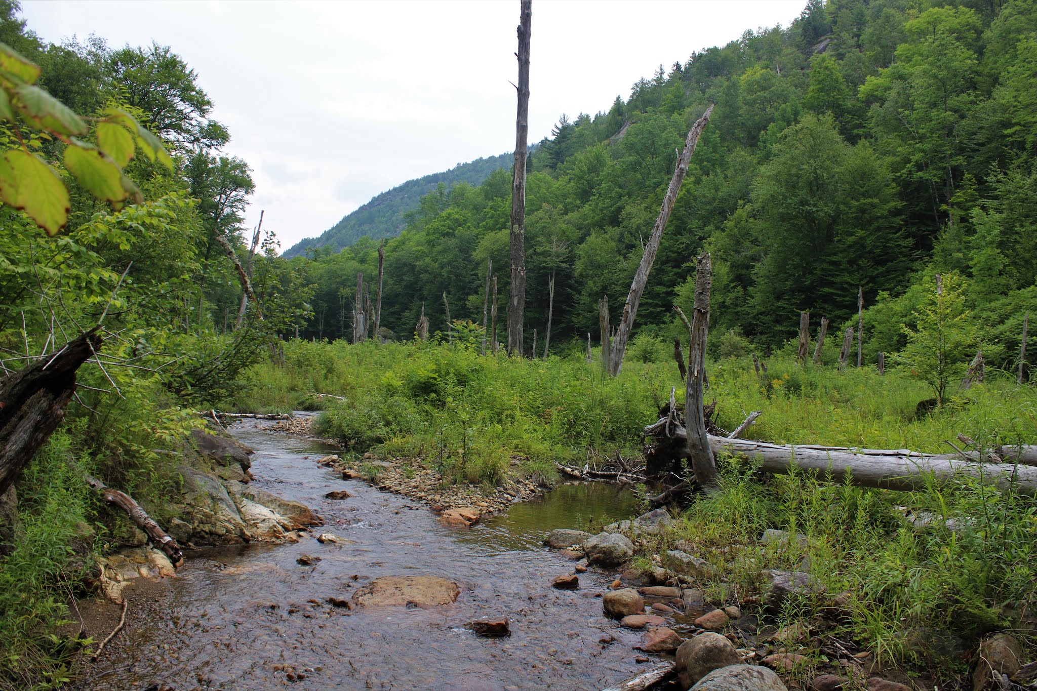
Headed up north again this afternoon to check out a pair of unnamed, obscure peaks that lay just off the beaten path west of Route 9N near the Tongue Range in the town of Bolton.  Although these peaks don't rank in the upper echelon in elevation, they pack a punch in fun, steep climbing and exploring.   There are no trails here either, so both of this peaks would be true bushwhacks.  Parked on the shoulder of the road at the corner of Padanarum Road and Wardsboro Road, where the old bridge over Northwest Bay Brook is being replaced(Elevation 435 feet).  

Began my hike heading north along beautiful Northwest Bay Brook for a few hundred yards before turning east and heading up the slopes of the first unnamed peak.

The woods were very open and easy to negotiate and in no time at all, I hit the first open area of ledges. 

There are a couple of different levels of open rock slab to explore, with solid views to the south.
From a nearby vantage point, a view west across the road towards my next peak, less than a mile away.

The open views were actually quite low on the slopes at about 750 feet, so it was a nice and easy bushwhack up through open woods east to the summit area.


Unfortunately, the 995 foot summit is wooded with filtered views to the south through the trees.

A steep, but quick and easy descent brought me back down to the road, where I crossed the bridge over Northwest Bay Brook and headed right back up the next peak.  This peak, which lies just west of the road, is a bit bigger and was a little tougher as well.  Although the climb up through ferns looks unassuming enough, there are ankle swallowing boulders hidden throughout.

The higher I got on this small peak, the more pleasant the hike became.  The woods really began to thin out and the gnarly boulders were replaced with gorgeous sedge grass.
The other nice part about climbing higher were the nice views that I was able to find, such as this look east towards my previous peak(with part of Bloomer Mountain's west ridge in the distance).

As I steadily made progress ascending, I kind of veered slightly south to gain better and better views where the slopes really dropped off.  Enjoyed this nicely framed up close view of a large swath of the Tongue Range from an open ledge.

Climbing around the steep, open and rocky woods below the summit.
There were several good viewpoints along an open area of southeast facing ledges, but it only kept getting better the more I went up. 
From an open perch, I found this spectacular view east towards the Tongue Range, with Five Mile Mountain being the high point on the ridge,
A sprawling view SE towards the entire southern part of the Tongue Range!

After enjoying the views, I continued on a short distance north to the wooded 1161 foot summit. 

I tried to take a slightly different route down in search of different views, and was able to find one nice clearing and view point to the NE towards Catamount Mountain.
As mentioned before, the elevation may not be all that high but the steep descents on these small peaks can really be a fun adventure.

Following a steep descent, I arrived back down at the foot of the peak, near the bridge crossing and headed over to my car.  A lot of bang for the buck in these small little hills!  Just over 3 miles RT(all bushwhack) with 1300 feet of combined ascent.

Map below features the two nameless peaks, marked with red X's.  The blue P, is where I parked.


Tuesday, July 20, 2021

Galway Nature Preserve(Galway, Saratoga County) & Mill Pond Park(Charlton, Saratoga County)

Did a couple of easy walks in rural Saratoga County this morning on what turned out to be a very hazy summer day due to smoke from Canadian wildfires filling the air.  My first stop was the Saratoga PLAN's 49 acre Galway Nature Preserve located off Crane Road in the town of Galway(Elevtion 745 feet).  I was the only car there when I arrived and enjoyed a nice and peaceful walk on the mostly level trails.


Yellow blazes head off in two separate directions from the trailheads, so you have an option on which way you want to start.  I headed east(right), where the trail quickly brings you to a large pond and wetland.

From the pond, I took various trails throughout the preserve, meandering my way through a quiet woodland.  Along the way, you may find remnants from the former land owners such as an old cabin, garage and stone fireplace(pictured below).
Peering out into a wetland.
Although it doesn't appear to be much more than a tiny stream, this unassuming little brook is actually part of the headwaters of the Mourning Kill, which drains into the Kayaderosseras further downstream in the town of Milton.
Hiked a little over 2 miles RT at the Nature Preserve and then decided to make a second stop just a few short minutes away at 10 acre Mill Pond Park, which is located along Crane Street in the town of Charlton.  There is a small unmarked pull off just south of a bridge crossing over the Alplaus Kill that provides access to the trails, which are also unmarked.  

I followed the well maintained, mowed path down past Mill Pond, which was a man made pond built way back in the late 1800's.

The park is quite small, but makes for a very nice pit stop, with unmarked paths heading through the woods and down to the Alplaus Kill.
There are several nice opportunities to enjoy the Alplaus Kill, which winds its way south from here, eventually emptying into the Mohawk River.
A quiet resting spot along the creek.
Walked about a half mile at this small, but lovely little park on a warm-but dry-summer morning.
 

Friday, July 16, 2021

Hennig Preserve(Providence, Saratoga County)

Turned out to be a pretty nice day, so took the opportunity to do a little exploring in rural Saratoga County at the 606 acre Hennig Preserve, which just happens to Saratoga PLAN's largest nature preserve.  I parked on the shoulder of Center Line Road at the eastern trailhead(Elevation 1530 feet) and headed north, where there is a large network of trails that meander through these high elevation woods passing by old stone walls and cellar holes dating back to the mid 1800's.

The high point in the preserve is marked with a sign and bench, but there really isn't much to see other than the surrounding woods.
At the far northeast corner of the preserve, just off trail, I came to a very picturesque wetland on the Round Pond Outlet stream.
Round Pond Outlet.
After a couple of miles of wandering, I crossed back over Center Line Road on a yellow blazed trail heading south, where you leave the Preserve and enter the County Forest.  You will hardly notice a difference, however, as the trails continue through a quiet woodland, soon dropping down to a footbridge crossing over Round Pond Outlet once again.  Here, the outlet is a peaceful, babbling stream and makes a great spot to stop and soak in the ambiance. 
The yellow blazed County Homestead trail continues making its way south/ southwest, where the sounds of rushing water soon hit your ears.  This is Cadman Creek, which is a fast flowing creek, with a couple of small cascades to enjoy along the way.
An informal herd path leaves the marked trail and continues along the creek, passing by the remains of the early 19th century Cadman mill site.
From here, I turned north, retracing my steps back to the car for a total of nearly 5 miles round trip.  With the weather being so nice, I was shocked to not see another person in the woods the entire time.  If you're looking for an impressive trail system and solitude, this is a pretty good place to be.
 

Tuesday, July 13, 2021

Indian Kill Nature Preserve(Glenville, Schenectady County)

Got out for a nice and easy walk at the 100 acre Indian Kill Nature Preserve this morning on yet another overcast, murky morning.  Parked at the trailhead along Hetcheltown Road in East Glenville and headed out, following the red trail down towards the Indian Kill and dam, which is one of the most scenic spots in the preserve.

With the abundance of wet weather, the wildflowers seem to be doing well.
As expected, trails were damp and quite muddy in spots.
The Indian Kill was flowing swiftly, but I actually thought it might be even higher after the recent heavy rains.
The blue and red trails both closely hug the water's edge, making for a very enjoyable walk.
There are a series of three falls that can be found along this stretch of the Indian Kill but only one actually sits within the confines of the Preserve.  Unfortunately, due to the recent wet weather, I was unable to cross the creek to access the trails on the other side of the Indian Kill.
As mentioned above, the woods were quite damp and with the high humidity levels to boot, it felt more like the Amazon then Schenectady County.
Enjoyed the blue, red and yellow trails as well as a couple of unmaintained foot paths for a total of about 2.5 miles and only saw one other person all morning.