Finally got a break from the rain today, so decided to take advantage of the rare dry day by doing a little off trail exploration some unnamed ledges in a remote part of the Lake George Wild Forest(west of the Tongue Range). On a recent hike of Middle Mountain last month I had noticed some ledges west across the Fly Brook valley, which got me digging into maps and potential bushwhacks. Not only did I locate the ledges that are near the Fly Brook Valley(off Wardsboro Road), but I spotted some more potential ledges near Comstock Road, which is a discontinued and unmaintained old road. Resting squarely on state land, I just had to get out and see what these ledges had to offer. I parked at the north end of Padanaram Road, where it meets unmarked Comstock Road(Elevation 830 feet) and set out north on foot on the old road, which is actually passable for a distance for high clearance vehicles.
The old road makes for a very pleasant walk, as it passes Round Pond Brook, which more closely resembles a beaver pond than a brook for this section.
Once beyond the foot bridge, the remnants of the trail all but disappear, so I began my bushwhack there. I headed generally NE, following a pretty drainage up into a draw.
The climbing up to this point had been minimal, but around 1200 feet, near the head of the drainage, the slopes become increasingly steep as I turned more due north.
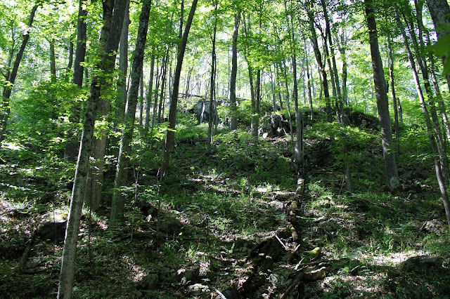
Sadly, the woods have been ravaged by thousands of gypsy moths, leaving the woods eerily open, and void of many leaves. There is almost an early spring like appearance to the woods, as they are very open and easily navigable.
As I circled up to the southern set of the ledges, around 1400 feet, I began to get decent views, with grassy, open cliff bands above.
The first of several very good view points takes in an open south/ southeast view, with Catamount Mountain in the distance.
In my opinion, the SW views from a couple of small, open ledges are the best of all. This is the valley of Round Pond Brook and Comstock Road, which was my route up.
There are a series of successive, open ledges and cliff bands that circle around from the south to the west side of the summit area-all with great views.
West facing views ranging all the way towards Gore Mountain and its neighbors.
I really enjoyed exploring the wide open woods and ledges all along this little peak. Once again proving that size isn't everything...this small peak has a lot to offer!
After tagging the nondescript wooded 1647 foot summit, I continued a bit NW where the slopes were a bit less steep and made for a much easier decent.
Once down low, I made my way back to the foot path, then road, which I followed back to the car. A nice and easy 4.2 miles RT, with 900 feet of ascent. A hidden little gem, far off the beaten path!
Map of area below, with Red circle being the small peak. Red X=start of hike


I think the same way; if I see ledges in the distance, I think "I wonder if there's a way up there"? But you really go for it! It's great to see these photos of places I have never been to.
ReplyDeleteThanks Ned! As always, the places less seen are the ones that draw me the most. This one was a good one but I certainly wasn't the first..believe it or not I noticed a couple of herd paths near the ledges!
DeleteCool! This just made the list.
ReplyDeleteThe gypsy moth damage is amazing. They seem to be targeting oak trees and sure do a number on them.
Thanks for sharing.
Yeah, this one is a good one. If it ever stops raining I highly recommend it!!!
DeleteAlso-the gypsy moth situation is absolutely crazy! Specifically in that area around the west side of Lake George. Eye opening when you see it in person.