Search This Blog

Friday, April 29, 2016

Ragged Mountain South Summit(Adirondacks)

My dad and I took a ride north to visit part of the new Boreas Pond Tract in the Adirondacks on a cool, beautiful spring morning.  We parked along gravel Gulf Brook Road just before the gate blocking all public motorized vehicles. 
After walking around the gate, we headed north Gulf Brook Road, with nice views back south towards Sand Pond Mountain.
Soon the road bends, crossing over Gulf Brook.
Less than a quarter mile past the brook crossing, an unmarked trail leaves the road and heads east.  It soon becomes a logging road and can be followed all the way to the notch between Ragged Mountain and its south summit.
Once at the notch, a nice view of Ragged Mountain opens up directly to the north.
I turned right and began climbing through the woods up the south summit, where I encountered some snowy patches.
The bushwhack is short and easy, climbing directly up to the south summit in just over .1 of a mile.  Had to search around a little bit, but easily found cliffs with awesome views.
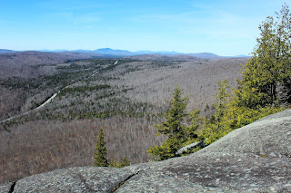
Clifftop views to the south and west, with Blue Ridge Road winding below.
A view south towards Hoffman Notch.
Great views.
I ran around the summit area, finding more views to the northwest towards Wolf Pond Mountain.
Sand Pond Mountain to the west.
Turned back here, bushwhacking off the summit to the logging road and then eventually back to Gulf Brook Road.  Hiked a total of about 3 miles RT. 

Wednesday, April 27, 2016

Rensselear Plateau Community Forest(Rensselaer County)

Visited the new(2015) 350 acre Rensselear Plateau Community Forest, located off Legenbauer Road in East Poestenkill with my father this afternoon.  Parking is available along the shoulder of the road.
 We began by following the yellow marked "Moose" trail, which soon crosses a newly built foot bridge over a small stream.
 The yellow marked trail soon meets up with a red marked "Sugar House Trail", which leaves to the left.  We took this for about 1 mile, winding through a mixed forest with mostly soft trail underfoot.  Here, we passed by a rocky hill near a bend in the trail and were lucky enough to see a new bike trail being constructed through the woods.
 Conditions were nearly picture perfect on a cool, but clear late April day.
 These woods are very quiet and peaceful, giving the impression that you are a million miles away from civilization.
 The red trail eventually meets back up with the yellow trail, where we hung a left and continued east, soon arriving at a creek crossing. 
 This small creek is easily passed by rock hopping or simply walking around.
 Continuing along the Moose trail under gorgeous blue skies.
 We saw many stone walls lining these woods.
 Following Sugar Rock Road.
 An old beaver meadow near the end of the marked trail.
 We returned along the yellow trail for about .7 of a mile back to the car.  These woods are made up of a network of old woods roads, serving as reminders of the past.  Here, we crossed a spring fed damp section of trail.
Walked about 2 and a half miles on a beautiful spring afternoon.

Monday, April 25, 2016

Constitution Hill(Berkshires)

Got out for a short hike at Constitution Hill in the town of Lanesborough in the beautiful Berkshires of Western Massachusetts on a mostly cloudy Monday afternoon.  The 252 acre property is owned and managed by the Berkshire Natural Resources Council and is found by taking Bridge Street west off of Route 7 in Lanesborough all the way to its end, where a parking lot and kiosk are found.  Additional parking can be found downhill at a bend in the road as well.
Some of the best views of the day can be found to the east as you approach the trail head on Bridge St.
 Continue uphill past the kiosk, where the road continues but becomes more of a rough woods road to the beginning of a blue marked loop trail.  You will have the option to go either way from there.  A right goes up to a power line crossing, where there are more nice views both east and west.  Here is east towards Farnams Hill.
 A closer look east, down towards Route 7.
 I backtracked down to follow the trail clockwise along woods roads.
 The north edge of the property passes stone walls, beautifully framed by budding plants.
 Large white quartz rock can be found along the summit ridge.
 A small bench marking the top of the wooded 1644 foot summit.
 An inscription on this rock marks the top of the mountain.
 This red oak was planted here to replace the enormous oak which stood for centuries before it was hit by lightning in 1902 and later burned by vandals in 1920.
 The entire hike is about 2.5 miles RT.  The informational kiosk at the trail head is very interesting and provides a glimpse into the Berkshires past.  Upon further reading, I discovered that a large bonfire atop the nearly bald summit signaled the Massachusetts ratification of the Constitution in 1788. 
If you are seeking a quiet, historical walk, then this may be just the hike for you.  Elevation gain is 400 feet.

Thursday, April 21, 2016

Pittstown State Forest(Rensselaer County)

Got out for a nice, easy walk this afternoon at the Pittstown State Forest, east of Troy and just north of Grafton State Park, on an exceptionally warm spring day.  The State Forest is located on Ward Hollow Road and there are several different trails and parking areas available along the road.  I drove east to campsite 6 and parked there.
From campsite 6, I headed north on the red marked "Bonnie and Clyde" trail.
The trail winds north and then west, following old stone walls before eventually meeting up with and crossing the yellow trail, before meeting up with the "Knuckle" Trail.
There are ups and downs along the "Knuckle" Trail, with some screened views of nearby hills.

I had read that a Lean To on a hillside can be found tucked away in the state forest, a few hundred yards away from the trail.  I followed a stone wall northwest from a red marked section of trail, and soon arrived at the Lean To.
The view out from the Lean To.
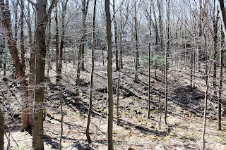
Another view of the Lean To through the bare woods.
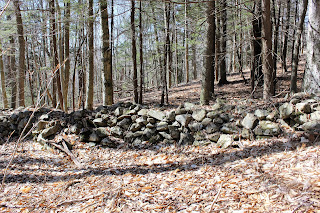
The stone wall near the Lean To.
After leaving the Lean To, I headed back out onto the blue and yellow trails, which head up to a plateau area, with more screened views of the surrounding hills.
Stonework along the trail.
Trail junction.
Headed back generally south through the woods, mixing some bushwhacking and trail walking along the way back to the car.  Walked about 3.5 miles total.  This small stream parallels the road for a little way.
Dry conditions are causing very dusty roads.  This is a quiet stretch along Ward Hollow Road.
After leaving Pittstown, I made a quick pit stop to White Lily Pond.  The pond is part of Grafton Lakes State Park and is accessed via a short trail from County Route 87(Babcock Lake Road).
Peaceful and serene White Lily Pond.


Tuesday, April 19, 2016

Stone Quarry

My dad and I took a nice hike this afternoon at an old stone quarry and former campground in rural Rensselaer County.  The area is not open to the public, so I decided to keep all descriptions of the area as basic as possible to keep it anonymous. The area is filled with trails and woods roads, as well as several small ponds.  We drove uphill on a rough road until it got too muddy.  We parked there and began to walk.
Just uphill from the truck we came to a nice pond, which used to be stocked when this was a campground.
We passed by several old buildings, which have now turned into crumbled piles of rotting wood.
We followed several woods roads which soon lead to the high banks of the stone quarry.
Stone quarry.
Looking for a way up the steep quarry.
We think we found a way.
Once atop the stone quarry, the views are marvelous.
Views south all the way to the Catskills.
Very steep drop off above the quarry.
Nearby homes can be seen across the still barren landscape.
Old stone walls line the woods.
We followed the edge of a steep ledge, which drops directly down to the creek.
We descended the steep ledge down to a stream running into the creek.
A small, spring fed stream that flows into the creek.
Looking across a wide open field towards the highway.
Buds along the shore of a tiny pond.
An old bench is all that remains from a crumbling mess where an old pavilion used to stand.
Passing through a large meadow under beautiful blue skies.  This area used to be a large, mowed field near the pavilion, but nature has now reclaimed it.
Hiked a little over 3 miles total on various old roads, trails and partial bushwhacks.