Search This Blog

Saturday, April 9, 2016

Mount Prospect via Haley Farm(Mount Greylock-Berkshires)

Got out for a nice afternoon hike up to 2690 foot Mount Prospect from Haley Farm in Williamstown after work.  Haley Farm is located at the very end of Hopper Road(there is a rerouted bridge at the beginning of the road) , which can be found off of Route 43.  Approaching the trailhead near the farm is a commanding view of the west side of Greylock, as well as Stony Ledge(R) and Mount Prospect(L), an area known as "The Hopper".
Farm scene at the trailhead.
Profile of today's goal=2690 foot Mt Prospect.
Views across pastoral Haley Farm fields towards the Taconic Range.
Almost immediately I swung left onto the ski loop trail, which drops directly down to Hopper Brook.
Following along Hopper Brook in the deep valley of the Hopper, where dispersed camping is allowed.
Once on the Money Brook Trail, a footbridge crosses Hopper Brook.
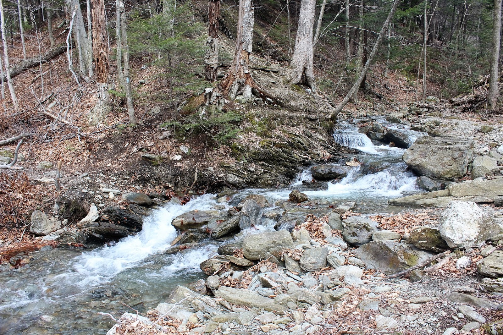
Looking upstream at the beautiful, but cold rushing waters of the brook.
The trail closely follows Hopper Brook much of the way, which makes for pleasant but at times muddy walking.
After a second bridge crossing, the trail begins to climb into evergreens, where I ran into some spotty snow as well.
There are two water crossings over Money Brook, which was a bit of a challenge due to recent rains and spring runoff.
After the second water crossing, the trail climbs up to junction, where the Mt Prospect trail heads left and the Money Brook trail goes right.  I took a left here and almost immediately began ascending up a steep rock face.
The ascent is steep and continuous, but great views back towards the Hopper through the trees are your reward.
Another steep, rocky section of trail.
Broken views through the trees towards rural Williamstown.
After a steep climb, a great view of Stony Ledge can be found over your shoulder.
A break in the trees and bam, you've got a nice view north and west into Williamstown.
Best view of the day!  Great views of the Green and Hoosac Valleys of Williamstown.
Once past the view point, the climb continues, although less steep, for another .2 miles to the wooded summit of Mount Prospect. After 3 miles of hiking, a large rock cairn marks the summit.
Heading back down off the summit.
After a steep descent of the mountain, the trail once again levels off near Money Brook and then Hopper Brook.  I passed the remains of this interesting old foundation along Hopper Brook.
Hiked about 6 miles RT, with 1590 feet elevation gain.


Friday, April 8, 2016

Great Dune(Albany Pine Bush)

Got out for an easy walk this afternoon at Great Dune, part of the Albany Pine Bush, located at the end of Willow Street in Guilderland.  Early spring in the northeast can be very frustrating, with frequent bouts of cold weather reminding us that winter is not ready to give up easy.  Cloudy, cool conditions persisted on this day, with temps hovering around 40 degrees with off and on snow showers.
I started out past the kiosk on the red trail,and turned right at the start of the red loop.  Then took my first right onto the blue trail after that.
The blue trail winds through a large area of tree thinning.
 Hints of green grass along the trail.
 I soon turned right again off the blue trail onto the yellow trail, which passes a wide open area.
 Looking back across the open fields towards the backyards along Willow Street.
 The yellow trail follows a wide road for about a half mile.
 Along the short section of white trail, which connects back to the blue trail.
 Back on the blue trail, as the clouds began spitting out snow pellets again, bringing back a wintry feeling.  The trail meets back up with the red loop soon after, where I turned right(east) onto the red trail again.
Passing beneath power lines on the red trail.
 Just after the power lines, I came across a small, vernal pond.
 Crossing a footbridge over the Kaikout Kill.
 The Kaikout Kill and its tributaries meander through these woods.
 The landscape is much more alive in green near the creek.
 Looking down at the winding Kaikout Kill's path through the woods.
 Although it feels as if you are far away from civilization, the sounds of rushing traffic on New Karner Road can be heard through the woods as the red trail continues its loop.  Here is the north part of the loop, which passes close by residential Pinehurst Blvd.
Completed the red loop trail all the way back to the car for an easy 3.45 miles total on a blustery spring afternoon.

Tuesday, April 5, 2016

Kings Highway Barrens(Albany Pine Bush)

Following a spring snowstorm and record cold overnight, I got out for a short walk at the Kings Highway Barrens in Guilderland, on a cold but sunny, bluebird Tuesday afternoon.  There are many access points to the Pine Bush, which is one of the few and best remaining inland pine barrens in the world.  Access to this section is on the north side of Kings Rd just east of the Townsquare Media Complex.  A small parking area and kiosk mark the starting point.
I passed the wooden fence and walked through a couple inches of compressed snow soon arriving at a red trail junction.  This trail junction is simply the beginning of a 1.2 mile loop trail so you may go whichever way you choose.  I found the deep blue skies and budding trees to be very picturesque.
The trail is very easy to follow and marked in red.
Tree thinning is performed periodically in the Pine Bush to restore the habitat where pitch pine trees and other tree species become crowded. This will allow pine barren plants and animals to flourish.
Came across this tire, which was under an inch or so of snow.
Native Pitch Pines reaching to the skies.
The snow covered dunes of the Pine Bush.
Contrast of seasons. Buds and snow fight it out along the trail.
Enjoyed a leisurely 1.2 mile RT walk.

Thursday, March 31, 2016

Pecks Brook Lean To and Falls(Mount Greylock-Berkshires)

When I got out of work this afternoon, the temperature was in the mid 60's, and even with a solid wind, it still felt very nice.  Due to the mild weather, I thought I'd grab a quick hike up the east side of Mount Greylock State Reservation to the Pecks Brook Shelter and waterfalls.  Access is off West Mountain Road in the town of Adams, at the first parking area on the right.  I was surprised to find that I was the only car there when I arrived.  I was going to be hiking the blue blazed Gould Trail up through Greylock Glen, which leaves directly from the parking lot.  The trail head is unique in that the summit is clearly visible right behind it when you start.
 The trail immediately passes a large area of white birch.
 Staying on the blue marked trail past a trail junction, you soon cross over babbling Pecks Brook on a  footbridge.
 The trail climbs steadily nearly the entire way, climbing the southeast face of Greylock and along the north side of Pecks Brook ravine.
 Most of the hike is through hardwood forests, with a couple of softwood area interspersed.  Once some elevation is attained, there are screened views that unfold to the east.
 After passing another trail junction(the Cheshire Harbor Trail cut off through the ravine), a sign for Pecks Brook Shelter and spur trail will be found at 1.4 miles into the hike.  Elevation at this point is just shy of 2500 feet, with an elevation gain of nearly 1200 feet from the car.  The spur trail is also marked in blue and crosses a tributary of Pecks Brook on its way towards the shelter.
 
About .2 of a mile and 150 feet lost in elevation, the spur trail arrives at Pecks Brook Lean To.
The Lean To sits literally on the edge of the ravine.
 Looking out from inside the Lean To, with obscured views beyond the ravine.
Steeply downhill from the Lean To are a series of beautiful falls formed on Pecks Brook.  Please be careful and watch your footing if going down for a closer look.
  It's pretty easy to follow the many different cascades and chutes upstream from the bigger falls downstream.
More picturesque cascades upstream.
 I bushwhacked down the very steep slopes in front of the Lean To to a great view of lower falls on Pecks Brook.  This is the best of the many falls on the brook, although hard to see because of the steep walls of the ravine. 
 There are also a nice series of falls formed on tributary to the left, but these are even more difficult to see because of the terrain. Here is the best shot I could get.
After climbing back up out of the ravine, I retraced my steps  to the Gould Trail and followed it down.
 On the descent of the mountain, I passed by this hollowed out tree, which literally could fit an average adult inside.
 Finally arriving back down at the footbridge crossing Pecks Brook and back to the car.
Hiked a little over 3.2 miles RT on a breezy but mild last day of March.