Had the day off and decent weather so decided to hike the Rounds Mountain section of the Taconic Crest Trail near the New York/ Massachusetts state line today. Rounds Mountain is a 2257 foot prominent peak in the Taconic Mountains. The trail can be accessed from a small pull off at the end of dead end Madden Road in Hancock, Mass. To the left is a private driveway and to the right, blue blazed markers with white diamonds mark the Taconic Crest Trail.
The old extension of Madden Road begins climbing immediately. It is wide and muddy through this section.
After .65 miles, the trail leaves Madden Road and swings to the right, climbing steadily. A sign clearly marks the turn.
A look down through the bare woods allows for a glimpse down into Hancock and other nearby peaks.
There were steady sections mixed with a couple of steeper areas on the climb.
A look south and east towards nearby Jiminy Peak.
After about 2.4 miles I found a clearing in the woods which provided views west into New York State.
West facing views over rural Stephentown, NY.
The steep, wooded slopes of Rounds Mountain.
According to the GPS, I hiked 5.22 miles RT on the mountain with an elevation gain of nearly 1400 feet. I still had a few hours of daylight left, though, so headed into the Berkshire Hilltowns to visit a couple of beautiful Trustees of Reservations properties near and along the Westfield River.
My first stop was Glendale Falls in quiet Middlfield, Mass. The Falls can be found off of remote Clark Wright Road, where a large parking lot with a Trustees sign is found at a bridge crossing over Glendale Brook.
The sounds of rushing water are immediately heard as you step out of your car. The brook runs past the parking lot, and several small cascades provide a teaser of what is to come.
A small walk gives a unique glance at Glendale Falls from the very top. The brook seemingly drops out of sight.
Another nice view of the upper falls area.
There is a very nice trail that wanders down the wooded hillside to the base of the falls. It is not long at all, basically a touch over .2 miles but still pleasant.
The Falls drop nearly 160 feet in all. Here is a shot of the falls with a bystander for scale.
This is a very popular attraction and I can now see why.
The awe inspiring power of the mighty falls is overwhelming at times.
There are several places where you can get very close to the falls, where the sheer size and power can be felt.
After leaving Glendale Falls, I headed just a bit further east to Chesterfield Gorge, another Trustees property. Both of these locations are also part of the Wild & Scenic Westfield River area. A sign indicating "Chesterfield Gorge" can be found along Ireland Street at the turn for gravel River Road. A short distance down the road is a large parking lot and kiosk for the Gorge.
Only steps away from the parking lot is a fence and overview over the East Branch of the Westfield River.
The scene below is truly remarkable, as the East Branch flows mightily downstream through the Gorge. The steep rock walls are an indication of the powerful force of the river down through the years, as it made its path.
Another view from the Gorge, looking downstream.
Several small brooks run down the hillsides past the East Branch Trail, dropping down into the Westfield River.
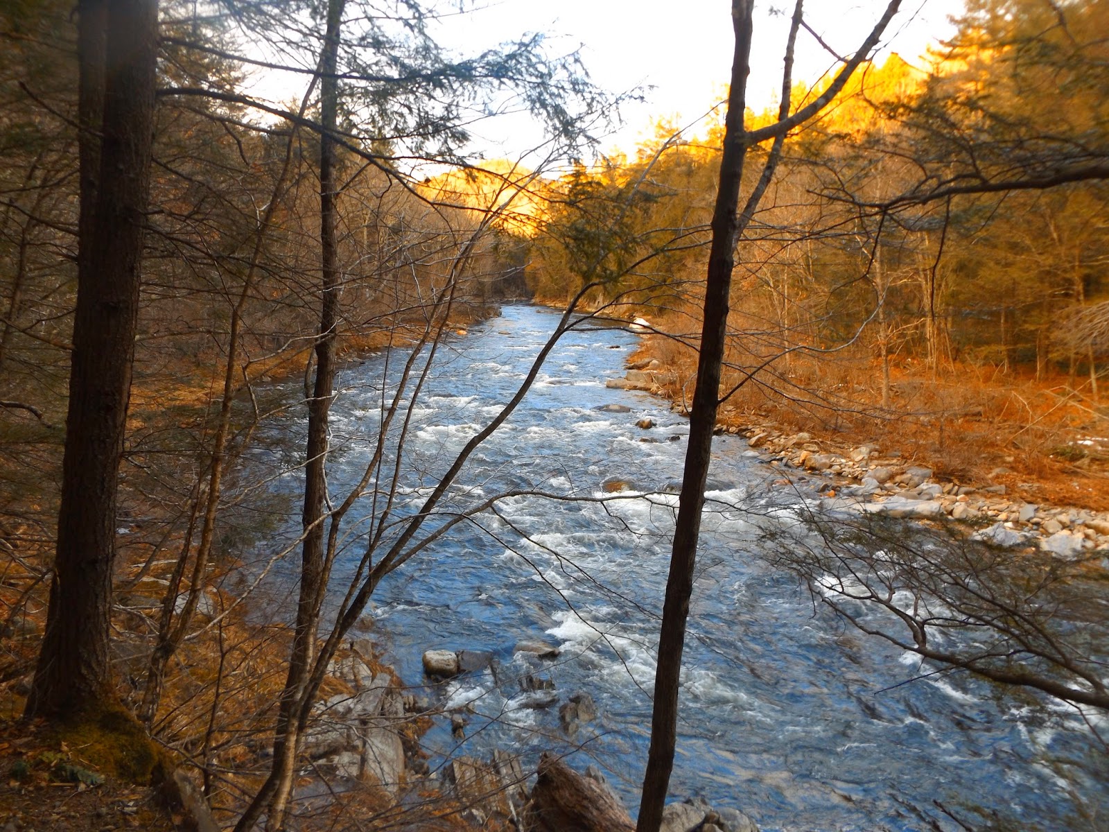
The East Branch Trail drops down beside the beautiful East Branch of the Westfield River, offering many views.
The East Branch Trail continues on for nearly 9 miles along the river.
A look back upstream from a higher spot along the trail.
A truly remarkable, yet peaceful place to enjoy the best of what nature has to offer. The daylight was dwindling unfortunately however, so decided to head back to the car. Hiked in about one mile before turning back. Had a fantastic day exploring some beautiful areas in the hills of Western Massachusetts.


No comments:
Post a Comment