The Long Trail signage after crossing the highway.
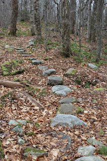
The trail immediately begins heading south into a hardwood forest away from the sounds of hustle and bustle of rushing traffic.
The LT/ AT crosses several small streams along the way. The first is crossed by a nice footbridge. All other streams are small enough to be crossed by rock hopping.
A cold stream rushing down through the woods, with ice forming along the way.
The trail soon turns west towards the ridge line, where screened views over the valley through the bare trees are available.
Passing through ferns.
A nice cascade drops down near a set of power lines.
Just prior to reaching the summit, you will pass by a substantial rock wall.
After 2.4 miles you will arrive at a small side path which climbs the rock outcrop to Spruce Peak's summit area. The path is not really clear but it is fairly easy to climb up the rocks to a nice view point west over Manchester.
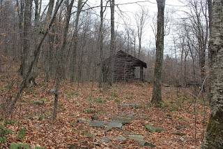
A short walk down the spur trail brings you to the shelter.
Spruce Peak Shelter, built in 1984, provides a unique cabin like lodging exerience.
The front view of the shelter.
Once inside, you have the option of leaving the door open or sliding it shut for a true indoor feel. There is a wooden table with reading material and windows, which provide good lighting.There are several bunks for sleeping.
The ladder to a top bunk.
A wood stove is found inside to provide warmth on cold Vermont nights, as well as a duraflame log and paper for burning. There are also written instructions posted on the interior wall.
A side view of the cabin.
The front porch area.
Just down the trail is a privy with these instructions. :-)
After enjoying the cabin for a little while, I turned back, retracing my steps north 2.8 miles to the car. There is another substantial view from a power line clearing. Route 11/30 can easily be seen winding along.
Arrived back at the car after completing 5.6 miles RT on this cloudy, cool last day of November.


No comments:
Post a Comment