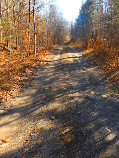
After about .6 miles the foot trail turns right, away from the woods road and then meets another trail junction. The marked trail heads left and follows an easier grade, while the right ascends a much steeper grade.
After about 1 mile, you will arrive at the first rock ledge, which affords nice views west towards Snowy Mountain and Griffin Brook Slide.A zoom view towards Snowy Mountain.
Continuing past the first ledge for another .1 mile, you will arrive at the next rock ledge marking Watch Hill's 2125 foot summit. The excellent views south and west.
The view from the ledges.
After enjoying the summit views, I continued east where the trail drops sharply down half a mile to Indian Lake's shores. Just before reaching the water, a large, beautifully hand crafted fire place stands.
Just feet away from the fireplace you will arrive at a small beach along Indian Lake's west shores.Enjoying the cool, but sunny and comfortable weather as the waves crash in.
Southeast views over the sun drenched waters.
A fairly easy 3.3 mile RT. I then grabbed some lunch and headed back down Route 30 south to Auger Falls. The parking area for Auger Falls is 1.7 miles north of the Route 8/30 intersection near Wells. From the large parking lot you can walk either left or right to start a loop. I began walking south on a rough gravel road .1 miles towards another smaller parking area. From there a marked trail heads east into the woods and towards the falls.
After about .3 miles you will begin to hear the loud, thundering crashing of Auger Falls. The sheer power of the falls creates a large area of mist dancing on the water.
Crashing water along a long chute just below the top falls.
I climbed up onto a large rock which provides one of the best views of the powerful falls.
A view of the mist in the sun from just above the falls.
A small camp spot with fire ring is found just downstream.
After exploring downstream for about .1 of a mile, I headed back upstream past the falls where an informal path follows the river completing a 1.2 mile loop.Most of the river is fast flowing with strong current along this section.
A footbridge on the east side of the river, where Macomber Creek flows in.
A small beach near a more tranquil spot on the river.
After leaving the river, the trail arrives back at the gravel road and parking area.
A nice, quiet day in the Central Adirondacks. Hiked about 4.6 easy miles RT total.


Good Lord, these pics are beautiful...I'm going to get there asap! I love being away from crowds and this seems like it would be.
ReplyDeleteYes, I'm sure it will be a crowded trail on nice weekends but compared to the High Peaks area it is much, much quieter.
Delete