Finally got some beautiful spring weather, so I took advantage by doing a thru-hike of the Taconic Crest Trail from Robinson Hollow south all the way to Madden Road. First spotted my car at the end of Madden Road in Hancock and then had my dad drive me up to the parking area high up on the west side of the Taconics in Robinson Hollow, located in the town of Stephentown. Robinson Hollow is a rough, rutted road that climbs steadily up to about 1700 feet elevation. I wouldn't recommend driving it without 4 wheel drive. From the parking lot, back track several yards on the road and look for a trail that enters the woods to the east.
The trail you will be following is the Robinson Hollow Access Trail and is marked with yellow DEC trail markers.
White birch and spring growth crowd this old road, as it ascends steadily toward the Taconic ridge.
As the access trail ascends up and over 2000 feet, filtered views begin to open through the trees to the north at the multiple ridge lines of Misery Mountain.
Nearing the top of the access trail, there is a section of trail rerouted around very muddy, washed out ATV tracks.
Wildflowers blooming out.
After .85 miles, and about 600 feet elevation gain, I arrived at the Taconic Crest Trail. The Robinson Hollow trail is marked here as well.
The intersection where Robinson Hollow meets the Taconic Crest Trail. An old closed down access trail used to head east from here down to Hancock at Rathurn Hollow.
Turned right(south) here and almost immediately ran into deep muddy, ATV mud holes.
Continuing south, I soon arrived at a wide open high elevation meadow. A small window provided a view towards the next ridge line to the south.
At a little under 2300 feet in elevation, this clearing seems quite unusual but very interesting.
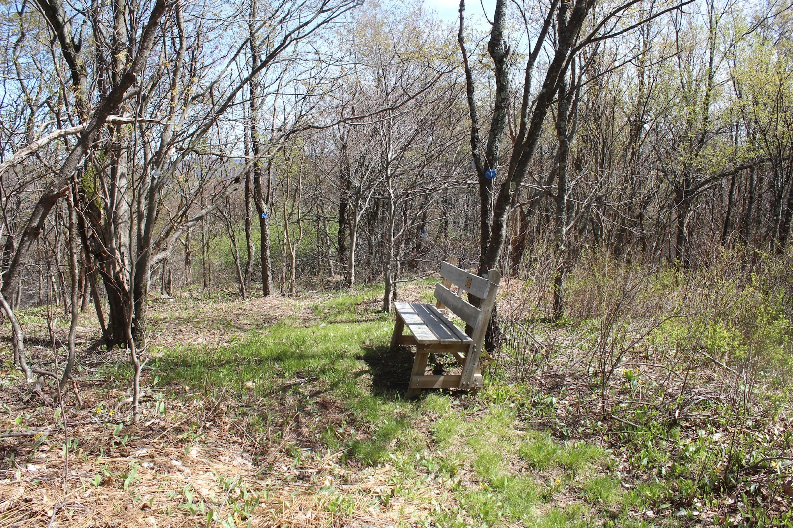
Just past the open clearing is a bench, placed here in memory of Phil Fountain.
Just to the east from the Phil Fountain Memorial Bench is a bit of a view across another meadow.
Looking back at the small summit bump with the bench near the top. I may be wrong, but think this spot may be known as "Bill's Lunch".
The trail continues south, bending its way up, over and around the many ridges. Here, through the trees, is a great view at one of Rounds Mountain's summit bumps just ahead.
Dropping down a steeper section of the TCT.
At a saddle between two bumps, I crossed a small marshy area.
Since the trail follows the crest of this mountain chain, there isn't much in the way of running water along the way. I did however, pass this small stream running out of the marshy area.
The trail passes through over 90% hardwoods, but one section does skirt an area of hemlocks and then around stone walls. As the trail turns southwest, I crossed over a pretty little drainage area in a low spot on the trail.
Where logging roads meet. The Taconic Crest Trail is not only a foot trail, but also follows a network of old logging roads and ATV trails, so you must take care to follow the blue and white TCT markers.
A fairly steep climbs swings you the west edge up a ridge of Rounds Mountain, with filtered views down into Stephentown to the west.
The TCT ascending Rounds Mountain up through hardwoods.
More screened views down into the rural New York countryside.
Perfect spring conditions.
Blue skies, a calm wind, and temperatures in the upper 60's made for great hiking and also allowed for trees at this high elevation to really being to flourish.
The Taconic Crest Trail swings left at a bend in an ATV trail, but continuing along the rutted ATV trail another .3 mile, I found a clearing at the 2257 foot summit of Rounds Mountain.
The summit of Rounds Mountain is a very large, wide open clearing.
Spectacular views can be found from this summit. Here is a great view west into New York.
West views all the way to the Catskills of NY.
A look at the large clearing atop Rounds Mountain. This appears to be a popular spot for ATV's, and 4 wheel drive vehicles.
The mountains of Pittfield State Forest to the southeast.
After enjoying the summit views, I back tracked to the Taconic Crest Trail, which follows the east slopes of Rounds Mountain. I found a small view down into the Hancock countryside.
Descending Rounds Mountain.
After nearly 6 miles, I finally came to the old extension of Madden Road in Hancock. I followed this all the way down onto the maintained, paved section of road where I had left my car.
Hiked about 6.5 miles total on a spectacular spring day. There are many ups and downs along the Crest Trail, but doing it in this direction, I think there was more descent than ascent. Total elevation gain for the day was about 1300 feet.


No comments:
Post a Comment