PLEASE NOTE-THIS PEAK IS PRIVATE! PLEASE SECURE CONSENT WITH LANDOWNER BEFORE HIKING.
Started the day from 1800 feet elevation and a very fine morning view of McGregor Mountain(L) to Utsayantha Mountain(R).
The early part of the hike found us crossing wide open farm fields with pleasant views all around. Here is a north view of Bald Mountain.
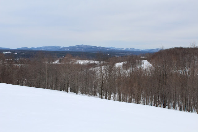
We continued south through deep snow and very nice views back to the north/ northeast.
A bit further along, we came to this stunning view towards Huntersfield Mountain with Cave and West Cave(Ski Windham) behind.
Our first glimpse at the 3000 foot north end of the NW Moresville, just beyond McGregor's ridge line.
Jim, crossing the wide open fields towards McGregor's ridge line through about two feet of snow.We came across this old, abandoned dairy truck ghost of the past. Looks like it may be used as a camp spot.
Crossing one more open field, with spectacular views, as well as a lone white birch.
Entering the woods, white birches became the theme as we passed through a large stand of them.
The white birch stand was extremely impressive and very pretty.
At just above 2400 feet, we came to a power line crossing.
Although the power lines themselves are not very appealing to the eye, the views they provide are very nice. Here is a view of the power lines running north, across Route 23 and into South Gilboa.
After passing the power lines, the climbing became pretty steep. The deep snow only slowed us down more, almost to a crawl at times.
A steeper push up. A real good thigh burner.
After hitting the 3000 foot ridge line, we continued south along the ridge, where we were lucky to spot a great view of McGregor(foreground) to Utsayantha(behind) to the northwest.
From the same view spot, looking west, Churchill(L), Utsayantha(center), McGregor's sotuh ridge(R).
The ridge leading to the summit is fairly long and uneventful, with one last push up to the wooded 3240 foot summit. My 87th CHH.
After hitting the summit, we turned back, retracing our steps off the mountain. Here is Jim, heading down into the cold between NW Moresville and McGregor.
Even through the trees, the views down into the valley are very pleasant. Crossing back over the farm fields on weary legs. The views to the east were still very nice, but much cloudier than in the morning.
Arrived back at the car, with exhausted legs. Breaking trail through 2+ feet of snow up a mountain is very tiring. 6.4 miles RT and about 1600 feet elevation gain.
With later sunsets, I decided to explore some back roads on the way home. Paused briefly to capture this peaceful farm in rural Gilboa.


No comments:
Post a Comment