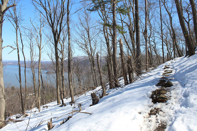
The Stillman Trail is blazed in yellow and follows a wide woods road. Only a few hundred yards into the hike I hit snow, but it was very trampled down allowing for easy walking.
The trail climbs steadily up the north side of the peak through gradually deepening snow. The trail utilizes many switchbacks and is never very steep.
As I gained elevation, views to the north to Cornwall on Hudson began to open up.
Winter is holding up very tightly on the north side of the mountain.
Bright sun and temps in the 40's helped offset the deepening snowpack.
The trail soon climbs up to the first of many spectacular open views to the south and east.
Directly across the Hudson is the impressive rock face of Breakneck Ridge, another extremely popular hike.
The southeast view focuses on Bull Hill and its rock quarry along its lower slopes.
A closer inspection across the river shows traffic rushing along on Route9D at the base of the mountains.A look west at more open rock.
More south/ southeast views down the Hudson River with Little Stony Point below Bull Hill.
Climbing up to the north facing views near the summit.
Looking down at the Cornwall Yacht Club and the western banks of the Hudson River.
The north view stretches all the way to the Catskills in the distance with the Newburgh-Beacon Bridge spanning the Hudson. Bannerman Castle can be seen on the small island in the foreground.
The view to the northeast shows Breakneck Ridge in front with Schofield Ridge stretching beyond.
The true summit sits only a few feet off the trail and was in very deep snow. The trail, however, was very well packed down.
I continued west/ northwest along the ridge towards Butter Hill. From a spot just below the summit of Butter Hill, I found a nice view back to Storm King.
Climbed up to the summit of Butter Hill, which, at 1380 feet, is actually higher than Storm King.
A short walk off the summit found nice views to the northwest.
The north view to the Hudson River.
Just past the summit is a spectacular view to the south, where Route 9W can be seen carving its way through the interior Highlands.
The southern exposure and open rocks mean almost no snow just below Butter Hill's summit.
The wintry peaks of the Hudson Highlands rising to the southwest of Butter Hill.
After enjoying the views, I headed back east to the blue/red marked Bluebird Trail, which is a connector back north to the Stillman Trail. Just prior to the steep drop, I found one more north facing view to village of Cornwall on Hudson.
The Bluebird Trail was a fairly steep drop through melting/ consolidating snow.
Once back on the Stillman Trail, it was a straight shot back to the car. Hiked about 4.7 miles with 1100 feet of elevation gain total.
After the hike I drove around to the north side of the mountain for a nice profile of the peak.


No comments:
Post a Comment