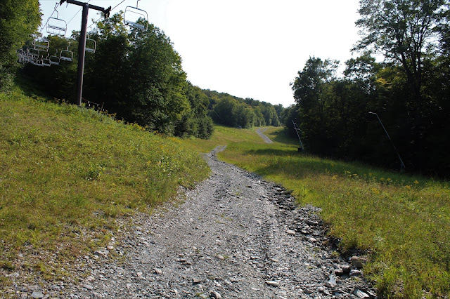
Not all ski runs make for great hiking. Sometimes, there are too many people and distractions going on for you to feel in touch with nature. Also, the slopes are usually relentlessly steep with no shade, especially on hot, sunny days. One thing, however, that all ski slopes do offer up are great views. I decided to visit nearby Jiminy Peak, located a short distance across the state border in Hancock, Massachusetts, after work this afternoon to check out their views. As I got started, the sounds of kids(and adults) enjoying all that the resort has to offer, as well as the Mountain Adventure Park resonated.
Elevation at the base of the Upper Lift Line was a touch under 1250 feet.
Right out of the gate, I headed directly up the steep slopes, quickly breaking into a sweat.
Almost immediately upon gaining elevation, I began to have views back down towards the resort, as well as nearby Vacation Village.
Continuing up at a steady rate. The climb to the high point is 1150 feet in about one mile.
Crossing under the Upper Lift Line on an access road.
I quickly left the access road, heading up through the top part of the peak, through open fields.
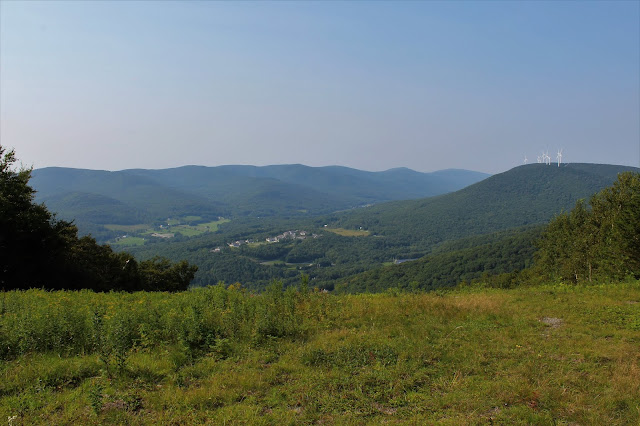
Near the top of the fields, and about 150 feet below the 2380 foot summit, I stopped to enjoy this view back to the north.
A zoom view down to the Hancock countryside.
Turning the corner at the top of the run, I ran back into the access road, as well as the large wind turbine that faces Route 43 west.
Instead of following the access road up, I seized the opportunity to get some shade, following a woods road up to the summit.
At the 2380 foot summit, I came upon the top of another lift line.
The summit is a long, flat area with an off limits area I had to get around. I found what I believe to be an ATV/ snowmobile trail that took me in the direction I wanted to go, so I followed it.
The ATV trail quickly came back out at a large clearing near the summit lodge. The views from the lodge are outstanding! Easily the best of the day.
You can easily trace the Taconic ridgeline to the west(left), with the Jericho valley of Hancock(center) and the southern end of Brodie Mountain's wind turbines(right).
A zoom view over 1100 feet below to my starting point at the resort.
One last look back west towards the Taconics.
Continuing east/ northeast, I passed by several other ski runs(Upper Whitetail, Jericho, Wild Turkey), each with great views. Pictured here is the view at the top of the Jericho run.
My route along the summit followed a rough gravel road, labeled Left Bank, and soon began to turn slightly more Northeast then east, offering up a bit of a different perspective. From here the wind turbines atop Brodie can easily be made out, as well as the access road.
Another view down towards the Jericho valley of Hancock, from a slightly different angle east.
The gravel road marked Left Bank drops down to a saddle between summit bumps. Just above the treeline, Mount Greylock can be seen peeking out.
A right turn onto the Easy Does It trail got me up to the top of the next summit bump following rough ATV tracks. Another lift line can be found there, with similar views asbefore to the north.
Just beyond the top, the trail begins to drop, where an incredible vista towards the Greylock Range begins to unfold. This marks the start of the Panorama trail.
Swinging around to the north, the Panorama trail lives up to its name, offering up lovely views. Just prior to a steady drop, I enjoyed this look at the nearby 2350 foot north summit of Jiminy Peak/ Potter Mountain.
As the trail swings around to the west, dropping quite steadily, I found this great view through the late afternoon sun down towards Ioka Valley Farm. with Rounds Mountain rising beyond.
I followed a series of ski slopes all the way down, heading west, then NW, completing a large loop.
Hiked about 4.3 miles total, with about 1400 feet of elevation gain total.


No comments:
Post a Comment