Did some exploring at the Partridge Run WMA out in the Albany County hilltowns this afternoon once it finally stopped raining. The clouds persisted, as did the humidity, but at least it wasn't pouring out, as it had been most of the morning. I parked at the west end of Partridge Run Road, just off of Albany County Route 6(Ravine Road), and began walking east along rough(but driveable) Partridge Run Road. This road also doubles as part of the Long Path here.
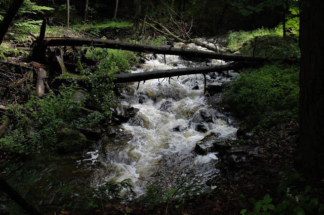
Within a couple minutes, the sounds of rushing water can be heard down a steep embankment off the right side of the road. This is a branch of the Switz Kill, which is really roaring strong after all of our recent heavy rains. A steep drop down brings you to a series of pretty 10 foot waterfalls. Footing can be tricky down here and it is off trail, so please be careful if visiting.A bit further downstream, the normally tame stream raging along.
After leaving the creek, I continued along Partridge Run Road to a junction. I stayed left, heading north through a picturesque forest on the Wood Duck Trail.
Moss covered stone fence.
The snowmobile trail soon enters a large meadow area, where the grass gets high and wet. Several yards off trail to the right is tiny Pickeral Pond.
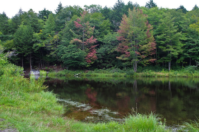
Just beyond Pickeral Pond is another trail junction. My route for the day would be taking me left, but Wood Duck Pond was such a short distance away to the right, I figured I'd give it a look. It is much bigger than Pickeral Pond, but appears exceedingly shallow, with multiple tree stumps near the far shore.
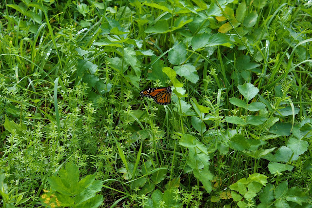
In the tall weeds near Wood Duck Pond, I fond this butterfly fluttering around.
After my brief pond visit, I turned back, picking up the snowmobile trail again, which headed in a westerly direction through an ominous forest. This trial was marked as the Redbelly Trail.
The snowmobile trail was quite wet, and headed down into an eerie, dark forest.
A small but pretty tributary babbles along through these lightless woods.
The trail crosses the tiny creek, which probably normally is never an issue. Even today, after all of our rain, it was still a fairly easy crossing.
Late summer wildflowers in bloom.
The snowmobile trail eventually heads NW, back towards County Route 6 and a road crossing. Just before that though, I stopped to check out yet another small, 5 foot falls on a tributary creek.
Upstream, just above the small falls.
I soon emerged from the woods at a parking lot along County Route 6, where it meets County Route 13(Sickle Hill Road). I continued across the road here, following Sickle Hill Road west for a litlte over half a mile. Incredibly, not one car passed me the entire time I walked the road.
After my road walk, I turned south(left), onto Fawn Lake Road. This is a gravel road, driveable in the summer, but designated a truck trail . This also marked my return to the familiar aqua blazes of the Long Path.
This road also sees very light traffic and I only saw one car on this road walk as well. As luck would have it, they happened to be driving into my picture frame as I stopped to photo Newt Ponds, found roadside.About a quarter mile further the road comes to an end in a large parking area. A short walk from here leads down to gorgeous Fawn Lake.
Although summer's heat and humidity has been relentless, signs of fall are beginning to creep in here and there if you look hard enough.
Back up at the parking lot, I noticed a small foot path heading downhill towards a dam. This path leads down to the outlet area of the lake, where a pretty man made waterfall can be enjoyed.
Back up to the parking lot, I headed east/ northeast on the Long Path through the woods and past more stone fences.
The Long Path makes a sharp turn directly east at a bend in the woods road, dropping down to another creek crossing. This time, a sturdy footbridge ensures safe passage.
Once on the east side of the creek crossing, the Long Path passes through a very wet and muddy area. Incredibly, it must've been worse before, because this is a rerouted section on slightly higher ground. Within a few minutes, however, I found myself on yet another truck trail. The Long Path headed back down to the car at my original parking area, but I knew that White Birch Lake was less than a quarter mile away on this road, although in the opposite direction. My decision was easy, as I proceeded along the road down to the lake.
As fate would have it, skies finally began to clear, just before my hike came to a close. Walking down to the dock on the White Birch Lake, with increasing sunshine above!
I had been waiting all day for the clouds to break up, and the blue skies above the water made for stunning photos.
Another unmarked footpath heads off into the woods for about 1/10 of a mile down to another dam and waterfall.
After checking out the dam, it was a quiet, uneventful walk back to the car. Hiked about 6 miles total, with many ups and downs but I didn't track my elevation gain. It was a very nice tour of this beautiful, seemingly under the radar area.


Great pictures!
ReplyDelete