Finally got into some downright balmy weather today, with temperatures climbing through the 50's with bright sunshine. Felt great cruising down the road with the windows open on my way into the Berkshires after work. Visited the Keystone Arch Bridges Trail, located in rural Chester, Massachusetts along the scenic West Branch of the Westfield River. The trail can be found by taking the Mass Pike east to exit 2 and then following Route 20 eastbound all the way to the town of Chester. Take a left hand turn(North) on Middlefield Road and follow it for 2.5 miles to a small pull off on Herbert Cross Road. Herbert Cross Road is not an actual road, but the beginning of the trail.
Trails are well marked throughout.
The trail drops immediately downhill and crosses Babcock Brook(a raging river today) on a wide footbridge. After a couple hundred yards, the beautiful West Branch of the Westfield River will be on your left.
Huge blocks of melting ice are washing up along the shoreline.
The first Double Arch Keystone Bridge comes into view almost immediately after beginning your walk along the river. These bridges were constructed in the mid 19th century and completed in 1841. The Western Railroad of Massachusetts used these bridges back then and believe it or not, are still in use today by CSX.
The snow remains fairly deep along much of the trail.
A look back downstream.
Melting snow and ice is streaming down hillsides from all directions, making for pleasant surprise cascades.
Another powerful cascade emptying into the river.
Snow crowds the shores of the beautifully scenic but cold river water.
Melting snow on the slopes above the river.
Typical early spring woods along the trail.
A footbridge crosses over a small, unnamed stream that comes barreling down a steep ravine.
Looking back at the footbridge bringing you from one side of the ravine to the other. Footing can be tricky along a few stretches of trail, as the banks above the streams and river are extremely steep.
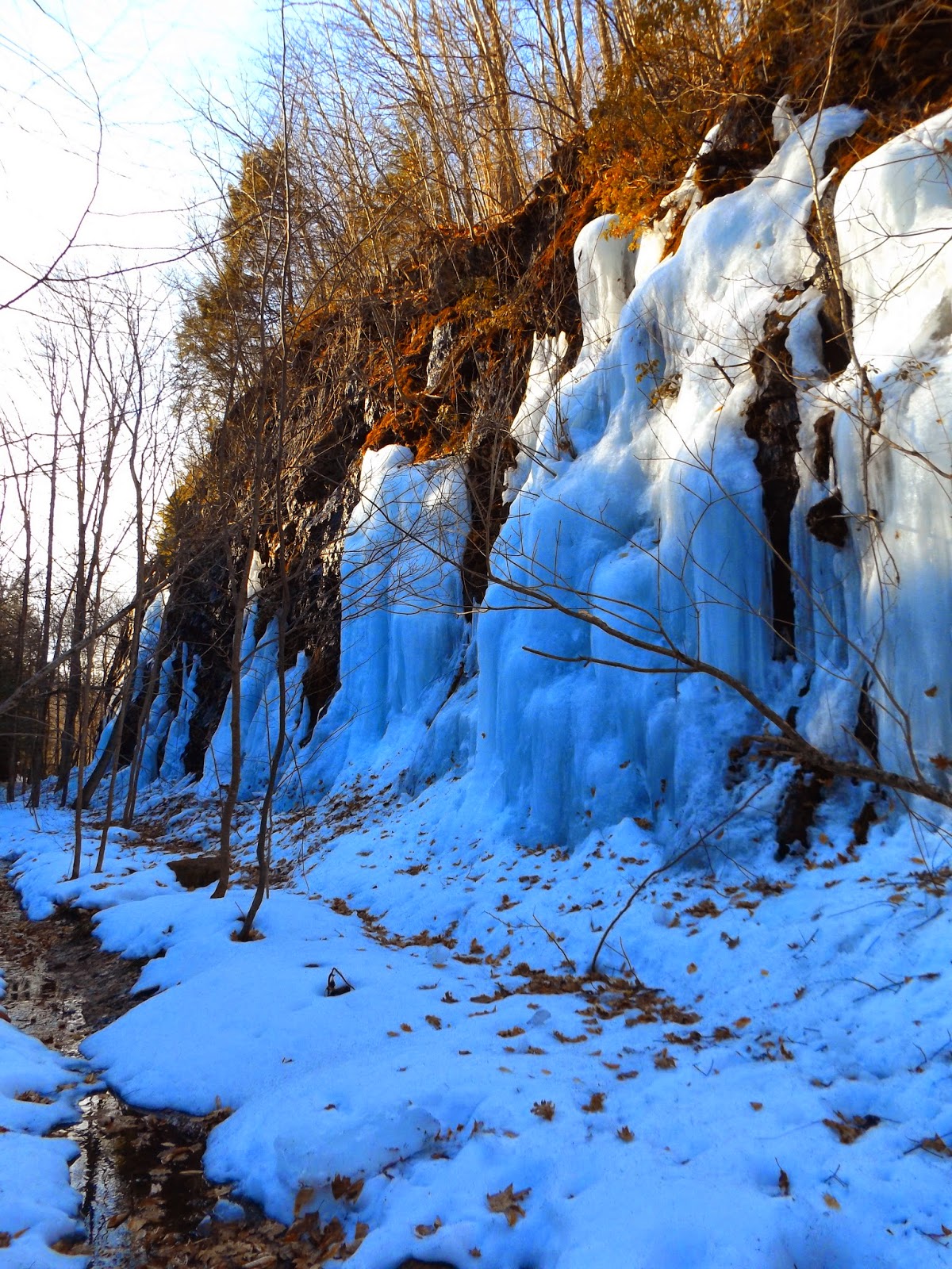
The trail proceeds through a large rock cut, with 30 to 40 foot rock walls rising straight up above the trail. Today, there were huge ice flows along the walls that seemed almost overwhelmingly big.
This part of the trail is perpetually colder than surrounding areas, meaning that snow and ice hold on much longer.
Looking up the West Branch Gorge from the top of the 70 foot Keystone Bridge A.
Remarkable view of the stonework on Keystone Bridge A.
A very short distance beyond Bridge A, you will arrive at the remains of a keystone bridge destroyed by a flood in 1927. This is the turn around point of the trail. The current train tracks(and maybe even a train) are several yards away on the left and a large kiosk standing before you explains some of the history of the area.
Nearing the car again, I passed by fast flowing Babcock Brook crashing down amongst the evergreens and ice.
Had plenty of solitude as I only saw one other couple out the whole day. Hiked about 5 miles RT on this out and back hike. The melting snow and ice make walking tough at times, but the warm temps more than made up for it.


No comments:
Post a Comment