The trail starts just beyond the gate and heads north on an old cart road used by the Shakers. An opening in the trees provides a good glimpse back at the beautiful buildings in the Hancock Shaker Village.
The trail was basically a sheet of ice, but I managed without the micro spikes.
Passing by the Shaker Reservoir, which was originally built in 1818 and then enlarged in 1894.
Continuing north, the trail soon meets up with Shaker Brook and closely follows it.
Nearly half a mile into the hike, the trail arrives at the Low Dam, which was built before 1818 and supplied North Family mills on the east side of the creek just downstream.
Just beyond the Low Dam and roughly half a mile into the hike, the trail crosses Shaker Brook on a sturdy foot bridge.
After crossing the brook, the trail turns back south heading past the old North Family dwelling(there are no remains today) and then turns sharply uphill left heading towards Shaker Mountain. The ascent is slow but steady and eventually crosses under power lines, providing a glimpse south.Although snow free for most of the hike at this point, I began to see quite a bit of snow above 1700 feet.
Approaching the summit area, I arrived at the Holy Ground, a large area of worship for the Shakers.
A pair of small white fences mark the main area of worship.
I left the trail to bushwhack a short distance east to the true summit of Shaker Mountain at an elevation of 1860 feet. Unfortunately, the summit is completely wooded with no views.
A cell tower near the true summit of Shaker Mountain.
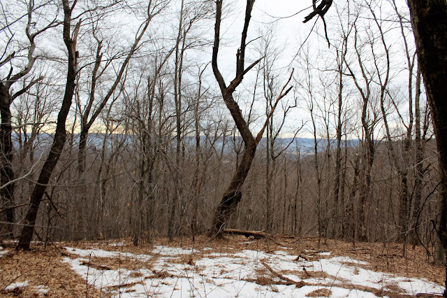
I continued to bushwhack the east side of the summit area, hoping to catch a decent view through the leafless trees. The best spot I could find was a sliver of a view down towards Onota Lake in Pittsfield.
Once back on the trail, I headed north and found a screened view west towards Mount Lebanon's holy site, 1968 foot Holy Mount. The area between the two mountains was referred to as the "great gulf" and can be seen in this shot.
Dropping down off the north side of Shaker Mountain, the woods become much more wintry and passes through an impressive white birch stand.
The Shaker Mountain Trail arrives at an intersection with the CCC(Civilian Conservation Corps)Trail and then almost immediately at another intersection, where I turned right onto the Shaker Brook Trail. This trail heads west through the deep forest, passing by old stone walls.
Seeing that I was only about half a mile below Doll Mountain's summit, I decided to leave the trail and bushwhack up the south facing slopes towards the summit. The bushwhack is pretty straight forward and passed through a gorgeous, deep, dark hemlock forest.
I decided to skirt the east slopes of Doll Mountain's summit area, and found filtered views down towards West Street in Pittsfield.
The 1930 foot summit of Doll Mountain is completely wooded and fairly level. I stomped around through the woods hoping to find high ground and settled on this dark, snow covered area.
Headed southwest off Doll Mountain's slopes, passing through an open hardwood forest and once again remains of stone walls.
At a low point between Doll Mountain and Holy Mount, I arrived at one of the branches of wintry Shaker Brook, winding through woods.
Ice on the brook.
I soon arrived back at the Shaker Brook Trail, which was very muddy and icy in other spots. Followed this a short distance west to the Holy Mount Trail.
The Holy Mount Trail heads south, ascending nearly 300 feet towards the summit. The stone walls on this peak are very impressive.
Stone walls near the wooded 1930 foot summit of Holy Mount. As stated earlier, this was the worshiping ground for Mount Lebanon's Shaker community.
After exploring the Holy Mount summit, I dropped west then south through the quiet winter woods. Arrived at an area known as "The Sacred Lot", the site of a spring and natural amphitheater.
The Holy Mount Trail meets up with the Griffin Trail, which heads east above an impressive gorge, carved out by a branch of Shaker Brook.
The Griffin Trail soon meets with The Shaker Trail and becomes quite intimate with this branch of the Shaker Brook. I paused here to enjoy the sounds of the cold rushing water.Heading south, I soon came to another historical marker for an old marble quarry. The Shakers used this location for building materials and can be found a short distance off the main trail. Unfortunately, the wintry woods made it difficult to see too much.
Arriving back along the banks of Shaker Brook, I began to feel a light freezing drizzle. Perfect timing to head home.
Hiked about 7 miles RT, with an elevation gain of just under 1300 feet.


I hike this area all the time,,believe it or not there seems to be less people in the summer lately,,,due to the lyme ticks perhaps,,,,Great place,,Just be careful not to get lost
ReplyDelete