Headed south on a late February morning to climb 3015 foot trail-less Little Rocky in my continuing quest to climb the hundred(102) highest Catskill Peaks. Little Rocky is often referred to as the toughest of the 67 non 3500 foot peaks on the list, due to its steepness and length of the bushwhack. The frustrating issue with this bushwhack is that a large chunk of private land is found between the parking area and Little Rocky, meaning, you must hike south for over a mile and a half before heading towards the peak, to stay on public land.
For those who do not know where Little Rocky is located, it is the peak directly southwest of Ashokan High Point, on the southwest side of the Ashokan Reservoir. Met up with my buddy Jim at the Kanape Brook parking area along Ulster County Route 42(Watson Hollow Road), the typical starting point for the trailed hike to Ashokan High Point. We crossed the road and headed down to the footbridge crossing over Kanape Brook.
Followed the red blazed trail along the beautiful brook towards the trail register. The trail was mostly bare ground or beaten down where there was snow and made for easy walking.
Passing along a stone wall as the morning sun broke free through the trees.
We hiked the trail for a little over 1.5 miles and then headed southwest into the woods, beginning a steep bushwhack up the slopes of Little Rocky. The ascent from the trail is no nonsense, climbing roughly 1600 feet in just over a mile. As we gained elevation, views began to open up across the deep valley towards 3061 foot Ashokan High Point.
Jim wandering around, trying to find a clear view of neighboring Ashokan High Point.
We continued our steady climb up towards the col between Little Rocky and Mombaccus Mountain. Once up on the main ridge between the two peaks, the ascent eased up considerably.
As we headed northwest towards Little Rocky, we encountered several smallish cliff bands, with interesting rock formations.
Heading through the mostly open woods, through several inches of snow. We chose to forgo snowshoes for microspikes and had no issues at all.
Jim enjoying the beautiful winter conditions as we climbed up over a southeast false summit on the way towards the true summit.
A large rock cairn near the false summit.
Although Little Rocky is not known for having many views, we were fortunate enough to locate some peek a boo views north towards the Devils Path peaks.
A zoomed view through an opening in the trees north.
More interesting rock formations and caves high up on Little Rocky.
The 3015 foot summit is completely wooded and directly on the state land/ private land boundary marker. Here I am at the top. My 64th Hundred Highest peak.
A large clearing on the return trek towards the Mombaccus col. Screened winter views through the trees offer only a glimpse from up here.
Looking at Mombaccus Mountain, which is actually the eastern high point of Little Rocky, covered in dwarf oak trees.
After the mellow walk along the ridgeline, we eventually had to head back down the steep slopes towards Kanape Brook. We took or time, being careful of our footing and headed straight down.
The descent was pretty quick, with only a couple of tricky spots to negotiate. Simply took our time, digging into the snow to gain purchase when needed.
Back down on the red marked Kanape Brook trail as we headed back out to the car.
Just off the trail, we spotted a large area of rock cairns so took a quick side trip to check them out.
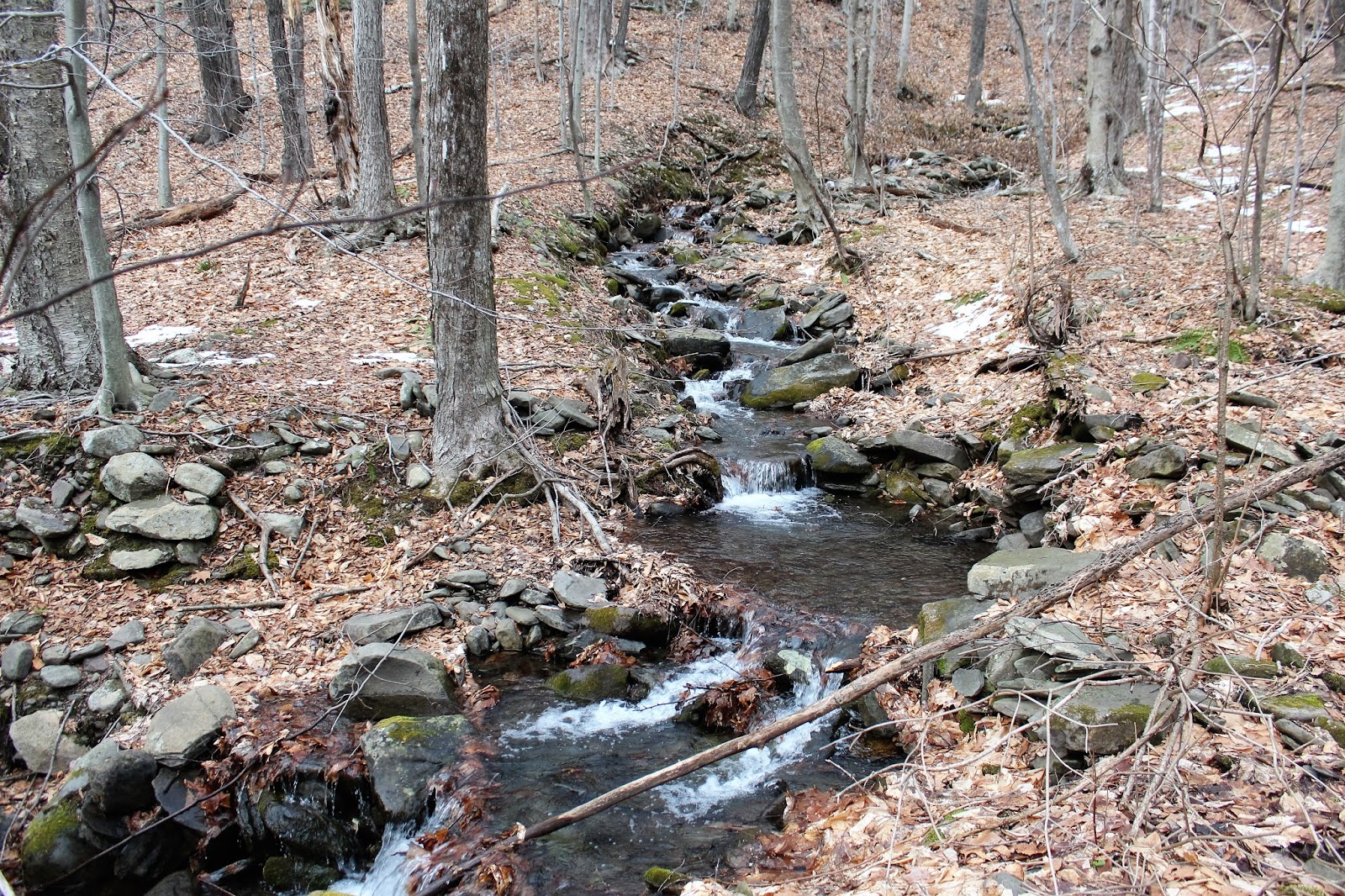
The recent warm temperatures have resulted in a lot of melting snow, which in turn has lead to lots of running water down the mountain sides. Small cascades made for a picturesque scene and a glimpse into spring.
Hiked about 8.5 miles RT, with 2200 feet elevation gain on a nice winter day. 64/102 CHH peaks completed.


No comments:
Post a Comment