The trail is marked with blue blazes and starts out nice and gentle on an old road.
Crossing over a tributary of McGinn Brook.
A fast running drainage bathed in early morning light.
The trail heads southeast, closely following the tributary, before turning sharply northeast.
After about half a mile of hiking, the trail enters the 6720 acre Big Branch Wilderness.
About a mile into the hike, the trail passes over a well built footbridge across a section of steep side hill slab.
Hand railing aids the hiker just past the foot bridge.
About 1.9 miles into the hike, the trail crosses over the main branch of McGinn Brook. Wet rocks can make this a bit tricky, but it is certainly doable.
Once across the brook the trail comes to a junction. A left leads up one mile to Baker Peak, and a right heads towards the Long Trail and Griffith Lake. I turned right here, climbing steadily up beside the brook on a muddy trail. This trail crosses over several small tributaries before eventually hitting drier ground.
About 1.4 miles from the trail junction and 3.3 miles from the car, I arrived at the Long Trail. Turning right(south) on the LT, the trail drops down to the shoreline of Griffith Lake in a short .2 miles.
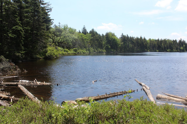
Griffith Lake is a quiet, high elevation(2600 feet)backcountry body of water with a feeling of remoteness.
I explored the shoreline for a bit, stopping to relax and have a bit to eat.
Pink azaleas were really showing off their pretty colors near the lake.
After enjoying the water's edge for a while, I turned back, heading north on the Long Trail through mostly hardwoods. The trail meanders along for nearly 2 miles before finally arriving at the Baker Peak Trail. From here a trail sign points you directly up the steep rock slab up to the peak.
The last .2 miles up is a fun rock scramble with great views opening up behind you.
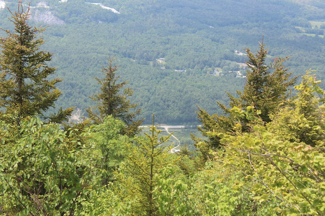
Turning around, the views are outstanding. Directly to the west, through the thick haze is 3770 foot Dorset Peak. Elevation of Baker Peak is 2850 feet. Mileage for the day at this point was about 5.6 miles.A look all the way down to South End Road where it leaves Route 7 near the parking area.
Southwest views over the Otter Creek Valley and the Route 7 corridor.
Route 7 can be seen way down in the valley below.
Turning slightly to the northwest, the view encompasses the north end of Dorset Peak and the Danby countryside.
After enjoying the great views, I headed down the Baker Peak Trail one mile back to the brook crossing and then the Lake Trail all the way back to the car.
Glad to get back to the car on a sticky, hot, and humid day. Total mileage of 8.6 miles RT, with 2350 feet elevation gain.


No comments:
Post a Comment