The forecast called for a good amount of clouds and rain moving in later in the afternoon, so my buddy Jim and I decided to do a couple of short hikes in the Catskills today, hoping to beat the rain. Our first stop was 2510 foot Ticetonyk Mountain, an untrailed peak that stands north of the Ashokan Reservoir and with 1640 feet of prominence, towers above the surrounding valley. We met up at the DEC parking area along Peck Road a little after 8am and got going quickly.
The lower slopes of the mountain are literally laced with stone walls and golden ferns.
We picked up a woods road and began following it steeply up.
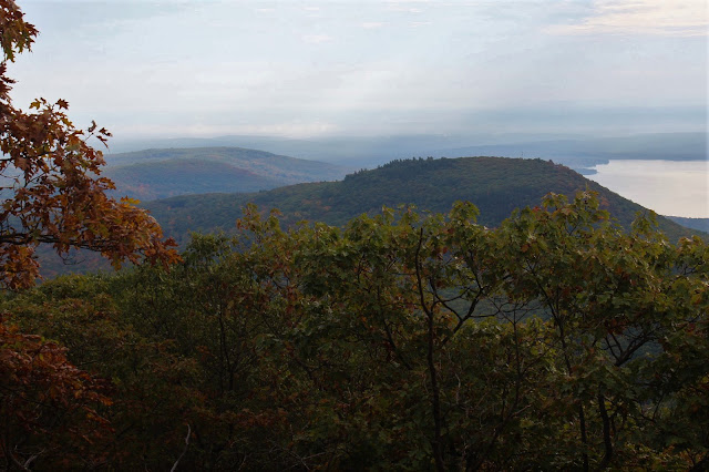
As we quickly gained elevation, we found some peek a boo views southwest towards the Burroughs Range. A hint of fall color made for a pleasant view.
As we ascended, we hit some impressive, large, overhanging rock bands. Here is Jim getting a closer look.
The woods were so beautiful and wide open it was almost like strolling through a park.
Arriving at the 2510 foot summit. The marker is found atop a large, flat boulder.
We dropped down off the summit to about 2400 feet on the southeast ridge and found a gorgeous ledge view over the Ashokan Reservoir. Tonshi Mountain is the mountain just north of the reservoir, sitting at an elevation of just over 2000 feet.
A more southerly view over the reservoir, with clouds lingering off in the distance.
East facing view over Tonshi Mountain and Ohayo Mountain beyond.
After enjoying the views, we headed further west on the mountain, passing through more golden fern glades.
Jim had previously hiked this mountain and knew of another view point towards the southwest, so we headed off in search of the elusive views. Unfortunately, we didn't find the open ledges he had told me about, but we did manage to find some very nice views over Samuels Point and towards the Burroughs Range.
Eventually we decided to move on, descending down the south slopes of the mountain, picking up the same woods road we had come up on.
Back down at the base of the peak, we began encountering more beautiful stone walls.
From the eastern edge of state land, we managed to find a view back up at Ticetonyk's ridgeline.
A beautiful peak that doesn't get much attention. Round trip was just over 3.5 miles and a little over 1200 feet elevation gain.


Love your blog. Is there a way to find hikes in the Catskills other than wading through archive?
ReplyDeleteThanks
R
Hi, thank you! Glad you enjoy the blog! The best way I have set up to find hikes for now is the search bar near the top of the page.
Delete