Blue skies and temperatures in the mid to upper 40's were enough to inspire many folks to get out for an afternoon stroll along the Ashokan Reservoir today. This is a popular spot for a peaceful stroll, a bike ride, roller skating or maybe even a jog. I saw all of these today.
I headed north from the west parking area, passing by the outlet of the Reservoir, where the Esopus Creek emerges far below.
Ashokan High Point rising to the southwest.
Ticetonyk Mountain to the north.
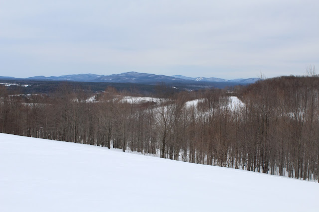
The Burroughs Range to the west.
A closer look at Ashokan High Point.
I was pressed for time so I decided to turn around just shy of the weir. One last view on my way back.
Adventures around the Capital Region area of New York State, as well as the Adirondacks, Catskills, Berkshires and Vermont
Search This Blog
Monday, March 26, 2018
Storm King Mountain(Hudson Highlands)
Headed down to the Hudson Highlands to hike 1340 foot Storm King Mountain along the west side of the Hudson River in the town of Cornwall. Storm King Mountain, paired with Breakneck Ridge across the river on the east bank, form gorgeous narrows and the northern gateway to the Hudson Highlands. Storm King is a very popular hike and offers tremendous views for relatively little work. There are a few different ways that you can hike Storm King, but I chose to start from the trailhead along Mountain Road, on the west side of the mountain. I was quite surprised to be the only car there when I arrived. The trail begins just beyond the stone gateway at an elevation of about 475 feet.
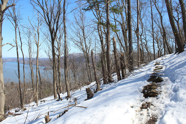
The Stillman Trail is blazed in yellow and follows a wide woods road. Only a few hundred yards into the hike I hit snow, but it was very trampled down allowing for easy walking.
The trail climbs steadily up the north side of the peak through gradually deepening snow. The trail utilizes many switchbacks and is never very steep.
As I gained elevation, views to the north to Cornwall on Hudson began to open up.
Winter is holding up very tightly on the north side of the mountain.
Bright sun and temps in the 40's helped offset the deepening snowpack.
The trail soon climbs up to the first of many spectacular open views to the south and east.
A look west at more open rock.
More south/ southeast views down the Hudson River with Little Stony Point below Bull Hill.
Climbing up to the north facing views near the summit.
Looking down at the Cornwall Yacht Club and the western banks of the Hudson River.
The north view stretches all the way to the Catskills in the distance with the Newburgh-Beacon Bridge spanning the Hudson. Bannerman Castle can be seen on the small island in the foreground.
The view to the northeast shows Breakneck Ridge in front with Schofield Ridge stretching beyond.
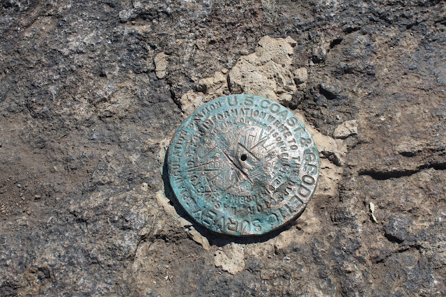
The true summit sits only a few feet off the trail and was in very deep snow. The trail, however, was very well packed down.
I continued west/ northwest along the ridge towards Butter Hill. From a spot just below the summit of Butter Hill, I found a nice view back to Storm King.
Climbed up to the summit of Butter Hill, which, at 1380 feet, is actually higher than Storm King.
A short walk off the summit found nice views to the northwest.
The north view to the Hudson River.
Just past the summit is a spectacular view to the south, where Route 9W can be seen carving its way through the interior Highlands.
The southern exposure and open rocks mean almost no snow just below Butter Hill's summit.
The wintry peaks of the Hudson Highlands rising to the southwest of Butter Hill.
After enjoying the views, I headed back east to the blue/red marked Bluebird Trail, which is a connector back north to the Stillman Trail. Just prior to the steep drop, I found one more north facing view to village of Cornwall on Hudson.
The Bluebird Trail was a fairly steep drop through melting/ consolidating snow.
Once back on the Stillman Trail, it was a straight shot back to the car. Hiked about 4.7 miles with 1100 feet of elevation gain total.
After the hike I drove around to the north side of the mountain for a nice profile of the peak.
The Stillman Trail is blazed in yellow and follows a wide woods road. Only a few hundred yards into the hike I hit snow, but it was very trampled down allowing for easy walking.
The trail climbs steadily up the north side of the peak through gradually deepening snow. The trail utilizes many switchbacks and is never very steep.
As I gained elevation, views to the north to Cornwall on Hudson began to open up.
Winter is holding up very tightly on the north side of the mountain.
Bright sun and temps in the 40's helped offset the deepening snowpack.
The trail soon climbs up to the first of many spectacular open views to the south and east.
Directly across the Hudson is the impressive rock face of Breakneck Ridge, another extremely popular hike.
The southeast view focuses on Bull Hill and its rock quarry along its lower slopes.
A closer inspection across the river shows traffic rushing along on Route9D at the base of the mountains.A look west at more open rock.
More south/ southeast views down the Hudson River with Little Stony Point below Bull Hill.
Climbing up to the north facing views near the summit.
Looking down at the Cornwall Yacht Club and the western banks of the Hudson River.
The north view stretches all the way to the Catskills in the distance with the Newburgh-Beacon Bridge spanning the Hudson. Bannerman Castle can be seen on the small island in the foreground.
The view to the northeast shows Breakneck Ridge in front with Schofield Ridge stretching beyond.
The true summit sits only a few feet off the trail and was in very deep snow. The trail, however, was very well packed down.
I continued west/ northwest along the ridge towards Butter Hill. From a spot just below the summit of Butter Hill, I found a nice view back to Storm King.
Climbed up to the summit of Butter Hill, which, at 1380 feet, is actually higher than Storm King.
A short walk off the summit found nice views to the northwest.
The north view to the Hudson River.
Just past the summit is a spectacular view to the south, where Route 9W can be seen carving its way through the interior Highlands.
The southern exposure and open rocks mean almost no snow just below Butter Hill's summit.
The wintry peaks of the Hudson Highlands rising to the southwest of Butter Hill.
After enjoying the views, I headed back east to the blue/red marked Bluebird Trail, which is a connector back north to the Stillman Trail. Just prior to the steep drop, I found one more north facing view to village of Cornwall on Hudson.
The Bluebird Trail was a fairly steep drop through melting/ consolidating snow.
Once back on the Stillman Trail, it was a straight shot back to the car. Hiked about 4.7 miles with 1100 feet of elevation gain total.
After the hike I drove around to the north side of the mountain for a nice profile of the peak.
Friday, March 23, 2018
River Street Park(Valatie)
Went out for a short walk at River Street Park in Valatie on a pleasant, but cool early spring day. Conditions were, as to be expected, a bit sloppy. Melting snow, mud and some pockets of deep snow.
A quiet spot along the Kinderhook Creek.
As I explored the creek's shores, I spotted a pair of ducks, who seemed eager to get away from me.
A quiet spot along the Kinderhook Creek.
As I explored the creek's shores, I spotted a pair of ducks, who seemed eager to get away from me.
Wandered around on all of the trails for about a mile total. It will be nice to have bare ground and no snow or mud again.
Tuesday, March 20, 2018
Moresville Range NW Peak(Catskills)
Headed down to the northwest Catskills again today to snowshoe hike 3240 foot Moresville Range Northwest Peak, yet another Catskill hundred highest peak.
PLEASE NOTE-THIS PEAK IS PRIVATE! PLEASE SECURE CONSENT WITH LANDOWNER BEFORE HIKING.
Started the day from 1800 feet elevation and a very fine morning view of McGregor Mountain(L) to Utsayantha Mountain(R).
We came across this old, abandoned dairy truck ghost of the past. Looks like it may be used as a camp spot.
Crossing back over the farm fields on weary legs. The views to the east were still very nice, but much cloudier than in the morning.
Arrived back at the car, with exhausted legs. Breaking trail through 2+ feet of snow up a mountain is very tiring. 6.4 miles RT and about 1600 feet elevation gain.
With later sunsets, I decided to explore some back roads on the way home. Paused briefly to capture this peaceful farm in rural Gilboa.
PLEASE NOTE-THIS PEAK IS PRIVATE! PLEASE SECURE CONSENT WITH LANDOWNER BEFORE HIKING.
Started the day from 1800 feet elevation and a very fine morning view of McGregor Mountain(L) to Utsayantha Mountain(R).
The early part of the hike found us crossing wide open farm fields with pleasant views all around. Here is a north view of Bald Mountain.
We continued south through deep snow and very nice views back to the north/ northeast.
A bit further along, we came to this stunning view towards Huntersfield Mountain with Cave and West Cave(Ski Windham) behind.
Our first glimpse at the 3000 foot north end of the NW Moresville, just beyond McGregor's ridge line.
Jim, crossing the wide open fields towards McGregor's ridge line through about two feet of snow.We came across this old, abandoned dairy truck ghost of the past. Looks like it may be used as a camp spot.
Crossing one more open field, with spectacular views, as well as a lone white birch.
Entering the woods, white birches became the theme as we passed through a large stand of them.
The white birch stand was extremely impressive and very pretty.
At just above 2400 feet, we came to a power line crossing.
Although the power lines themselves are not very appealing to the eye, the views they provide are very nice. Here is a view of the power lines running north, across Route 23 and into South Gilboa.
After passing the power lines, the climbing became pretty steep. The deep snow only slowed us down more, almost to a crawl at times.
A steeper push up. A real good thigh burner.
After hitting the 3000 foot ridge line, we continued south along the ridge, where we were lucky to spot a great view of McGregor(foreground) to Utsayantha(behind) to the northwest.
From the same view spot, looking west, Churchill(L), Utsayantha(center), McGregor's sotuh ridge(R).
The ridge leading to the summit is fairly long and uneventful, with one last push up to the wooded 3240 foot summit. My 87th CHH.
After hitting the summit, we turned back, retracing our steps off the mountain. Here is Jim, heading down into the cold between NW Moresville and McGregor.
Even through the trees, the views down into the valley are very pleasant. Crossing back over the farm fields on weary legs. The views to the east were still very nice, but much cloudier than in the morning.
Arrived back at the car, with exhausted legs. Breaking trail through 2+ feet of snow up a mountain is very tiring. 6.4 miles RT and about 1600 feet elevation gain.
With later sunsets, I decided to explore some back roads on the way home. Paused briefly to capture this peaceful farm in rural Gilboa.
Subscribe to:
Comments (Atom)


