The snow was deep but compact and held me up on a nice layer of crust.
I followed the Cross Trail to a junction with the yellow blazed Ridge Trail and then continued on that towards the summit.
From the slightly lower 1553 foot west summit bump, I enjoyed some nice northerly views towards Gage Mountain.
To the west, through the trees, stands the unmistakable profile of Crane Mountain.
The summit ridge was quite nice, with fairly open woods and screened views all around.
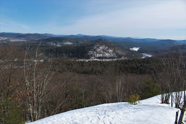
From a nice set of ledges just off the 1582 foot summit, impressive easterly views open up.
If you do check out these trails, be sure to pick up the spur trail below the summit, which provides similar(but still nice) open view points.
A bit of a zoom down towards Route 28 and the snaking Hudson River.
NE views.
A bit zoomed out, you can make out the Hudson winding SE from the Glen(left) on its way down towards Warrensburg.
Wandered around until I found a small window facing north, where the distant high peaks are capped in white.
There are a myriad of trails in these woods, and thankfully all are well marked.
Followed the Ridge Trail, which drops steadily down below the summit ridge.
Soon, I picked up a wide, jeep trail(marked as the Valley Trail on the map), which passes by a picturesque beaver pond.
As the trails arrive at the north end of Dippikill Pond, there are two options. One follows the east shore, the other follows the west. I chose to take the east trail because it was a bit longer and the day was so nice.I passed by several nice looking campsites along the pond's shores. Each site has direct water access and a picnic table.
Looping to the south side of the pond, I caught this nice look across the frozen pond towards Dippikill's summit ridge.
Near the south end of the pond by the launch site sits a handsome Lean To, labeled on the map as Campsite 1.
Campsite 1 definitely took the cake for me as the nicest site.
I followed a series of trails winding through the woods, back to the car. Didn't see another soul all day, hiking about 4.5 miles with a little over 800 feet of ascent.


I've stayed at the cabins on the other side of the road a few times. It's a nice place.
ReplyDeleteI was wondering about them when I drove by. Looks like a nice place to spend a weekend.
Delete