Headed up into the Adirondack High Peaks region Monday with my buddies Mark and Joel to finally knock off 4347 foot Allen Mountain. The weather looked perfect and the we still had long daylight hours, so it seemed like a perfect day to tackle this 18+ mile hike. Unfortunately, I did not have my camera with me so all photos are with my Android phone, which regretfully isn't even close.
39 Degrees when we signed in at the trailhead! Perfect if you ask me! Mark crossing the Hudson River suspension bridge as we start the day.
Early morning on the Hudson River.
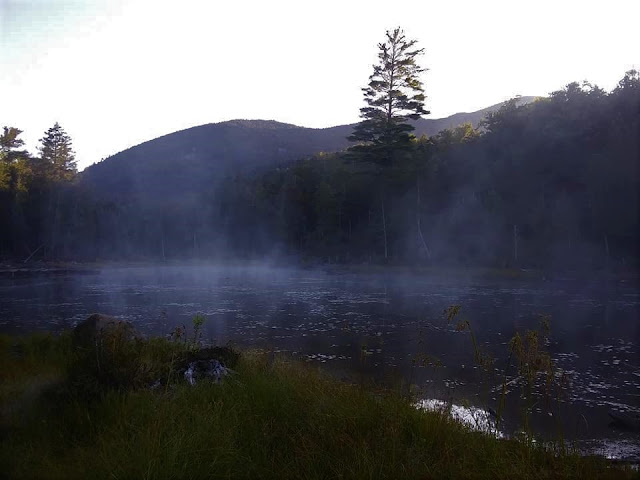
Within a very short time we arrived at the shore of Lake Jimmy, where the early morning fog was still lifting.
Having previously hiked Mount Adams, everything from that trail junction on was virgin territory for me. Within a few minutes after that, we spotted Lake Sally through the trees. Very beautiful in the cool morning air.
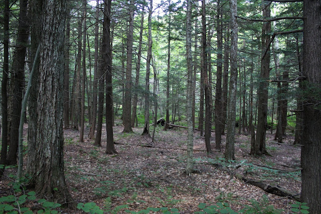
The trail winds its way south and then east around a couple of small ridges, soon arriving at the banks of the Opalescent River. We followed the river for a while, with the water barely visible through the trees much of the time. There are a couple of open spots to venture down the water, but we had a lot of miles to cover.
After 5.5 miles, we left the marked trail and began following the herd path. As long as you have a basic idea of where you are going, it is very easy to follow. Even after leaving the trail, the herd path never really gains a ton of elevation until the last 1.5 miles. Unfortunately, not only does the trail get very steep from here, but it gets VERY wet and muddy.
Once you begin gaining elevation, the ascent is relentlessly steep, gaining roughly 2000 feet over that last 1.5 miles. Climbing up on open rock was a bit scary, especially with the infamous green or red slime coming down. I found that the traction is actually much better than it appears, but the feeling of exposure is really something through this stretch.
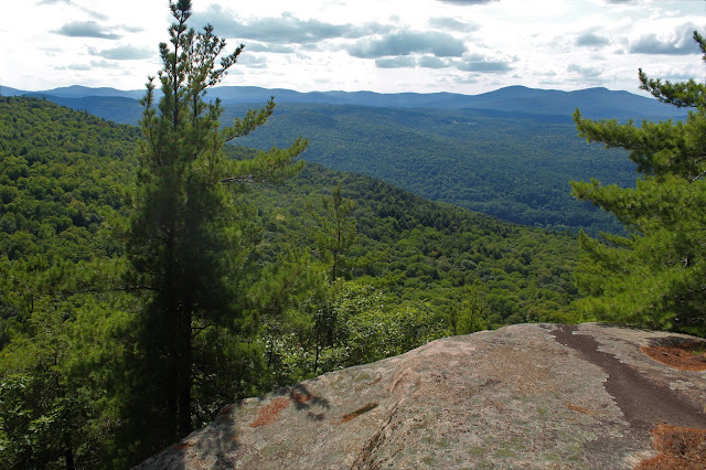
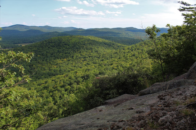
The views from the open rock were quite spectacular. For me, this was the highlight of the hike.
After a tough, steep push up to the summit ridge, we found some killer views south and west. Directly across the valley to the west is Redfield's ridge. Way, way off in the distance from this vantage point one can see the Santanoni Range(not pictured here) and the Sewards(barely visible upper left).
South view from the summit ridge. The North River range stands out very prominently from this vantage point.
Way, way off in the distance from this vantage point one can see the
Santanoni Range and the Sewards.
After one last, final push up, we arrived at the wooded 4347 foot summit.
Just a few short yards beyond the summit, we enjoyed great views towards Panther Gorge and many of the other high peaks.
We didn't linger more than 20 minutes at the top before turning back, and carefully descending the steep, wet mountain. Once off the worst of the steeps, it was just a long, mind numbing hike out. I can certainly understand other trip reports that talk about the hike out being never ending.
From a clearing near a large beaver pond on the way out, we did enjoy one very distant view of Allen. This spot made us all realize just how far away it was, and just how long this hike had been.
We arrived back at the car, pretty exhausted. My GPS showed 20.3 miles, but most other trip reports are closer to 18 miles. Either way, it was a very long day, with 10 hours of actual moving time. WE were all quite happy to see the car at the end of the day. In my opinion, this hike gets a bad rap for being so long(which I understand), but I think it is actually a very nice and scenic day, with plenty of photo ops.
Adventures around the Capital Region area of New York State, as well as the Adirondacks, Catskills, Berkshires and Vermont
Search This Blog
Monday, August 26, 2019
Tuesday, August 20, 2019
Robert Ingalls Preserve(Stephentown, Rensselaer County)
Got out for a short, early morning stroll along the banks of Black Brook in the deep woods of the Rensselaer Land Trust's Robert Ingalls Preserve today.
The woods were bathed in early morning light, with the sounds of bird songs filling the air.
Closer to the ground, our recent wet weather means that the newts are out enjoying the summer too.
The woods were bathed in early morning light, with the sounds of bird songs filling the air.
Closer to the ground, our recent wet weather means that the newts are out enjoying the summer too.
The highlight of this preserve is certainly Black Brook, though, which is at a normal summer time low level now, even with our wet bouts of late.
Walked a quiet and peaceful 1.5 miles at this out of the way little gem.Thursday, August 15, 2019
Middle Sister(Lake George Wild Forest-Adirondacks)
Did a short afternoon hike to one of the "Three Sisters" in Warrensburg today. The three peaks rise prominently along the east shore of the Hudson River and are easily recognizable from many other southern Adirondack summits. I had previously hiked Bald Mountain, the southern most peak, and today I would be hiking the 1740 foot unnamed middle peak, located just north of Bald. Although there is no given name to the mountain, it is appropriately referred to as the Middle Sister by many folks.
I parked at the end of the driveable section of Katts Corner Road and then started my hike on foot along the abandoned section of road, which starts just south of a gate and closely follows the shore of the Hudson River, before entering the woods. Elevation to start is a low 632 feet.
After nearly a mile on the old road, I decided to leave the road and begin the bushwhack heading steeply uphill to the east.
The climbing was quite steep in spots but went by fairly quickly through open woods. As I neared 1200 feet, I began to veer closer to the southern rock ledges, where I found some decent views.
From high up on the slopes of the south ledges, just below the summit, I found an incredible view towards Thompson, Baldhead and Moose Mountains.
The rock outcrop that provided the great views.
I circled around below the summit and found even more rock outcrops and ledges facing east and southeast.
From yet another set of ledges a bit further east, I found this great view of Pine Mountain, the third "sister", and home the Hickory Ski Center. To the left, barely visible through the trees, are the streets of Warrenburg.
Once back on Katts Corner Road, it was a nice and easy hike out on the old road, enjoying the Hudson River views along the way. Even saw some people out tubing on this warm summer day. 4 miles RT and almost 1200 feet of ascent.
I parked at the end of the driveable section of Katts Corner Road and then started my hike on foot along the abandoned section of road, which starts just south of a gate and closely follows the shore of the Hudson River, before entering the woods. Elevation to start is a low 632 feet.
After nearly a mile on the old road, I decided to leave the road and begin the bushwhack heading steeply uphill to the east.
The climbing was quite steep in spots but went by fairly quickly through open woods. As I neared 1200 feet, I began to veer closer to the southern rock ledges, where I found some decent views.
From 1200 feet up to the southern edge of the summit area, the mountain is ringed with incredibly steep ledges, which provide very good views. Here is a view of neighboring Bald Mountain from around 1600 feet.
The woods above the ledges were very nice and almost park like... a bushwhackers dream.From high up on the slopes of the south ledges, just below the summit, I found an incredible view towards Thompson, Baldhead and Moose Mountains.
The rock outcrop that provided the great views.
I circled around below the summit and found even more rock outcrops and ledges facing east and southeast.
From yet another set of ledges a bit further east, I found this great view of Pine Mountain, the third "sister", and home the Hickory Ski Center. To the left, barely visible through the trees, are the streets of Warrenburg.
After enjoying the numerous view points around the mountain top, I finally headed up to the true 1740 foot wooded summit. Not much to see here.
I left the summit and decided to basically drop straight down the steep slopes, heading NW back towards Katts Corner Road.Once back on Katts Corner Road, it was a nice and easy hike out on the old road, enjoying the Hudson River views along the way. Even saw some people out tubing on this warm summer day. 4 miles RT and almost 1200 feet of ascent.
My route.
Monday, August 12, 2019
Mud Lake Ridge, West Stony Creek Mountain and Sacandaga Peak(Shaker Mountain Wild Forest-Adirondacks)
Headed up into the southern Adirondacks to do some off trail exploring with my buddy Jim today. Our goal for the day was to hike up to three unnamed peaks, each with open rock ledges, in the Shaker Mountain Wild Forest. We started at the new(ish) trailhead for the Northville-Placid Trail off Collins-Gifford Valley Road at an elevation of 900 feet. A winding section of the NPT climbs steadily up to Mud Lake in 1.8 miles, where a short scramble down through the woods brings you down to your first views of the lake.
After enjoying the water views, we headed back up to the trail before quickly re-entering the woods and beginning our bushwhack up to a long set of open rock ledges often referred to as Mud Lake Ridge. Although only a touch over 1800 feet in elevation, these ledges provide outstanding views. Here is a view NW toward the Benson hills.
There are even views SE towards a small portion of the Great Sacandaga Lake. Big Oak Hill is the ridge directly in front of you.
There are a series of open areas along the ridge, each separated by a small area of hardwoods.
Each open rock area provide good views and were quite pleasant. This third open area made a nice break spot.
Continuing NW off trail, we descended sharply off Mud Lake Ridge, dropping into a pretty hemlock forest in the col.
From a low spot of 1425 feet, we ascended the slopes of our next destination, an unnamed 1980 foot peak, known simply as West Stony Creek Mountain. The climbing was steadily steep, but through very open hardwood forests. There were a god number of low pricker bushes through this stretch as well.
Emerging at an open area at about 1800 feet that we had seen earlier, we enjoyed views back to Mud Lake Ridge.
Although only mid August, there are certainly some subtle, yet undeniable signs of fall if you look around.
This moss covered rock really caught my eye.
From the east side of the summit area, we found another good view back towards our next destination"Sacanadaga Peak"(L), and Mud Lake Ridge(R), with the Great Sacandaga between.
The west side of the summit provides a far reaching west view over the West Stony Creek valley. This is a spectacular destination and a perfect lunch spot.
After enjoying the great vista, we continued on, heading east towards the next unnamed peak, 2020 foot "Sacandaga Peak". From a low spot of 1475 feet, a stiff climb brought us up to the wooded summit area.
A short distance away from the true summit, we found the open rock ledges on the south side of the peak, which provide some of the best views we had for the day. The view north/ NW provides a look back at the ridge between West Stony Creek Mountain and Sacandaga Peak.
West views provide a glance at the two peaks we had already climbed, with Pinnacle and Shaker Mountain beyond.
There are a lot of open rock ledges to explore, each with a bit of a different perspective. We found this very nice view of the Great Sacandaga Lake near the state land boundary.
Being attentive to the state land boundary, we dropped down very steeply through a series of chutes and ledges heading back towards the NPT near Mud Lake.
After a steep descent we finally arrived at the low spot between the peaks, where a very pretty drainage greeted us.
After enjoying the water views, we headed back up to the trail before quickly re-entering the woods and beginning our bushwhack up to a long set of open rock ledges often referred to as Mud Lake Ridge. Although only a touch over 1800 feet in elevation, these ledges provide outstanding views. Here is a view NW toward the Benson hills.
There are even views SE towards a small portion of the Great Sacandaga Lake. Big Oak Hill is the ridge directly in front of you.
There are a series of open areas along the ridge, each separated by a small area of hardwoods.
Each open rock area provide good views and were quite pleasant. This third open area made a nice break spot.
Continuing NW off trail, we descended sharply off Mud Lake Ridge, dropping into a pretty hemlock forest in the col.
From a low spot of 1425 feet, we ascended the slopes of our next destination, an unnamed 1980 foot peak, known simply as West Stony Creek Mountain. The climbing was steadily steep, but through very open hardwood forests. There were a god number of low pricker bushes through this stretch as well.
Emerging at an open area at about 1800 feet that we had seen earlier, we enjoyed views back to Mud Lake Ridge.
Although only mid August, there are certainly some subtle, yet undeniable signs of fall if you look around.
This moss covered rock really caught my eye.
The west side of the summit provides a far reaching west view over the West Stony Creek valley. This is a spectacular destination and a perfect lunch spot.
After enjoying the great vista, we continued on, heading east towards the next unnamed peak, 2020 foot "Sacandaga Peak". From a low spot of 1475 feet, a stiff climb brought us up to the wooded summit area.
A short distance away from the true summit, we found the open rock ledges on the south side of the peak, which provide some of the best views we had for the day. The view north/ NW provides a look back at the ridge between West Stony Creek Mountain and Sacandaga Peak.
West views provide a glance at the two peaks we had already climbed, with Pinnacle and Shaker Mountain beyond.
There are a lot of open rock ledges to explore, each with a bit of a different perspective. We found this very nice view of the Great Sacandaga Lake near the state land boundary.
Being attentive to the state land boundary, we dropped down very steeply through a series of chutes and ledges heading back towards the NPT near Mud Lake.
After a steep descent we finally arrived at the low spot between the peaks, where a very pretty drainage greeted us.
Subscribe to:
Comments (Atom)


