Headed up into the Adirondack High Peaks region Monday with my buddies Mark and Joel to finally knock off 4347 foot Allen Mountain. The weather looked perfect and the we still had long daylight hours, so it seemed like a perfect day to tackle this 18+ mile hike. Unfortunately, I did not have my camera with me so all photos are with my Android phone, which regretfully isn't even close.
39 Degrees when we signed in at the trailhead! Perfect if you ask me! Mark crossing the Hudson River suspension bridge as we start the day.
Early morning on the Hudson River.
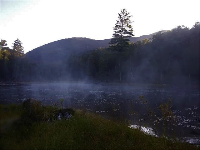
Within a very short time we arrived at the shore of Lake Jimmy, where the early morning fog was still lifting.
Having previously hiked Mount Adams, everything from that trail junction on was virgin territory for me. Within a few minutes after that, we spotted Lake Sally through the trees. Very beautiful in the cool morning air.
The trail winds its way south and then east around a couple of small ridges, soon arriving at the banks of the Opalescent River. We followed the river for a while, with the water barely visible through the trees much of the time. There are a couple of open spots to venture down the water, but we had a lot of miles to cover.
After 5.5 miles, we left the marked trail and began following the herd path. As long as you have a basic idea of where you are going, it is very easy to follow. Even after leaving the trail, the herd path never really gains a ton of elevation until the last 1.5 miles. Unfortunately, not only does the trail get very steep from here, but it gets VERY wet and muddy.
Once you begin gaining elevation, the ascent is relentlessly steep, gaining roughly 2000 feet over that last 1.5 miles. Climbing up on open rock was a bit scary, especially with the infamous green or red slime coming down. I found that the traction is actually much better than it appears, but the feeling of exposure is really something through this stretch.
The views from the open rock were quite spectacular. For me, this was the highlight of the hike.
After a tough, steep push up to the summit ridge, we found some killer views south and west. Directly across the valley to the west is Redfield's ridge. Way, way off in the distance from this vantage point one can see the Santanoni Range(not pictured here) and the Sewards(barely visible upper left).
South view from the summit ridge. The North River range stands out very prominently from this vantage point.
Way, way off in the distance from this vantage point one can see the
Santanoni Range and the Sewards.
After one last, final push up, we arrived at the wooded 4347 foot summit.
Just a few short yards beyond the summit, we enjoyed great views towards Panther Gorge and many of the other high peaks.
We didn't linger more than 20 minutes at the top before turning back, and carefully descending the steep, wet mountain. Once off the worst of the steeps, it was just a long, mind numbing hike out. I can certainly understand other trip reports that talk about the hike out being never ending.
From a clearing near a large beaver pond on the way out, we did enjoy one very distant view of Allen. This spot made us all realize just how far away it was, and just how long this hike had been.
We arrived back at the car, pretty exhausted. My GPS showed 20.3 miles, but most other trip reports are closer to 18 miles. Either way, it was a very long day, with 10 hours of actual moving time. WE were all quite happy to see the car at the end of the day. In my opinion, this hike gets a bad rap for being so long(which I understand), but I think it is actually a very nice and scenic day, with plenty of photo ops.


No comments:
Post a Comment