Got an invite from a couple of my old buddies to tackle 4091 Seymour Mountain, an Adk High Peak that we had orphaned the last time we tackled the Seward Range. Got up to the parking lot at the end of Coreys Road prior to 7am and were lucky to squeeze into one of the last spots...even on a Monday morning. A steady rain had just ended on our drive in, allowing for partial clearing and even a little sunshine.
Early morning sun peeking through the hardwood canopy along the never ending Ward Brook Trail. Unfortunately, with the sun came the humidity.
The Ward Brook Trail basically heads east uneventfully for over 5 miles, crossing several small tributaries of Ward Brook along the way.
About 500 feet beyond the Ward Brook Lean To, and over 5 miles into the hike, the Seymour Mountain herd path heads right, marked with this rock cairn.
At about 2150 feet, the herd path starts off generally tranquil, closely following a tiny drainage before soon getting steep. Once the herd path gets steep, it stays steep, actually getting steeper as it goes.
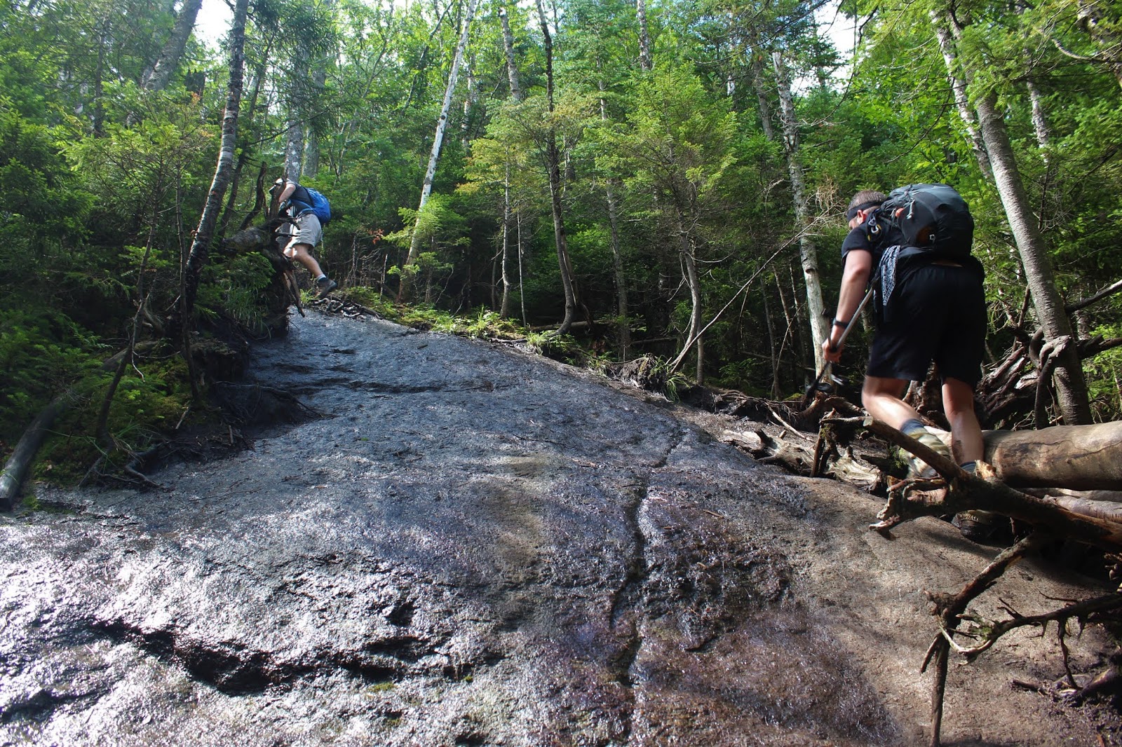
As the trail nears 3200 feet, there are several exposed areas of wet rock to be negotiated.
Although the rocks can be slick, the footing is usually better than it appears, gripping nicely. With that said, it is still best to take your time and clutch onto exposed roots or fallen branches to help keep your balance. When all else fails, stay low.
Just below the summit, the mud is at its worst. This photo pretty much covers it all...humidity steaming up the lens and mud swallowing my hiking boots.
Less than 1/10 of a mile before the summit, and a few feet off the main herd path, is a spectacular ledge offering up sweeping 180 degree views to the north. Ampersand Lake and Ampersand Mountain are the most prominent features.
The multiple summit bumps of the Sawteeth Range(The Hundred Highest peaks) sit just to the NE.
From the edge of the ledge, a spectacular view of the Seward Range across Ouluska Pass. A sliver of Long Lake is visible in the distance to left.
Continued the short distance from there up to to the 4091 foot summit, tucked into a neat little area of scrub spruce.
Just a few yards past the summit is yet another great view, this one extending to the southeast. The Santanoni Range is easily viewed from here, across the Cold River valley.
East views extend over the tree tops towards Preston Ponds and MacNaughton Mountain, as well as numerous other High Peaks beyond.
After enjoying the summit area, we turned back, carefully retracing our steps off the mountain.
The descent on the herd path is pretty much a straight shot down, dropping nearly 2000 feet in less than 2 miles.
We stumbled across this birds nest sitting directly in the herd path, slightly hidden by brush. A very odd spot to build a nest and lay eggs.
Once back down on the Ward Brook Trail, it was a relentless 5+ miles back out to the car. As always, the return hike at the end of the day always seems longer than the way in. Got back to the car, drenched in sweat. Hiked roughly 14 miles RT, with 2700 feet of ascent along the way. 24/46.


No comments:
Post a Comment