Headed south today to do a little exploring in the Sundown Wild Forest, where I figured the foliage would be holding on a bit longer. My goal for the day was to hike to Vernooy Kill Falls from the Upper Cherrytown Road trailhead, then bushwhack south up Cherrytown Ridge, where it looked like there may be some views. I was stunned to see no other cars in the lot when I arrived, but I guess the clouds and light drizzle kept folks away. The forecast for the day was for clouds and fog early to be replaced by clearing skies and increasing sunshine along with mild temps, so I headed out optimistically. Elevation at the trailhead is 1225 feet, where I crossed the road and headed NW into a damp, mixed forest.
Just a quarter mile into the hike, a nice footbridge crosses a tiny tributary stream. From there it is a nice and steady ascent for another 1.5 miles NW towards the falls.
Welcome to Upper Cherrytown!
The rushing sounds of falling water could easily be heard now, so I rushed on over to check out the Vernooy Kill Falls. From a footbridge, the views of the main falls are very nice. There are actually a series of falls that drop over 60 feet both above and below the bridge.
Looking back upstream at the footbridge and falls.
Just downstream from the bridge, located along the east side of the creek are the remains of the"Cornelius" Vernooey mills, which operated from the early 1700s until 1809.
Upper falls on the Vernooy Kill.
I explored the creek both upstream and downstream a bit, where I actually bumped into a couple of guys camping just north of the falls. This is a nice look at the creek just upstream from the falls.
After enjoying the falls and surrounding area, I headed back up the trail the way I came, hitting a height of land, where I picked up a woods road going south up Cherrytown Ridge. The woods road was very good at first, but soon became a bit rougher, then turned into a foot path, and then split off in several different directions. Some of the paths were easy to follow, while others seemed to go nowhere. As I gained elevation on the ridge, the clouds and mist only seemed to increase. I found several large clearings up on the ridge, but the clouds didn't seem to want to budge.
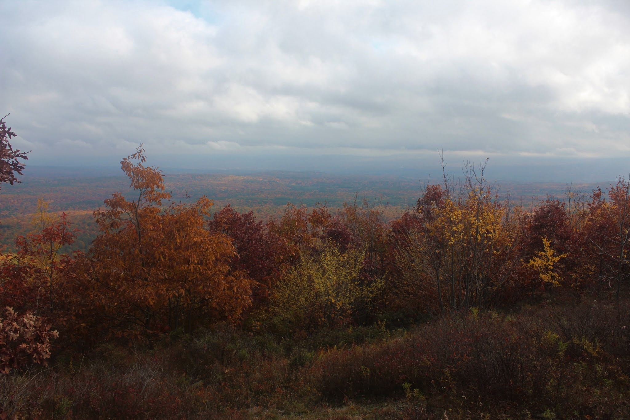
Not willing to give up just yet, I continued south up the ridge, nearing 2000 feet, and prayed for the clouds to move out. Almost on cue, as I circled over to some steep east facing ledges, the skies cleared out just enough to allow a colorful view out over the Rondout and Wallkill Valley's to the east.
Looking east straight down towards someone's house along Upper Cherrytown Road.
A few yards up from the steep slopes, there was a bit of a clearing that provided a wider perspective to the east.

More of a SE view from the same clearing, where the clouds seemed to be just a bit thicker.
After checking out the east facing views, I headed over the top of the ridge and down slightly to the west, where I hit a very large clearing and wide open views. From here, I enjoyed this very unique view to the NW, where Bangle Hill, Samson Mountain(the high spot on the ridge) and Spencer's Ledge can be seen.
Directly to the west, the view takes in a slightly lower unnamed Cherrytown Ridge, with the multiple summits of East Mountain just beyond.
SW facing views towards the south end of the unnamed ridge just west of Cherrytown, with East Mountain just beyond.
After enjoying the nice west and north facing views, I headed back over the ridge, continuing over to the steep east slopes. From a small framed opening in the trees, I did manage to find a neat view NE towards the lower slopes of Mombaccus and High Point, as well as a sliver of the Ashokan Reservoir poking out.
Instead of following the ridge north all the way back, I decided to simply dip down into the woods, descending steeply to the NE. For the most part, the woods were open, with just a small tangle of mountain laurel here and there.
Once back on the trail, I hummed right along, making it out in no time at all. I was a bit surprised to see half a dozen vehicles in the parking lot when I arrived at my car.
Hiked a bit over 5 miles RT with 1260 feet of ascent along the way. A mild, but damp day in a gorgeous little corner of the Catskills. Today's rough route below. Red=Trail Blue=Bushwhack
As always, one of my favorite parts of hiking in the Catskills, is the drive to and from. Today was no exception, as I enjoyed this unique view of Ashokan High Point and Little High Point from the south at a bend on Samsonville-Kerhonksen Road.


I was there late in the day on Thursday. Only missed you by a day! I walked in on the shorter (only 1 mile) trail from Trail's End Road to the northwest. It's a shorter, flatter hike, and I wanted to maximize time at the falls so late in the day. Next time in the area I want to take a right turn at the falls and go upstream to see if there's any other interesting scenes along the creek. Here's my photos from that day: https://photos.app.goo.gl/NmDVkqxzQumboBGE8
ReplyDeleteThanks so much for all the work you do to put this blog together! I've often been able to get valuable advance knowledge about a hike I'm considering because you've already done it!
Glad you enjoy the blog! It's a labor of love for sure.
DeleteYour photos look incredible, thanks for sharing. The colors look so vibrant!! That is a really beautiful little corner of the Catskills. As I've always stated...the ride is almost as fun as the hike in that area