Headed down to the Catskills to do a little off trail exploring to an unnamed 2125 foot high point on Mount Pleasant's far SE ridge, utilizing both NYC Watershed land and State land. Parked in a small DEP pull off on Traver Hollow Road(room for one car), elevation 950 feet, and headed northeast into the open woods. The slopes were steep and littered with fallen leaves, which made for a somewhat slippery ascent. Thankfully, as I neared the top of the ridge over 1300 feet, many of the leaves were replaced by flat rocks that made for easier climbing.


From an open ledge above the steep NE slopes of the ridge, I found great views over Boiceville and Route 28, with Piney Point and Ticetenyck just beyond.

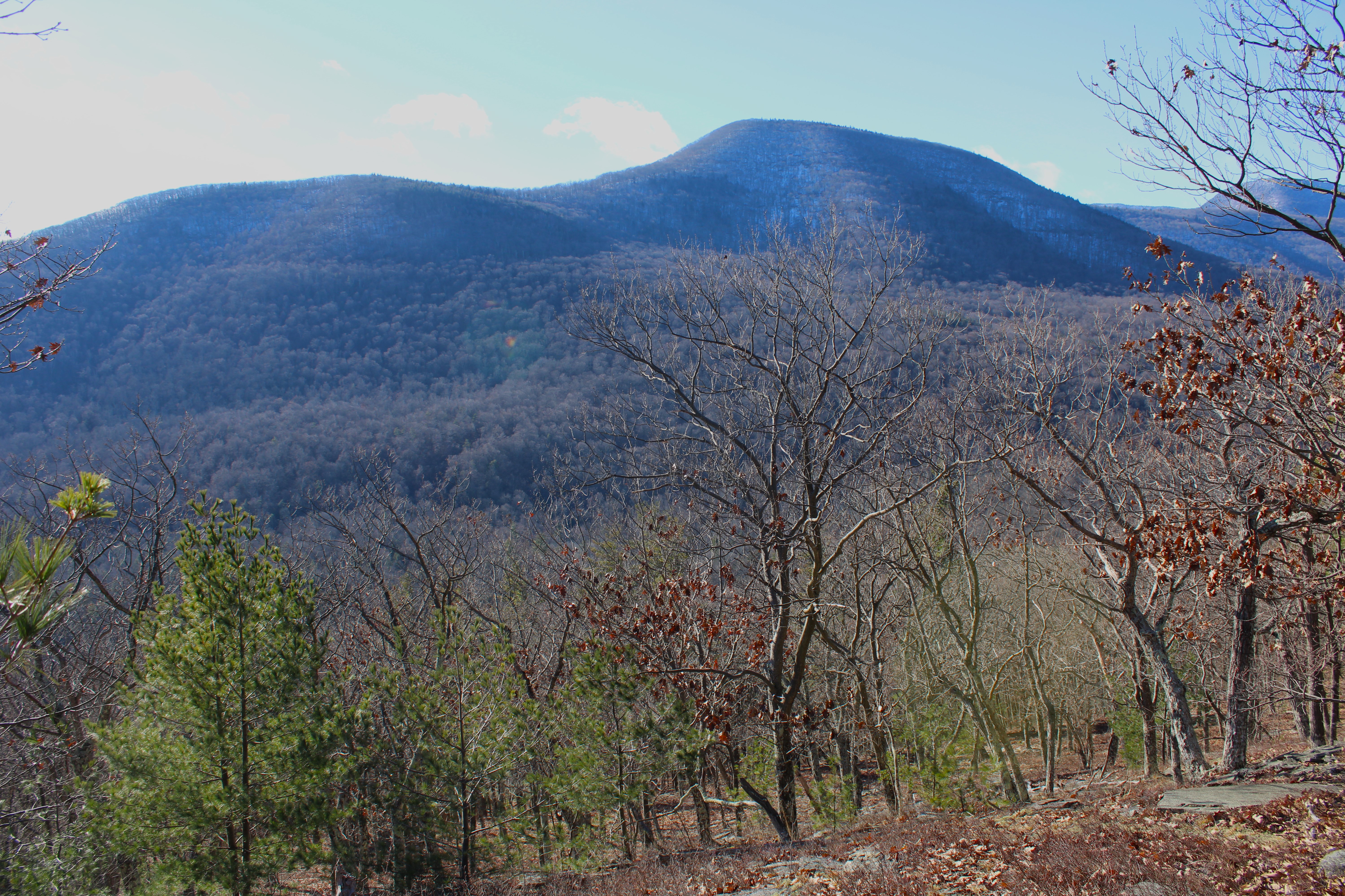
From the same ledge, looking north towards Mount Tobias.

Heading up over the top of the ridge again, I stumbled upon-literally-the best seat in the house. A stone seat propped up with a killer view towards Samuels Point.

A few yards away from the stone seat, I enjoyed this view of Samuels Point with the top of Wittenburg poking out high above Traver Hollow.

Directly across Tracer Hollow rises Little Samuels Point(left) and Samuels Point(right).
Continuing on my way NW up the ridge, I soon encountered mountain laurel, which became increasingly thick on the ridge line. Staying just off the ridge to the north, the woods remained nice and clear though.

My intention was to ease my way down the north slopes of the ridge, through a deep cirque, and then onto an old quarry at about 1150 feet. The woods remained very open and easy to navigate with no snow or ice to contend with. In no time at all I found the old quarry I had been searching for, as well as a few other abandoned ones too. From the top of the quarry, the views east over the Ashokan Reservoir were quite nice. A unique vantage point for sure.

From the top of the quarry looking NE over Boiceville and Route 28.


Just above the old quarry is an overgrown former quarry road that climbs up through open hardwoods and sedge grass. I passed by at least one or two more smaller quarries just above this.

Followed quarry/ woods roads up to around 1600 feet, before the one I was on petered out to nothing, forcing me to bushwhack straight up the steep north slopes of the ridge. At around 1700 feet I began to encounter the first few patches of snow here and there.

A straightforward, steep climb up through open hardwoods brought me up to the 2125 foot summit, which is laced with mountain laurel. I found one small clearing at the top, which was covered in about an inch of snow.

From the summit, I descended SE through several thick patches of mountain laurel, while hugging the state boundary line. There were many through the trees views but nothing too great to speak of.

While under nearly 100% sunshine high up on the ridge, once I dropped back down into Traver Hollow, darkness and late afternoon shadows quickly swallowed me up. Sunsets come early this time of year-especially in the deep hollows.

Covered about 3.5 miles RT, with over 1600 feet of combined ascent.
Map Below. Blue P=Parkng Black X's=Views atop SE ridge Blue=Quarry Views Red=Summit Knob

Old quarries are always fun to explore...Great photos!
ReplyDelete