Search This Blog

Tuesday, February 27, 2024

Allaben Quarry(Shandanken Wild Forest/ Hunter-West Kill Wilderness-Catskills)

My second short hike for the day was a quick jaunt up to an old, abandoned quarry and tailings pile just east of Broadstreet Hollow.  I parked at the Allaben Primitive Camping Area(Eevation 1125 feet) north off of Route 28 and headed into the woods, closely hugging the state property line, while climbing north.

I veered right to the northeast through wide open hardwoods, soon picking up an old quarry road.
Arriving at the first of three large tailings piles, around 1520 feet.


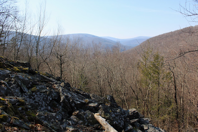
At the top of the first tailings pile, I found a nice view north towards North Dome(left) and Saint Anne's Peak(right).  Part of Mount Sherrill can be seen on the distance left.


SE view from second tailings pile across Broadstreet Hollow.

View south towards Garfield(left) and towards Panther's multiple ridgelines.

From the viewpoints, I turned back south, following the old quarry road back.  From there, a very short bushwhack brought me to the car.

Hiked a total of 1.4 miles RT, with over 400 feet of ascent.  

Map below.  Blue P=Parking   Blue X=Quarry View


Boiceville Overlook on Piney Point(Ticetonyk Mountain Unit DEP-Catskills)

Did a couple of short hikes and enjoyed some stellar views in the Catskills on an unseasonably mild February day.  My first stop was to an open view on the west side of Piney Point, a peak I had previously climbed to the top of.  Piney Point is a high point on the far west ridge of Ticetonyck Mountain and can be accessed from NYC DEP land.  

I got started from a DEP parking area along Piney Point Road(Elevation 850 feet)and headed south ona  well trodden old woods road, passing through several large patches of mountain laurel along the way.


Where the trail turns sharply left, an unmarked foot trail heads right, climbing steadily towards the view spot.


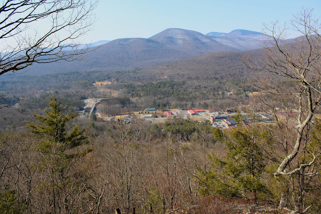
A short, steep ascent finally brings you to the view point, which is quite striking and hard to miss.  The view west down over Boiceville and towards Little Samuels Point, Samuels Point Cornell and Wittenburg is really nice!


To the south/ southwest is a clear view of Ashokan High Point and the west end of the Ashokan Reservoir as well as Route 28A down below.

The view is terrific and partially improved by some tree cutting, providing a nice look towards a shoulder of Mount Pleasant high above Boiceville and the Route 28 corridor. 

Turned around and retraced my steps back to the car from there.  A nice and easy 1.3 miles RT with 450 feet of climbing.


Map Below.  Blue P=Parking   Blue X=View


Tuesday, February 6, 2024

Unnamed Dunham Reservoir Peak(Grafton Lakes State Park-Town of Grafton, Resnsselaer County)

Took advantage of a brief window of free time by visiting an obscure, unnamed 1667 foot peak in the Grafton Lakes State Park.  The sun was shining bright, but there was a crisp bite in the air to remind me that winter is still here(especially on the Rensselaer Plateau) as I parked along the south shore of the Dunham Reservoir(Elevation 1335 feet).  A few feet away from the parking area I enjoyed my first glimpse of the Reservoir, which was completely frozen over-but didn't see any ice fisherman out there.

A short distance up the road, a marked trail meanders along the east shore of the water, but I chose to jump directly into the woods to begin my bushwhack instead.  A short distance in, I crossed over the first of several small streams that flow downhill to the Res.

I headed basically NE, crossing over the trail at one point, but maintaining an easy bushwhack climb through a few inches of snow.  As I gained the main ridge, I caught filtered views down to the Reservoir and the small peak just SW of the water across Dunham Road.

Once up high, it is an easy walk along the spine of the ridge, eventually arriving at the wooded summit, where more screened views can be found to the north.

A small but steep drop brought me down to a clearing just below the top, which provided a neat look back up at the summit.

A straight drop west down the slopes of the peak, eventually brought me down near the waters edge, which I closely followed SW all the way back to the car.  This is a view from a small bay and inlet area, with the late afternoon sun casting long shadows on the ice.

An easy bushwhack brought me back to the car, where I saw a lone ice fisherman heading out onto the water.  Covered a little under 2 miles RT, with 400 feet of ascent.

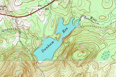
Map below.   Red P=Parking   Red X=Summit