Search This Blog

Saturday, June 3, 2017

Pillsbury Mountain(Adirondacks)

3597 foot Pillsbury Mountain and its fire tower have been on my radar for a while now and a free Saturday afternoon seemed like the perfect time to go hike it.  I usually enjoy the ride up to this quiet part of the Adirondacks and today was no different.
The trailhead for Pillsbury Mountain is located in a remote area of backcountry some 6 miles of dirt roads off of Route 30.  Just north of Mason Lake, take a sharp left turn onto a seasonal dirt road(Perkins Clearing Road) and follow it for 3.3 miles to a junction marked with a signpost.  Turn right here, following the signs towards Pillsbury Mountain. Another 1.8 miles leads to an area known as Sled Harbor.  Some people park here and hike in the remaining 1.2 miles on the access road to the trailhead.  The road appeared to be in decent shape so I drove it, being very cautious, with no issues.  I have almost no clearance with my car, so I would say that in the summer there shouldn't be any problems making it for most cars.
I was quite surprised to see about 7 or 8 cars there when I arrived at the parking lot.  I signed in at the register and began my hike, passing the sign indicating 1.6 miles to the summit.
The trail immediately drops steeply down to a footbridge crossing the Miami River.
 Once across the Miami River(which is much more like a brook), the trail climbs up and into a hardwood forest.  Parts of the trail here are quite crowded with spring growth.
The trail ascends pretty steadily all the way, but is never overly difficult.  Just under a mile into the hike, I found a small view through the trees.
Much of the trail is fairly typical of an Adirondack hike, with mud, rocks and roots.
As I gained elevation up above 3000 feet, there was quite a bit of blowdown, and the trail had to be rerouted in at least two spots.
Climbing up into a dark, cool forest with the winds picking up.
Nearing the summit, the trail levels out passing through a deep conifer and spruce forest.
After 1.6 miles and nearly 1500 feet of ascent, I arrived at the clearing, the old cabin, and fire tower at the summit.
The enclosed cab at the top of the fire tower is closed, but you can climb up to the top flight of stairs with panoramic 360 degree views.  Here is the view south towards what I believe is Little Moose Pond.
The north view towards Cedar River Flow with Blue Ridge to the right.
The view east/ northeast towards the Siamese Ponds Wilderness.  The Jessup River can be seen winding along in the valley.
A direct view east encompasses much of the Siamese Ponds Wilderness.
The southeast view provides a glimpse of Sacandaga Lake and Lake Pleasant.
The northeast view provides a great view towards Indian Lake and Snowy Mountain to the left.
Little Moose Pond(?) to the south.
The abandoned caretaker cabin from the second flight of steps.
I hung out on the summit by myself for a little while, hoping skies might clear but to no avail.  I retraced my steps back off the mountain, making good time.  Just prior to the parking lot, I came to the Miami River crossing again.
The Miami River is a wild mountain stream, which eventually empties into Lewey Lake to the north.
Climbed steeply up away from the Miami River and back to the parking area. Round trip distance was 3.2 miles.
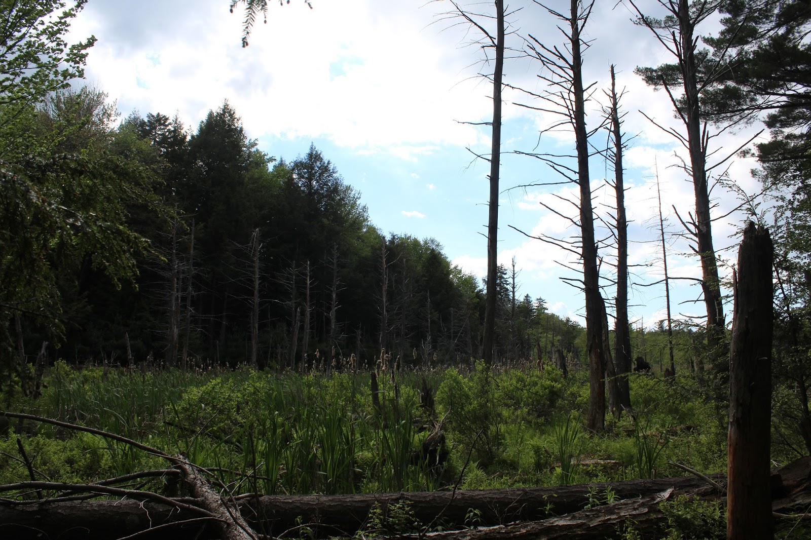
Clouds and light rain made my decision to go home an easy one.  I stopped by at a quiet spot along Perkins Clearing Road where a large, picturesque beaver swamp sits beside the road.  This area of the Adirondacks has such a remote feeling to it.  I love it.


Thursday, June 1, 2017

Dunham Reservoir(Grafton)

Grafton Lakes State Park is a rather large state park at over 2500 acres, but few people realize that there is a large southern section containing many miles of trails and the 98 acre Martin-Dunham Reservoir.  I parked in the small parking lot along the south side of Route 2, across from the main entrance to the State Park, with the plan of hiking all of the southern trails in the park.  To begin, the Gartler Trail leaves busy Route 2 and heads south through a wide open field.
At the bottom of the field, the trail becomes more defined, crossing a small drainage and following some sort of woods road up to a blueberry meadow.
The woods road is very obvious, but is also extremely muddy.
The trail soon enters a predominantly conifer forest, and suddenly the sounds of traffic and civilization seem to disappear all at once.
This trail also doubles as a snowmobile trail, and soon it passes over a bridge wide enough for a sled to cross, beside a large beaver swamp.
After about 1.3 miles, the Gartler Trail begins to drop out of the conifers and arrives at the quiet, calm section of the Quacken Kill.  A couple of benches and fire pit would suggest that this is a popular place to relax and perhaps do some fishing.
Such a peaceful, calm area of the Quacken Kill.
The trail skirts the Quacken Kill and offers several different spots to throw in a fishing line.
Just beyond the Quacken Kill, and 1.5 miles from Route 2, the Gartler Trail ends at seasonal Johnson Road.  This gravel road offers plenty of access to the Dunham Reservoir, which sits on the south side of the road.
I walked a very short distance west along Johnson Road until I came to a pull off area and trail sign for the Double Bit Path.
The Double Bit Path runs south for just over 1.6 miles along the west side of the Reservoir.
After meandering through the woods and in and out of the coves for about a mile, the trail comes to a small brook crossing.  The recent wet weather meant that this normally easy stream crossing was quite difficult.  Luckily, I found a snowmobile bridge just downstream a short distance.
The tricky stream crossing, which is usually easily crossed by rock hopping.
About a hundred yards past the stream crossing, I came to the Reservoir's spillway.
I climbed up to get a fine perspective of the rushing water dropping out of the Reservoir.
Just below the spillway, the water comes crashing down as the reformation of the Quacken Kill.
 The water below the spillway was running extremely high and was quite dangerous to cross.  I had to follow the creek downstream quite a way, before I could find a safe crossing.  Once across the creek, I continued south in search of the trail.  I couldn't find it, so I just continued on to Dunham Reservoir Road at the south end of the Reservoir.  There are a few pull offs along the road, each with fine views and small picnic spots.  Here's a view back at the earthen dam and pump house.
A fantastic view across the placid waters.
The South Dunham Trail can be quite tricky to find, as it located about .2 of a mile uphill on the road and is not well marked.  I found a trail marker in the woods and was on my way north, high above the east side of the Reservoir.  This trail also follows an old road, which was very muddy.  Here's a spot where a stream drains down off the hillside, crossing right over the trail.
Typical stretch of the South Dunham Trail, which stays far up into the woods away from the water much of the way.
Eventually, the South Dunham Trail drops down to the east side of the water, where dark clouds had quickly rolled in.
A quick moving system moved in and out within 15 minutes, providing a much different Reservoir view than just an hour before.  After about 1.85 miles, the trail comes to gravel Johnson Road at the north end of the Reservoir.
I walked along Johnson Road the short distance back to the Gartler Trail and retraced my steps back north towards the car.
As I continued along, the sun began to break out again.  As nice as it was to have the sun out, the thick mud did nothing to help the mood.
Got back to the car under blue skies and the sounds of rushing traffic along Route 2.  Hiked just shy of 7 miles Round Trip.

Levine Preserve(Providence, Saratoga County)

Visited the Levine Preserve after work Thursday, a Saratoga PLAN property located in the town of Providence, just south of the Adirondack blue line.  Parking is located along the shoulder of Center Line Road beside an informational kiosk.  The trail heads south through the quiet woods along Tabor Road, an old road that is now a foot trail.
 At 177 acres, the preserve is quite a large tract of land, lined with stone walls throughout.
I followed the Tabor Road trail through the center of the preserve to a side, yellow marked trail that leaves to the right. This yellow trail is less than a .2 of a mile loop and leads to a very old foundation.
The old foundation is quite fascinating, and you can wander around it freely, imagining what this homestead must have been like back in the 19th century.
Just beyond the old foundation is a beautiful fern glade.
The yellow trail must have been a small entrance road to the old homestead, as it is framed in by stone walls and hardwoods.
Once back on the Tabor Road trail, I quickly arrived at babbling Joby Creek, a small stream that eventually runs into larger Cadman Creek a bit downstream.
Joby Creek.
After crossing Joby Creek, I turned left onto the half mile East Green Trail.  This trail heads east then south, eventually meeting up with Cadman Creek.  Where the East Green Trail meets up with Tabor Road, there are a pair of benches for resting and taking in the sounds of the rushing creek.
A very wet spring means that Cadman Creek is running high and fast.
The West Green Loop Trail closely follows the banks of Cadman Creek before eventually turning north and climbing up and away from the water.
The West Green Trail heads west then northwest, crossing back over Joby Creek on a small footbridge before meeting up with the West Orange Loop Trail.
I followed the .85 mile West Orange Loop Trail back north all the way towards the trail head near Center Line Road.  Hiked about 2.2 miles total at this beautiful preserve.