Search This Blog

Tuesday, March 15, 2022

Shatterack Mountain(Town of Russell, Massachusetts)

Followed the weather forecast today and headed southeast into southern Massachusetts to check out 1145 foot Shatterack Mountain, which sits just NW of Tekoa Mountain, a peak I had hiked back in November.  From what I could see, it appeared that Shatterack had a lot of open rock and views to offer so I thought it would be a fun little mountain to explore on a mostly clear, 55 degree later winter day.  I parked in an unmarked pulloff near the junction of Carrington Road and Station Road, just east of the Westfield River(Elevation 290 feet). I picked up a white marked trail that starts off pretty inconspicuously as it climbs steeply into the woods.


Once on the trail, it is obvious and easy to follow.  It is, however, an unmaintained trail, so there are at times white or blue blazes, and other times no blazing.  The trail heads SE, gaining elevation at an angle up onto the main ridge.  Once on the ridge, the trail swings sharply to the north, with splendid views to be enjoyed through the bare trees.

The mountain may be small in stature, but its slopes are steep, and I found some real nice off trail views directly west over Main Street in Russell and the Westfield River directly below.


It seems that this mountain is well known and used by locals, as painted rocks(such as this below) are a common scene on this ridge.

The views from Shatterack's ridge are quite nice, and quite numerous as well!  SE views with Tekoa Mountain dominating the scene to the left, with Route 20 and the Mass Pike down in the valley below.


NW views can also be enjoyed, following the valley of Route 20 and the Westfield River into the hills of Hampden County.


After all of the fireworks along the ridge, a quick drop and then re-climb brings you up to the open and flat 1145 foot summit.


A view just below the summit to the west.

I continued a little bit past the summit, where the trail actually widens into an old road, where there are even more views to the north to enjoy.  The snow here was sparse, as this little spot near the summit was one of the only spots I saw any today.
Retraced my steps back off the mountain and to the car, stopping to check out a couple of additional other views off trail.  A nice little 3.3 miles RT, with just over 1000 feet of ascent.


Thursday, March 10, 2022

Albany Pine Bush-Rensselaer Lake to Rapp Barrens Loop(Albany County)

Got out and enjoyed a short and easy loop hike at the Albany Pine Bush starting from Rensselaer Lake(Six Mile Waterworks Park) on a slowly improving weather day.  With skies clearing and temps  climbing above 40 degrees, yesterday's snowfall was quickly disappearing as I walked.

A light breeze and sunny skies made for very pleasant conditions as I made my way west to the Rapp Barrens Trailhead on Lincoln Ave.


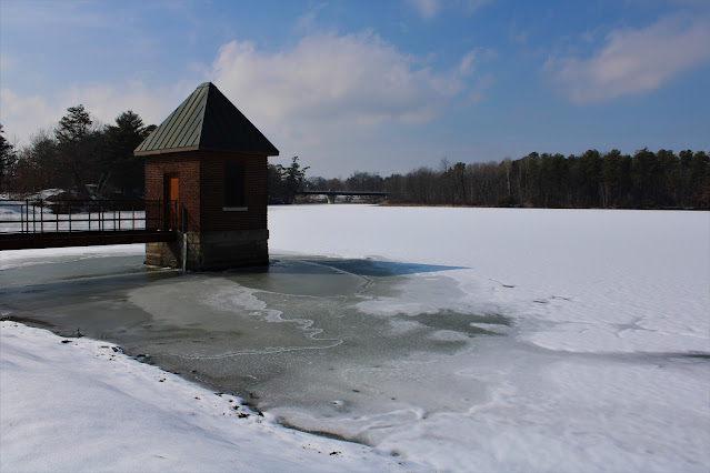
Circling back to Rensselaer Lake near the Northway overpass, with the snow and ice receding before my eyes.


A very nice 2.4 mile loop, and only saw a couple other folks out enjoying the day.

Tuesday, March 8, 2022

Gutierrez Family Forest(Town of Stephentown, Rensselaer County)

Did a short walk at the Rensselaer Plateau Alliance's new 65 acre Gutierrez Family Forest located just past the Robert Ingalls Preserve on Garfield Nassau Road in rural Stephentown on a sunny but cool and breezy afternoon.  There is no formal trailhead or parking area so I simply parked on the shoulder of the road and walked down to a kiosk and the start of the Bobcat Loop Trail. (Elevation 985 feet).

The trail is well marked and easy to follow, meandering through a dark, mixed forest and along old stone walls.
The highlight of the trail is where it skirts the edge of a very large wetland, with several pleasant spots to take in water views with the nearby hills as a backdrop.
All in all, it is a nice, new addition to the RPA family of trails, with total mileage just under 1 mile.  Appears that this forest, however, is still in its infancy phases with lots of room to grow more trails.


Friday, March 4, 2022

Robert Ingalls Preserve(Town of Stephentown, Rensselaer County)

Did a short after work walk at the Robert Ingalls Preserve along the banks of Black Brook in Stephentown on a brisk but sunny late winter day.

Trails were well packed down and footing was good as I hiked about 1.5 miles total.
 

Thursday, March 3, 2022

Schaghticoke Mountain(Kent, Connecticut-Litchield Hills)

Did a quick out and back hike today along a section of the Appalachian Trail up 1330 foot Schaghticoke Mountain along the NY/ Connecticut border on a cool but sunny late winter afternoon.  I got started from the parking lot for Bulls Bridge(Elevation 350 feet), which is a well known covered bridge that crosses the Housatonic River.

The rough and tumbling falls on the Housatonic just below Bulls Bridge.

From the bridge it was a short road walk on Bulls Bridge Road and then onto Schaghticoke Road, which actually doubles as part of the Appalachian Trail for about 3/10 of a mile.  The familiar white blazes of the AT head west into the woods and then climb steadily up the east slopes of Schaghticoke Mountain.  There was some spotty snow here and there on the trail but nothing of real consequence. 

Straddling two different states.

After roughly 2 miles of hiking I hit an open south facing viewpoint towards Ten Mile Hill(left) and Gardner Hill(right).  This is a great spot to take in the views.
From the same viewpoint, looking east into rural Connecticut.
Same vantage point, with Leather Hill now visible to the far right.

Just a few yards off trail from the lookout, I found some additional decent views to the west/ southwest as well.

With the clock ticking on the remaining daylight I skipped hitting the summit and turned back at the viewpoint, quickly dropping back down off the mountain and passing by handsome old stone walls on the way.

A nice and easy road walk me back to the car in no time.  About 4 miles total with a bit over 1000 feet of ascent. 

As I started my ride home, I caught this nice glimpse of part of Schaghticoke's south profile rising above the meadows below.


Monday, February 28, 2022

Mud Pond Preserve(Town of Nassau, Rensselaer County)

Did a local walk today at the Mud Pond Preserve in a quiet little corner of Rensselaer County on a cold winter morning.  100% sunshine couldn't offset the wintry feeling of 4 inches of snow and temps in the mid teens as I set out through the peaceful woods from the trailhead located on (CR 16)Central Nassau Road(Elevation 790 feet).


The air was cold but wasn't too bad if you kept on moving. 

Wetlands surrounding Mud Pond from the end of the Overlook Trail.

Used all three trails at the Preserve and even noticed what looks like a new trail being marked with pink flagging?  This would connect the Casey Farm Trail with the current end of the Overlook Trail.

Walked about 1.6 miles total and didn't see another soul in the woods. 


Thursday, February 24, 2022

Partridge Run WMA(Town of Berne, Albany County)

Headed up into the Helderbergs this afternoon to do a little exploring in the eastern section of the Partridge Run WMA before a major winter storm moves in tonight.  I parked in a small, informal parking area on the shoulder of Ravine Road(Elevation 1545 feet) less than 2/10 of a mile north of Kingfisher Road.  Once I got all geared up I headed out under mostly clear skies and temps in the mid 20's.  

I first headed over to the area known as "The Gulf", an enormous, deep ravine, and followed its western rim via a rough herd path.

The slopes above The Gulf are extremely steep and quite impressive, but ice and snow kept me far back from the edge.

Followed the herd path south along the rim until the terrain eased up and allowed me to drop down to the frozen stream that flows through The Gulf.

A fairly easy rock hop(ice hop) got me across the creek and then onto Kingfisher Road, which I immediately left to follow a blue blazed trail.  This trail was quite icy as it drops down towards the east side of the Gulf.  Just prior to the views out across the Gulf, however, I found this picturesque wetland just off trail. 
The main event of this hike is the walk along the eastern edge of The Gulf, where a great view opens up across the deep ravine and to the north.
After enjoying both sides of The Gulf, I continued hiking the blue trail, which heads east then south, almost paralleling Kingfisher Road.


After re-emerging on Kingfisher Road, I followed it south for a short distance to the Long Path, which also doubles as the Wood Duck Path, heading west.  This trail, by no small coincidence, leads to beautiful Wood Duck Pond, which was 99% iced over today.

From Wood Duck Pond, I decided to venture off trail and into the woods, wandering past old stone walls and gorgeous forests.

I briefly followed a pretty little creek that drains the higher slopes above.  These sheltered parts of the woods were noticeably colder and had much more snowpack than the more open areas I had passed through earlier.

Passing by more old stone walls deep in the woods off trail.
Continuing NW, I soon emerged out of the woods and back onto Ravine Road, where I walked the rest of the distance back to the car.  Didn't see another person the whole day as I hiked about 3 miles total on what turned out to be a pretty nice, although cold, afternoon.  With nearly 100% sunshine, it's hard to imagine we will be getting close to a foot of snow starting tonight!