


Rocky ascent.

One of the first views north and east through an opening in the trees.

The sun began to break through the clouds as I entered a section of evergreens.

As I continued climbing, the temperature continued dropping.

Getting steeper.

Emerging from the woods to open rocks and a sliver of blue skies at about 1.7 miles.

The first real view on the trail and what a treat!

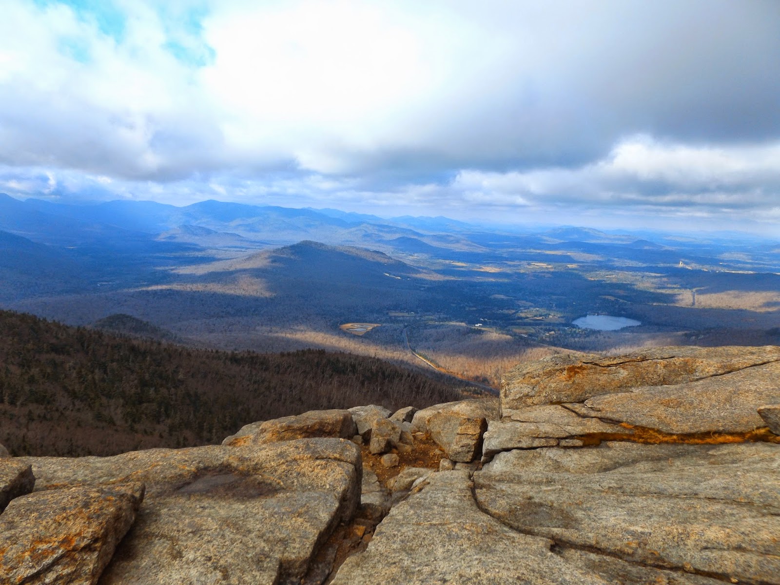
Incredible views and not even to the top yet!

Climbing up steep, wet rocks towards the trail junction.

I chose to continue up Cascade Mountain first.

A level section amongst evergreens just before arriving at the final, rocky ascent.

The last .2 miles are strictly rock climbing, with plenty of wind.

The open, rocky summit
Route 73 far, far below.

The entire summit area is totally exposed, making this both pleasant and miserable. A truly amazing spot.

Brutal winds made it hard for me to fully enjoy the summit area, but the incredible views all around are simply breathtaking.

Cascade Mountain's summit at 4098 feet.

Looking north and east towards Pitchoff Mountain.

North facing views.

A panorama from Cascade's summit.

A view off the steep slopes

Thick clouds rolling in.

Climbed back down the .3 mile to the trail junction and continued on towards Porter Mountain. There was more ice and mud on this trail.

Footing was tough at times along the .7 miles towards Porter.

Wet, icy and muddy trail.

A view of Porter's summit from a shoulder of the mountain.

A rocky clearing provides an incredible view

Looking beyond the evergreens towards Cascade Mountain.


The very muddy trail on the way to Porter's summit.

Porter Mountain's 4059 foot summit.

A great view of Cascade's summit from Porter's summit.

A panorama towards the west and many of the Northern High Peaks.

After grabbing lunch in Lake Placid, I drove a bit further west towards Saranac Lake to hike up Mt Baker. The trailhead is located on a residential street next to Moody Pond.

Although never overly steep, the .9 mile trail ascends nearly 900 feet. A section filled with roots and pine needles.

The village of Saranac Lake with Lake Flower below.

Oseetah and Kiwassa Lake with the Sawtooth Range beyond.

Thick clouds hung on, but the views were still nice.

A panorama off the rocky clearing.

Mountt Baker's 2457 foot summit. There are no clear views from this spot, but several small foot paths lead to vistas.

On my descent, the sun came out. It was great seeing blue skies again.

A nice view east over Mckenzie Pond.

Many of the High Peaks are easily visible from the rocky clearings.

A steep section of Mt Baker. There are countless views from these rocks.

Continuing down the trail.

A total distance of 7.4 miles RT for the day. Three peaks climbed and wish I had more daylight to climb more!
No comments:
Post a Comment