Due to the overwhelming praise I've heard and great views available from the Jay Mountain Range in the northern Adirondacks, it has been on my radar for quite some time now. Today ended up being the day that I would tackle the "highway in the sky" as it sometimes referred to. An informal path lead to the summit ridge for many years, but in 2012 the DEC, ADK trail crews and Student Conservation Association Crews completed a new, slightly rerouted marked trail. Parking is available just east of Upper Jay, at the intersection of Jay Mountain Road and Upland Meadows Road.
The first 2.1 miles travel through mixed woods with blue discs to lead the way.
Although it seems fall is a little behind schedule this year, the leaves are certainly beginning to change in the northern Adirondacks.
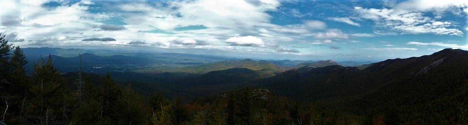
After a steady ascent of about 2 miles, the trail arrives at a junction. The main trail continues right towards the ridge and summit, but the left leads 250 feet to a rocky, western peak on the ridgeline. From here there are nice views in nearly all directions. Here is the view to the north towards Au Sable Forks and beyond.
A view east towards Jay Mountain's summit ridge.
Fantastic panorama from the north all the way to Jay Mountain.
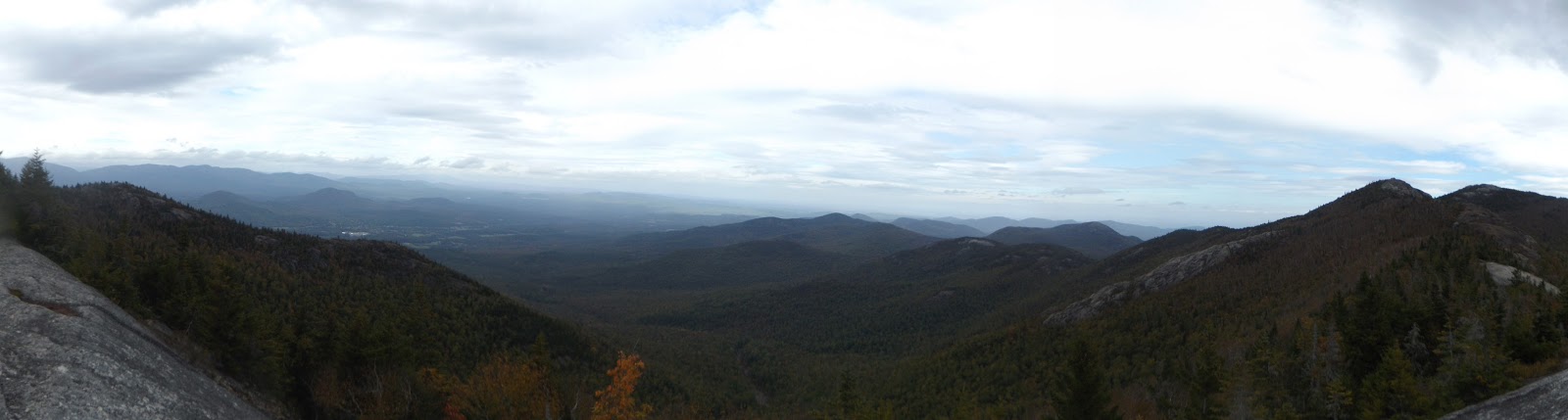
A panorama of the Jay Mountain Ridge.
My little trail companion was also enjoying the vistas.
Continuing back on the main trail towards the summit ridge, there are additional views to be found here. This is an exposed rock area with south facing views towards many of the nearby mountains and high peaks.
The marked section of trail stops at the open rock area, but rock cairns mark the way from here.
A small explosion of fall color as the trail enters a small col between peaks.
Although not marked or maintained, the trail is very easy to follow. There is not a bad view to be found anywhere.
Following the wide open rock made for great hiking. Seeing the summit laying ahead.
Another breathtaking panorama.
Looking back south and west from the rocky ridge walk.
The views on this hike are truly endless, making it so unique. Unfortunately another characteristic of this hike is a lack of water, so make sure you bring plenty along.
There are up to five sub peaks along the ridge walk, with cols separating each. As you hike, you can clearly see the ascent and descent before you. A touch of fall covers this peak.
Climbing up a steeper section out of a col.
Much of the summit walk has a lunar feel to it.
The rock cairns are abundant and truly incredible.
Continuing east along Jay's ridgeline.
Looking straight down at Marriam Swamp.
Lake Champlain clearly becomes visible the further east along the ridge you go.
The final open rock summit along the trail.
As I began heading back along the ridge, a rain shower moved in, accompanied by stiff winds. This made me a bit more hasty on the return walk. Even shrouded in clouds the ridge walk is still incredible.
Retraced my steps all the way back down the mountain for a total hike of about 7.2 miles RT. I would recommend this hike to anyone, but it is a stiff climb with an ascent of nearly 2300 feet to the 3576 foot summit. This is a truly special mountain with much to offer, and is now one of my favorite hikes.


No comments:
Post a Comment