After parking the second car at a DEP parking area along the north side of West Settlement Road, we crossed the road and began our bushwhack towards Meeker Hollow Mountain. We found a beautiful old stone wall and followed this for a short distance into the woods.
Although small in stature, 2980 foot Meeker Hollow Mountain had some fairly steep slopes, as we ascended 900 feet in about .6 of a mile.
As we continued our climb, we soon hit some patchy snow.
Passing over an old woods road, in a wide open hardwood forest.
The snow and remaining foliage made for a nice treat for the senses, as winter meets fall.
As we neared the summit of the mountain, there were plenty of screened views of the surrounding peaks through the trees.
Beautiful open forest.
Passing through the only thick area of brush on the way.
Jim making the final push up the mountain.
Fall leaves and winter snow.
We found a screened view south towards the ski slopes of North Plattekill Mountain.
The wooded 2980 foot summit of Meeker Hollow Mountain.
Starting the descent off the peak in a snow squall.
The squall picked up in intensity as we continued the descent.
Once back down below 2200 feet, the snow had stopped and we passed through an eerie evergreen forest.
At about 2000 in elevation, just past our spotted car, we passed through a beautiful, foliage lined country lane on DEP land, heading towards East Gray Hill.
Emerging into an open meadow with a great view of our next goal, 2980 foot East Gray Hill looming to the north.
Just northeast of us was another hundred highest peak, 3000 foot Old Clump. This mountain will have to wait for another day though.The climb up the south slopes of East Gray Hill was very pleasant, as we passed more old stone walls and open hardwoods.
Bushwhacking through a checkerboard of DEP land, being careful to stay away from private property.
More stone walls near what we presumed to be an old farmstead.
We weren't expecting much from this climb, but the ascent from this direction proved to be challenging.
A glance back down the slopes we had just climbed up to the south.
Nearing the top of East Gray Hill, the ascent got increasingly steep.
We wandered around an area of small, rock ledges looking for views. We did manage to find a couple of nice views through the bare trees towards the nearby farmland.
While the climb up East Gray Hill was fairly uneventful, the summit area was laced with prickers and blackberry canes.
Besides the prickers, there wasn't much else to see at East Gray Hill's summit, so we moved on fairly quickly. Here's a nice shot to the north, with a shoulder of Narrow Notch Mountain clearly visible through the trees on our descent of East Gray Hill.
After passing by the first spotted car in the col, we continued north on an on again-off again old woods road.
The first .3 of a mile from the col, is a steady climb up to around 3100 feet.
We found a small opening and rock ledge with tremendous south facing views. Many of the western Catskill peaks can be seen from here, with the double peaks of Graham and Balsalm Lake Mountain standing out like beacons in the night.
The nice view south, with sunshine taking turns with passing snow squalls.
A great shot of our last peak climbed, East Gray Hill to the immediate south.
Once you have gained the main ridgeline, it is a fairly easy hike along the old woods road. It is a long, mile or so along the ridge heading north then west to the summit.
There were many screened views to the north, but mostly just teases of what could be better views. Here is a glimpse through the trees at some of Narrow Notch Mountain's north bumps.The wooded, nondescript 3220 foot summit of Narrow Notch Mountain.
After hitting the summit, we retraced our steps back about 1.6 miles to the car parked in the col.
Total mileage for the day was about 8.5 miles, with 2700 feet of elevation gain over three peaks.
We were both thoroughly impressed with the Relay State Forest, with its single track road and mountainous terrain. Here's a view west towards the Warren range.
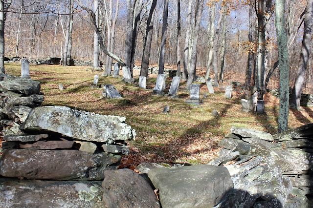
We also stopped by the Nesbitt Cemetery, which was hauntingly beautiful.
The old 19th century cemetery lined with old stone walls.


No comments:
Post a Comment