Met up with Jim Hopson to bushwhack 3360 foot South Vly Mountain in the Catskills on a cool December morning. We wanted to hit nearby Sleeping Lion Mountain as well, but I was very limited on time so would have to settle for just South Vly. There are several different ways you can approach South Vly, but we opted to start at the DEC parking area on Condon Hollow Road. The first thing that struck me when I parked the car was the amount of stone walls and stone work scattered all around.
Beginning on our hike up gravel Condon Hollow Road just beyond the DEC parking area.
The town maintained road ends a short distance past the parking area, but remnants of an old extension of the road continue on. A look into the cold woods as we ascend Condon Hollow to the southwest in the early morning.
The old, crumbling road closely follows a mountain stream.
The old road swings sharply right to the northwest before eventually turning back again to the southwest. As this second turn, we left the old road and headed into the woods to begin the true bushwhack. Along the way, we passed over good sized bear tracks.
The woods are pretty open and straightforward, with short, steep climbs combined with small, flat areas. This is referred to as stair steps up the mountain.
Just below the summit is a large, unusual clearing. Unusual because of the elevation. Of the many theories as to why this is here, we like to think that it is a martian landing field.
We almost always bring along our buddy Alan Via's Catskill 67 book on these Catskill bushwhacks. He was at least with us in spirit.
We wandered around near the "martian clearing", and found some nice ledges with views to the south, including an outstanding view towards Belleayre Mountain ski area.
Views southwest over Turk Hollow towards Halcott Center and beyond.
The nearby ridge line of Sleeping Lion Mountain.
After about 2.75 miles, we arrived at the 3360 foot wooded summit. I paused for an obligatory photo and snack break.
Beautiful, snow covered snow walls line the old section of Condon Hollow Road.
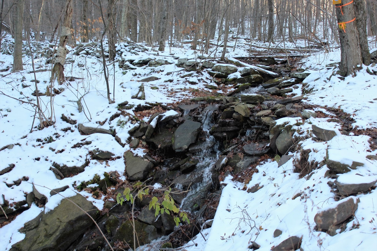
As we descended back down into the hollow, we arrived back at the mountain stream, which eventually empties into the West Kill.
Some nice, small cascades accompany this section of the hike.
Hiked about 5.5 miles RT, with about 1400 foot elevation gain. My 57th Catskill Hundred Highest.
The drive out of Condon Hollow Road, where it meets Beech Ridge Road provides maybe the most spectacular view of the day. A great view east towards Mount Sherill and North Dome.
Panoramic view at the junction of Condon Hollow Road and Beech Ridge Road.
A short distance east on Beech Ridge Road is another incredible view, this one towards Deep Notch. For my money, this is one of the best shots in all of the Catksills. I simply love the red barn in the foreground, with Deep Notch just beyond. Balslam Mountain and Sleeping Lion Mountain's steep walls line Deep Notch's deep notch.


VscepcuPtranne Jacobi Greene Download
ReplyDeleteprogram
arnolegat