My buddy Jim and I decided to do a long traverse in the Catskills today, which would be about a 50-50 bushwhack and trail hike. We spotted a car at Notch Inn Road in Edgewood(east off of Route 214) and then drove east to Mink Hollow Road's southern trail access. Weather conditions were cloudy but comfortable in the low 40's at an elevation of around 1500 feet.
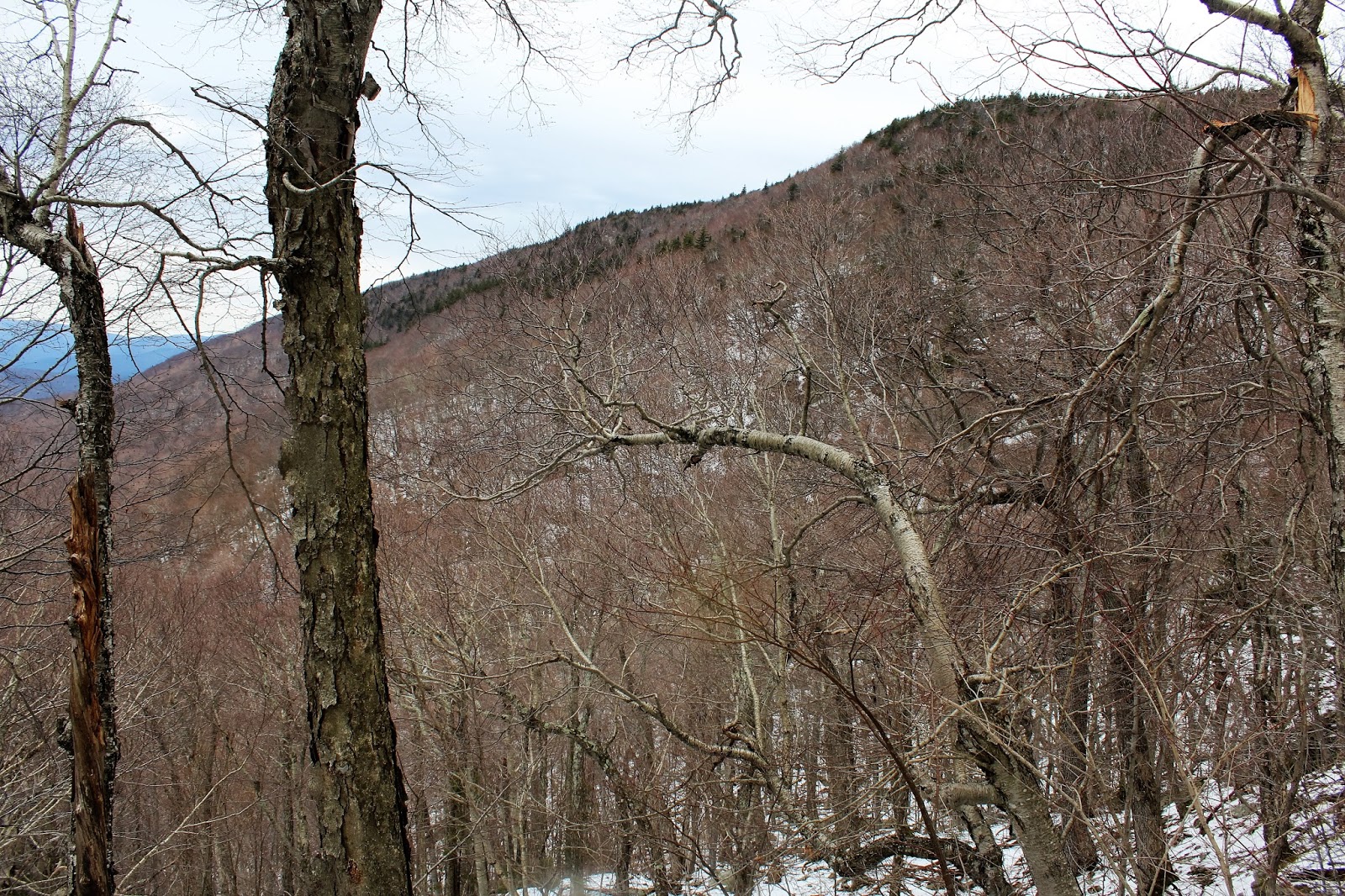
We began by heading northwest through a hardwood forest, with screened views towards Sugarloaf's long southern ridgeline.
Early spring is a time of wet woods and lots of runoff streams. We passed over this small, cascading stream which made for a pleasant spot to stop and take a photo.
We were heading towards the Olderbark/ Plateau col and at an elevation of around 2400 feet, began climbing quite aggressively.
Here's Jim trying to poke around the steep, rocky slopes picking his way up the mountain. What made this part of the climb so tough, was that the rocks below your feet were loose and constantly slipping out from under you.
As we continued our climb up the steep, rocky slopes, we began to encounter slushy, rotten snow. Wasn't a lot, but with the loose rocks and wet snow, it was a very slow climb up.
We managed to find a break in the trees and a very nice valley view behind us.
One of the most impressive parts of this tough bushwhack, were the enormous rock cliffs on the east facing slopes.
Passing more large rock bands.
Another small hole in the trees, gave a quick glimpse down towards Cooper Lake to the south.
Jim, taking a break to catch his breath. This is NOT an easy bushwhack, and I actually would consider it one of the tougher ones out of all the Catskill 67.
We were slightly on the Plateau side of the col, which actually provided impressive views of Olderbark Mountain.
A zoom view southwest over Olderbark's shoulder, with Mount Tobias in the foreground and Ashokan High Point and Little Rocky in the distance.
Up and over 3000 feet, the slopes remained quite steep as we approached the col.
Dropping down into the beautiful coniferous forest in the col bwetween Olderbark and Plateau at around 3100 feet elevation.
The climb to Olderbark's summit was slow and steady but made much more difficult with these eye gauging trees closing in on us.
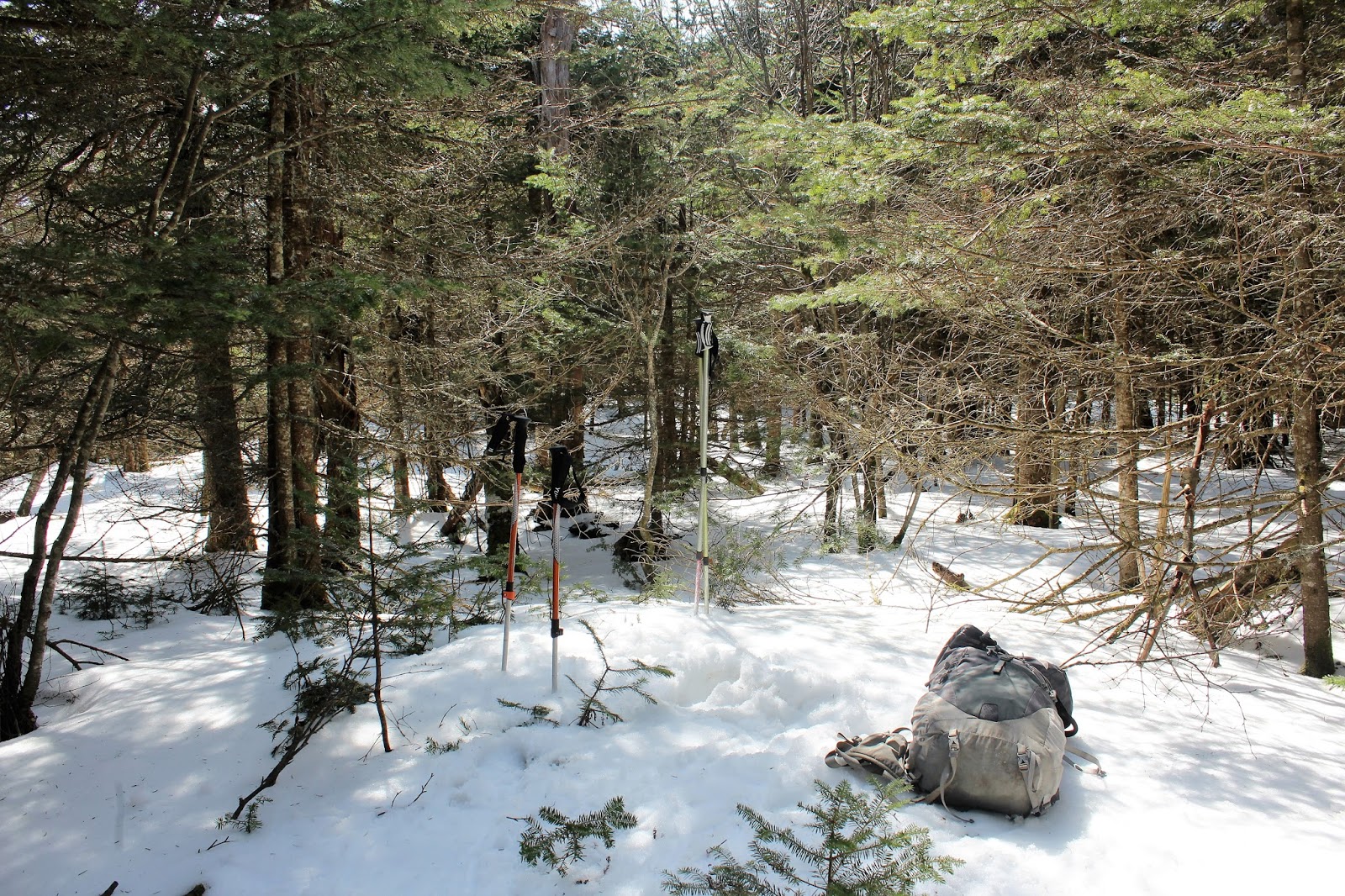
The wooded 3440 foot summit of Olderbark Mountain! Another peak in my quest to climb all Hundred(102) of the Catskill's highest mountains.
After hitting Olderbark's summit, we donned the snowshoes and headed north back through the col and towards Plateau Mountain. We hugged the east side of the ridge, hoping for views. We were lucky to find nearly continuous screened views towards Sugarloaf and Twin Mountains.
The ridge line hike was very pleasant, passing through hardwoods and a deep, quickly melting snow pack. The ascent was very gradual and steady.
We did luck out and found a nice view east towards Overlook Mountain(with South Twin Mountain in the foreground).
Continuing north, we had improved views towards Sugarloaf Mountain through the bare trees.
There was one last steep push up to Plateau's summit through a dark, conifer forest, which was quite challenging in the deep snow and ice.
Once past the toughest push towards the summit, we managed to find a ledge with a south view. This provided a great look at the ridge line we had just hiked up.
After hitting Plateau's 3840 foot summit, we were both glad to hit the Devils Path and its long level trail through the deep, dark woods. After a long, grueling bushwhack, a trail hike can be very welcoming.
Arriving at the trail junction with the Warner Creek Trail. We turned left here heading towards Daley Ridge.
Dropping down towards Daley Ridge with a great view back towards Plateau's summit ridge.
Jim, enjoying the edge views over the Warner Creek Valley far below. Olderbark Mountain sits directly in front of us here. Hard to believe we had just come from there.
The hike up Daley Ridge and down towards Notch Inn was difficult due to melting snow and a slick, steep descent. Arrived back at the spotted car, tired but satisfied. Hiked about 9.5 miles with around 3000 feet elevation gain for the day.


Phew.. Wondering if the traverse from Plateau would be the better choice.
ReplyDeleteHaha, you should be okay whichever route you take. The ice and snow just made things a bit more difficult on our route. One of my favorites though!!
Delete