Visited the 500+ acre Corinth Cooperator Area this evening, located just southwest of the village of Corinth and just north of the Adirondack blue line, on Saratoga County Route 10. The area is a hidden gem, and has been recently improved for outdoor recreation, with new trails and an informational kiosk.
I lathered myself up with bug spray and first dropped down to beautiful, babbling Hickok Brook near the parking area.
Just beyond the parking area is an old road that leads to the Upper Reservoir in just under a quarter mile. There were several young people out fishing above the dam when I arrived. I quickly crossed the weir and turned left, following the reservoir's east shore.
There is a marked trail that loops around the reservoir and even passes by a fire pit.
I turned off onto the Bald Mountain Trail, which leaves the reservoir, heading southeast.
The Bald Mountain Trail is marked with red diamonds and heads steeply up the slopes of the mountain. Unfortunately, the summit of the mountain is on private property and they seem set on keeping people off the summit.
The Bald Mountain Trail eventually meets up with the blue blazed Wilson Pass Trail, which meanders through mixed woods passing over several logging roads.
Rock cairns and stone walls can be found throughout the woods, and are very numerous along this trail in particular.
The Wilson Pass Trail drops down to an old town road(a snowmobile route) and crosses over to the Redmond's Overlook Trail.
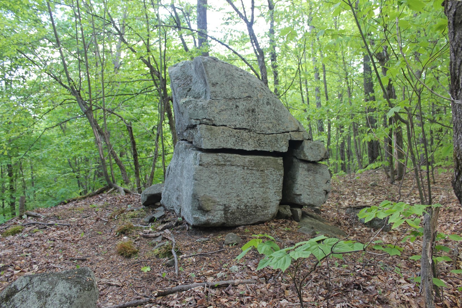
This trail climbs steadily up, passing by this interesting "split" rock along the way.
After about a half mile of ascent, I arrived at Redmond's Overlook at an elevation of about 1550 feet.
The view from Redmond's Overlook is quite impressive, extending north and east into the southern Adirondacks.
East views towards the village of Corinth.
To the north the Hudson River can be seen winding along.
Directly to the east is 1525 foot Bald Mountain.
After enjoying the views, I dropped back down off the Overlook Trail back to the old town road and followed it north. Along the way, I passed the Wilson Farm Historic Site with remnants of old foundations.
Continuing north on the wide, old town road, I eventually crossed back over to the Upper Reservoir's south side, passing over the inlet.
From the inlet, I headed south on the green marked Western Ridge Trail, which passes beside Hickok Brook as it ascends.
Small cascades on Hickok Brook.
The Western Ridge Trail continues north passing by a small beaver pond on its way to the red marked Upper Beaver Pond Trail. This trail heads less than half a mile all the way towards a large beaver pond at the north edge of the property.
This beaver pond is quite peaceful and makes for a very nice setting.
Once leaving the beaver pond, I headed back to the Western Ridge Trail, which descends all the way back to the Upper Reservoir. From there, I walked the remaining short distance to the main parking area.
My last stop for the day was the much smaller Lower Reservoir, located less than .2 miles east. This reservoir is much less secluded than the Upper, with the sounds of nearby traffic taking away from the ambiance.
Hiked nearly all of the trails on the property and arrived back at the car as darkness began to settle in. Total mileage was about 7 miles total.


Nice find!
ReplyDeleteJust drove past this spot on my way to Hadley Mt. Took a pic of the sign and googled it. Your post is the only thing that came up. Usually I'd at least get a DEC listing. Is this not state land?
ReplyDeleteHi there! This property is owned by the Village of Corinth. Not sure how the DEC is tied into the property to be honest, but it's a really nice spot to hike. If you do choose to go, I've attached a trail map at the end of the post.
Delete