The Dix Mountain Wilderness is an absolute bushwhacking paradise with numerous bare rock summits and more rock ledges than I count. When Jim an I were on Nippletop(not the High Peak) last week, we spotted some gorgeous open rock north towards Spotted and Wyman Mountains and knew we had to go explore. We looked over maps and trip reports and decided on a hike to Elizabethtown 4 and Spotted Mountain from Route 73. We met at the small pull off just west of the Route 9 and 73 split off exit 30 and headed into the woods, following a very good unmarked foot path. The path travels southwest for a little over 2 miles high up on a bluff, closely paralleling the South Fork of the Boquet River. Just past a campsite, the South Fork splits and that's where we left the foot path, crossing the creek and beginning the bushwhack.

The elevation at the creek was about 1200 feet and we began climbing almost immediately. Most of the hike up Elizabethtown #4 was through open hardwoods and was pretty easy going.
It didn't take long, but soon we hit some open rock slabs and we were treated to the first of what promised to be many views.
Giant Mountain(L) and Rocky Peak Ridge(R) could be seen rising above the tree tops to the north.
Approaching open rock near E#4 at about 2400 feet elevation.
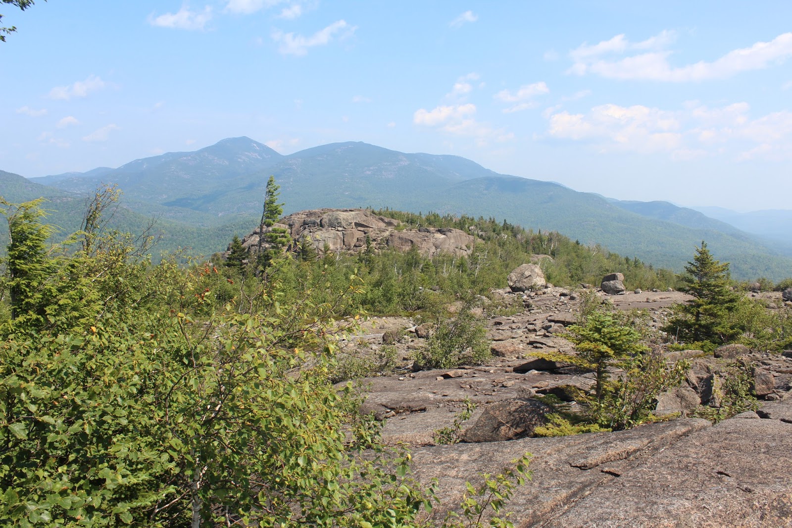
A very large, open rocky clearing provided our first really good views of the day. The views north and east were basically unimpeded.
Just below E#4's summit, we "spotted" our first view of Spotted Mountain, hovering nearly 1000 feet above us a half mile away.
The area around and just below E#4 is a open rock playground, with nearly 360 degree views. Once again, the views north towards Giant and RPR were spectacular. We also spotted a large rock monolith between us and those two peaks. We would be back to visit later.
A fantastic view southwest towards Spotted Mountain(left foreground) and Dix Mountain, with the Beckhorn slide beyond.
The view west-southwest of Dix Mountain is spectacular. A very unique and rewarding look at the 4867 foot peak.
We wandered around exploring all of the the open rock on E#4.
Approaching the summit of E#4 with Spotted's summit getting closer.
The monolith in front of Giant and RPR once again.
Moss and water beneath the summit rock on E#4.
Spotted Mountain from E#4's summit rock, which sits just shy of 2700 feet.
E#4 is officially just an unnamed bump along the ridge to Spotted, so we didn't drop more than 20 feet before beginning our ascent up Spotted. The climb varied between thicker woods and open rock.
Open rock high up on Spotted Mountain provides a vast view northeast over Elizabethtown #4 towards Giant and Rocky Peak Ridge.
From a rock on the northwest shoulder of Spotted we were able to catch a glimpse towards Noonmark and Round Mountains(L) and Upper and Lower Wolfjaws(R) distance.
Less than a quarter mile below the summit.
Round Mountain with Giant and RPR beyond.
Emerging at the 3445 foot summit of Spotted Mountain, which more closely resembled the moon than a mountain summit. The Dix Range to the west can be seen rising beyond.
Jim had fun wandering the summit, enjoying the marvelous views.
The view due south towards Wyman Mountain.
The most spectacular view of the day was up the ridgeline towards East Dix(Grace) with Hough to the right.
Southeast views towards the peaks in the Hammond Pond Wild Forest.
The summit area on Spotted.
A last view back northwest towards Noonmark, Round, Giant and RPR(L-R).
On the descent we missed the ridge a bit to the left, so the going was a bit thicker and a bit more steep, but it also allowed us to see different things, including this red moss.
Once back on E#4 we were hoping to enjoy some of the Eclipse views but all that it did was add a red tinge to everything. I guess it wasn't all it was "cracked" up to be.
The descent allowed us a very nice view due east towards a group of peaks known as the 3 Gems.These are also now on our radar.Gems.These are also now on our radar.
The descent off Elizabethtown #4 was pretty easy as far as bushwhacks go, passing by more open rock.
We got back down to the South Fork Boquet River and followed the path out for a beautiful 9 mile RT hike, with 2400+ foot elevation gain.


No comments:
Post a Comment