Anyone who knows me or has hiked with me knows that the Adirondack High Peaks are not my first choice for hiking. While they are jaw dropping beautiful, they are also very over crowded and make for very long day hikes. Every so often I do enjoy hiking these gorgeous peaks, however, and Monday I planned on meeting a couple of friends(Jim and Melissa) to hike 4715 foot Mount Colden, the 11th highest mountain in High Peaks. Another friend of ours, Spencer, who has vast experience and knowledge of these mountains, suggested we hike up from the east side of the mountain via a bushwhack/ slide on a tributary of the Opolascent River as an alternate to the trail. We all agreed that it would be a fun way to ascend the peak and met bright and early Monday morning at the Adirondack Loj. Luckily, the Monday morning crowd was a bit subdued, so we got a good parking spot and were on our way under cool, fall like weather conditions(temps in the low 40s).

The first brook crossing of the day, a couple of minutes into the hike on the Van Hoevenburg Trail.
After 2.1 miles, we arrived at a major crossroads in the heart of the Adirondack High Peaks...Marcy Dam. Unfortunately, the dam was forever altered by Tropical Storm Irene, vastly changing this gorgeous location. Lucky for us, the view is still nothing short of breathtaking. The slides on Wright Peak look close enough to touch.
The trail, which used to go over the dam, had to be rerouted several years back and a footbridge now crosses Marcy Brook. Once across the brook, another clearing just off the trail provides a very nice view of Wright.
We left the dam passing Avalanche Camps heading southeast on our way to Lake Arnold, with a steady ascent.
At another trail junction we arrived at tiny but very picturesque high elevation Lake Arnold. The lake sits at an elevation just under 3800 feet just below a ridge of Mount Colden. On a map, it almost appears to be nothing more than a teardrop amongst the peaks.
We continued on the trail on a steady descent southwest towards the Feldspar Brook Lean To. It can be frustrating to lose elevation that you had worked hard to attain, but we had to keep dropping down until we could find the second brook crossing, with the slide above. On the way, we had some small viewsup towards Colden's summit some 1500 feet above.
We left the trail a touch too early, literally following the brook up through some thick brush and blowdown.
We soon saw light through the trees and within a few moments we found the slide. Extremely impressed.
The slide provided outstanding and unique views east towards Mount Marcy...
..and Gray Peak.
The tributary is small and runs down the lower portions of the slide with large amounts of moss. This created a green slime effect at times.
Our route basically followed the brook, which looked a lot like the many herd paths in these high peaks.
I am almost always impressed with the clarity of the these tiny mountain streams.
A small pool on the stream sits at the foot of a nearly 20 foot wall with a tiny waterfall runnign down the center.
The lower portions of the slide were plenty rocky, but fairly easy to negotiate.
Jim leading the way on our ascent.
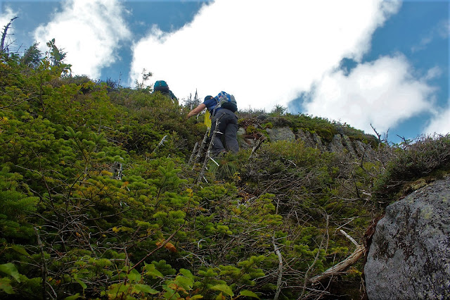
The climb got steadily steeper as our elevation increased.
We stopped several times on the way up to catch our breath with ever expanding views opening up behind us to the east.
Blue skies opened up above us just in time for us to see one of the head walls of the slide just below the summit.
This slide, which drops down the steep southeast side of the mountain, was created in 1990 and is quite impressive. It is a lesser known route up the mountain and can be a bit intimidating.
The views only get better!
The grade began getting tougher and tougher, slowing us down a bit, being careful to find the best route.
The good news is that the rock was very "grippy", almost having a velcro effect, which helped us along the way.
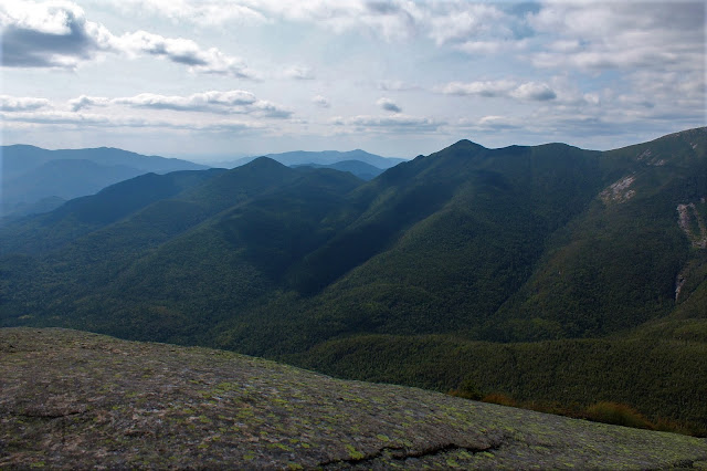
As we continued to gain elevation at an alarming rate, the views behind us were absolutely spectacular.
Jim leading the way above.
I stopped to take this photo of Melissa climbing up behind me and almost got vertigo.
The Great Range emerging to the northeast.
Jim and Melissa crossing over a steeper section of open rock as we neared the top.
We all let out a collective sigh as we hit the top end of the slide, entering a thick, scrubby woods with a faint herd path. A couple of steeper scrambles got us up to the trail along Colden's summit.
Felt odd being on a trail and seeing people again, but the views on top are stunning. The west view 2500 feet down into Avalanche Pass is amazing. To put things into perspective, that is 3800 foot Avalanche Mountain sitting in front of 5115 foot Algonquin Peak.
Continuing on down the ridge to the best views of all to the southwest over Lake Colden and Flowed Lands.
The amazing view north up Avalance Pass with Wright Peak hovering above to the left.
Colden's southern ridge.
Melissa soaking in the spectacular views.
The jaw dropping MacIntyre Range looms large directly to the west of Colden.
A zoomed look at the southern ridge of Colden, with hikers approaching the summit.
The southern end of the MacIntyre Range, from Marshall(S) to Iroquis(R).
The view north towards Lake Placid beyond this large glacial erratic, sitting precariously on the edge.
After enjoying the summit views for about 45 minutes, we began dropping off the top taking L.
Morgan Porter Trail. A fun scramble between two large boulders starts the descent.
As we dropped off Colden's summit, we enjoyed a terrific view of the northern sub summit of Mount Colden.
I loved the view up towards the true summit of Mount Colden from the sub summit.
The northern end of the MacIntyre Range from Algonquin(L) to Wright(R).
A last view towards the Great Range, with Giant Mountain in the distance beyond before descending.
Dropping below the Alpine Zone.
As always, the hike out was long with a steady descent. Luckily, good company makes the miles go by much quicker.
Got back to the car at about 7pm ending a long, but fun hike. Total mileage was just over 12 miles with roughly 2600 feet elevation gain. My 17th Adk high peak.


Very very cool! Great pic's along the way as well...I love Colden!!
ReplyDelete