I have read multiple trip reports on the many gorgeous mountains spread across the vast 45,208 acre Dix Mountain Wilderness Area and after seeing all of the open rock scattered about on many of the peaks from Google Maps, I knew I had to go. Outside of the High Peaks in the Dix Range, none of these other mountains have trails or herd paths, so it would require bushwhacking to get there. After talking it over with my buddy Jim, we opted to try for 3018 foot Nippletop Mountain. Not THE Nippletop, but a much more secluded, less visited Nippletop. There is access to many of the peaks in this area via several tunnels under the Northway. Finding our access point today was a bit of a challenge, but well worth the effort. We parked on the shoulder of Route 9, exactly 3.4 miles north of its junction with Blue Ridge Road. The small dirt road marked Walker Road, "Private", is actually a right of way to access the Northway tunnel. We followed this west for about half a mile before we came to a crossing of the Schroon River. The area to cross is fairly shallow, but you will get your feet wet, so be prepared.

Once across the river, there are myriad of jeep trails that meander around. We just stayed mostly straight following the sounds of traffic on the Northway. Soon enough, we came to the tunnel crossing. A little eerie but it gets you where you need to go.
Very soon after crossing the Northway, we saw our first DEC state signs. This is always a welcome relief, and we continued on a well defined woods road/ path to peaceful Walker Brook, flowing down through a beautiful hemlock forest.
The woods road crosses over stone chocked Walker Brook and continues west with the stream within earshot.
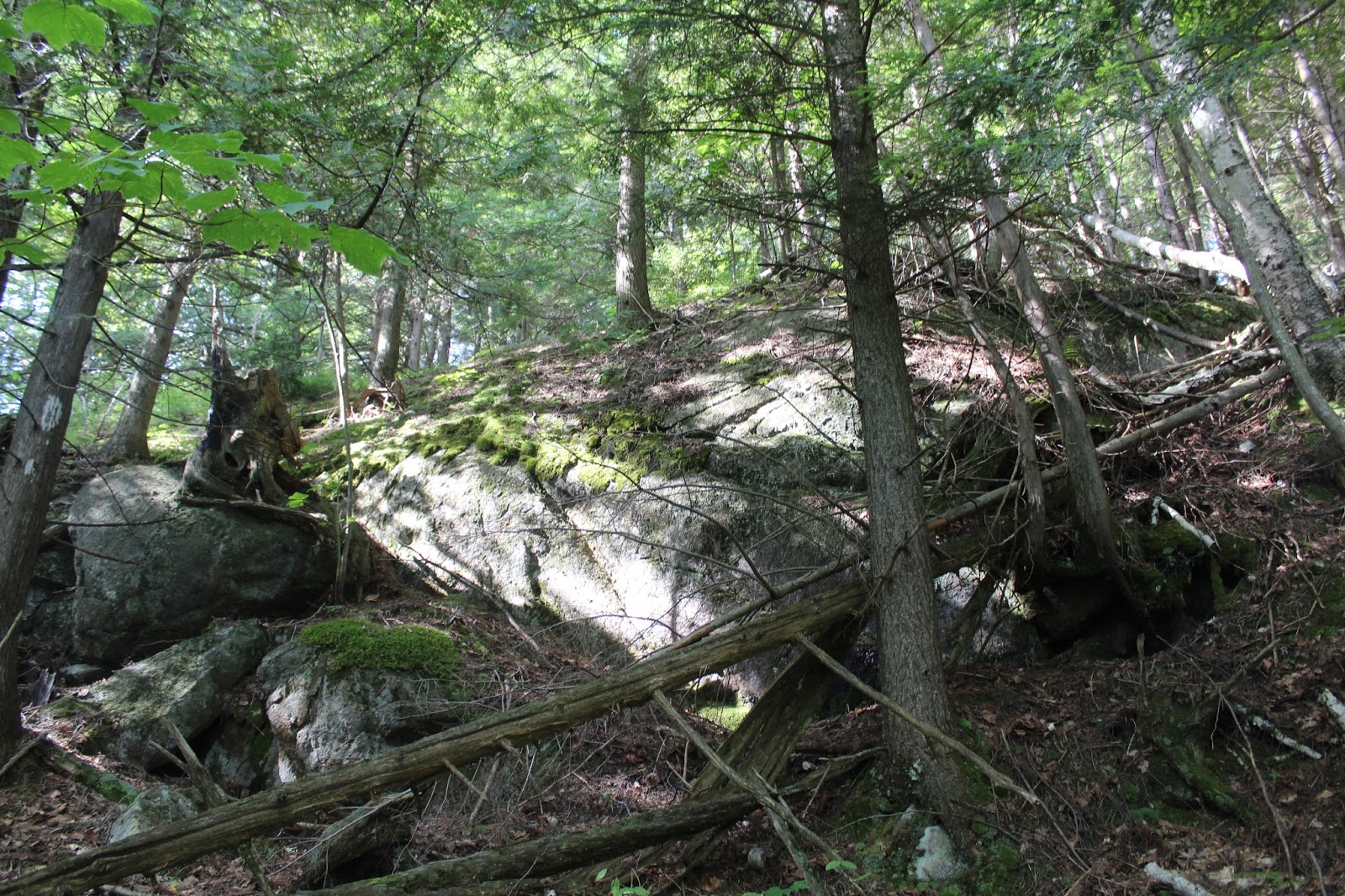
We followed the woods road for a little while, before thick blowdown eventually made us lose it altogether. We shrugged it off and began the bushwhack from there, climbing steeply though an open forest. The terrain on the lower slopes of the mountain wasn't terrible at all, just steep.
We passed several open rock slabs on the climb, eventually finding this one with a nice view of the north summit bump.
From another open rock slab, we managed to find this nice view down to Exit 30 of the Northway.
As the elevation increased the woods got a bit more scrappy, but still nothing terrible to contend with. Here is yet another rock slab with views to the east.
We continued our ascent until suddenly we emerged at the beginning of the north(lower) summit. The views from the open rock were absolutely stunning. We decided to take a break there and soak in the outstanding views. How were we to know that this was just the warm up?
From the north summit, we got a nice look at the south, true summit.
There are actually a series of open rock areas on the north summit, each with a better view than the previous. Here is the view towards the Dix Range in the High Peaks as well as Camel and Camels Hump.
Dropping down off the cliffs of the north summit, where we were quite surprised to spot some early leaves changing color already.
A look up at our destination on the south summit from the col between the two.
The area between the two summit bumps was the thickest we had been in all day, with a lot of blowdown. Nothing terrible though. Here we are emerging through a field of blueberries at the summit.
The 360 degree open rock summit is a truly remarkable experience. While only 3018 feet high, the feeling is that you are much, much higher. There is much to explore up here, so we wandered around, enjoying every minute. The west view here is towards Big Marsh Pond and Marsh Pond Mountain on its right. To the left is Hoffman Mountain and Blue Ridge.
The north view towards neighboring Niagara Mountain.
The south view allows a glimpse down towards Schroon Lake and the Northway.
A zoom view of Marsh Pond Mountain.
I particularly liked this shot with Schroon Lake(L), Hoffman Mountain(center) and Big Marsh Pond(R).
North views towards the High Peaks of the Dix Range with Giant and Rocky Peak Ridge in the distance.
Love seeing the open rock on the Dix Range and Wyman Mountain. In the foreground is Camels Hump and Camel.
A view up at the summit from below.
An incredible view of the North summit from the south summit. Look at all of that open rock!
We dropped down off the main summit cone trying to miss the steep, rock cliffs and ended up a bit further east near the cirque. This way, while a bit rougher with blowdown was an interesting change from our ascent.
Steep drop off near the cirque.
Rock slabs on the cirque with the south summit ridge beyond.
Emerging into a clearing on a rock slab, with a fantastic north view towards 2338 foot Old Far Mountain and the Northway winding below.
Early fall colors in the middle of August! We were both astonished.
The descent was steady and steep but fairly uneventful. Hiked about 8 miles RT with about 2150 feet elevation gain.


No comments:
Post a Comment