West Mill Brook is your companion for the first par to the hike, sitting down a steep bank on the right. We stopped off to check out a small, but pretty 10 foot waterfall.
We continued on the road for nearly 1.5 miles before leaving the road and beginning our bushwhack. Here, Jim and Spencer ascend through an open hardwood forest.
Instead of heading directly for the summit, we opted to first hit the Igloo, a large, dome shaped rock outcrop, that sits just east of Wyman's summit. This route ended up being extremely steep, even vertical in spots. Luckily the rock was very "grippy".Steep drop off the false summit.
These vertical rock walls acted much like a fortress, which we had to skirt to find a way up.
This was a very exhausting ascent, with many heart in our throats moments. Luckily we found small clefts in the rock to make our way up.
Once atop the rock fortress, we enjoying our first of many spectacular views for the day.
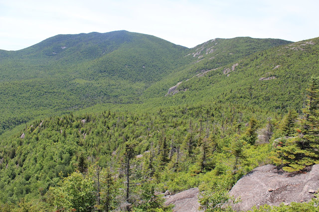
Wyman's 3304 foot summit towering nearly 700 feet above us, as we neared the Igloo.
From the 2653 summit of The Igloo, Jim checks out the surrounding peaks.
After enjoying the Igloo's marvelous views, Spencer lead us down through a steep crack.
After a quick descent, we began our steep ascent up Wyman. Not surprisingly we hit open rock, which acted as a ramp up towards the summit.
Our rock ramp up Wyman.
We hit moderately thick spruce near the summit cone, but were rewarded with jaw dropping views of 3/5 of the Dix Range. Here is Carson(center) with Grace(right) and part of Macomb(left).
Camels Hump and Niagara Mountain to the south, with the valley of Niagara Brook below.
Macomb and Carson rising impressively to the southwest.
Carson(South Dix) from the open rock ridge below the summit.
Grace Peak(East Dix) due west off the rocky ridge.
Macomb(right) with its long easterly ridge, which forms a horseshoe type cirque. Appropriately, Spencer dubbed this Horseshoe Peak.
Our descent off the summit through thick spruce. Luckily this was all the spruce we really endured all day.
Mountain art on some of the open rock.
To the northwest, we enjoyed the marvelous ridge of Spotted Mountain. We had hiked this peak last year and it was a sheer pleasure.
Spencer exploring the open rock ridge below Wyman's summit.
One more view of Spotted Mountain, with Giant and Rocky Peak Ridge in the distance beyond.
As we sauntered along, enjoying the incredible views, I turned back to enjoy one more look at Macomb's massif rising beyond the shoulder of Wyman.
A zoom view of the slopes on Grace.
The pitch on these slopes was VERY steep, and didn't look like we could descend.
Luckily, the rock was amazingly "grippy", allowing for us to descend what looked to be an impossible route.
Jim and Spencer heading down ahead of me, proving it's sometimes a situation of mind over matter.
Looking back up at where we had descended, it still seemed impossible. Baffling! If I hadn't done it myself, I wouldn't have believed it.
There are several small, open rock bumps off of Wyman, each with spectacular views. Here's a look back at Wyman and some of the nearly vertical rock that we had just descended.
From our open rock perch, northeast of Wyman's summit, we enjoyed this view all way north to Giant and Rocky Peak Ridge.
East views all the way to Vermont.
Jim and Spencer soaking in a breeze and great views. Wyman can be seen rising beyond.
One more rocky bump ahead. The sheer amount of open rock to explore was downright incredible. It was almost overwhelming by the end of the day.
A long, steep descent brought us eventually back to West Mill Brook, where we picked up our old road out.
The clean mountain water made a great place for us to wash up and get some of the bugs and grime off of us.
We followed our initial route in, back out to the car, completing a long and exhausting day. This was a very tough bushwhack and I was feeling it by the end of the day. 9.5 miles RT and over 2800 feet elevation gain.


No comments:
Post a Comment