Finally! At long last, the extreme summer heat and humidity broke today, so I headed up to the northeast Adirondacks to do some off trail exploring. Parked on the north side of Ensign Pond Road in an unmarked pull off, with a view of a shoulder of Harris Hill(the mountain I would be climbing). Crossed the road and headed into the woods, immediately beginning to climb. Elevation to start was 1190 feet.
After climbing a small bump, I began the real climb, which was steep, but not anything terrible. Passed through several open areas with slick, patchy moss on the way up.
Near the top of the false summit, I began getting some very nice west views.
West views towards the Dix Range.
Open rock and moss(which was quite slick) just below the 2125 foot false summit.
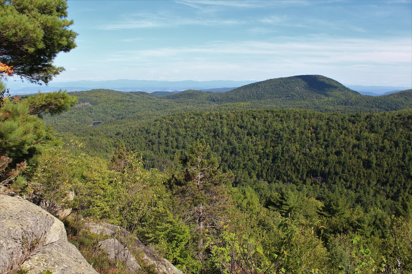
SW views over the Northway towards the Hoffman Notch Wilderness.
Riding the thermals on this beautiful late summer afternoon.
NW views stretching from the Dix Range towards Giant Mountain and RPR.
Wide open exploring on the slopes atop the false summit.
South views towards Hail Mountain.
SW views. These slopes were incredibly open and inviting to explore.
The grassy summit of the false peak.
After a very small descent, I headed up to a second bump, which was very open as well and overed in blueberry bushes.
Views from the second bump. Pine and Hammond Ponds visible.
The true 2211 foot wooded summit of Harris Hill.
I wandered south, dropping steeply down to an open ledge, with more outstanding views. The mass of Hail Mountain stands imposingly over Pine Pond from here.
Bald Peak rises to the SE.
A zoom view all the way towards the Taconics of Vermont.
Directly south from the ledge stands Lock Mountain with Hail hovering behind.
Took a different route down just for variety and regretted it. Went south off the true summit heading towards a woods road. When I got there it was more of foot path than a woods road .There was all sorts of dead fall and blow down along this path too, making it tough going. Eventually left the path and went a bit higher to avoid the blow down heading NW back to the car. Overall, a pretty easy hike with about 4 miles RT and 1350 feet of ascent.


Thank you for this very informative blog, beautiful pictures and feedback on your adventure trails. I just moved to Williamstown and looking forwards to all the new nature discoveries. Very helpful !!
ReplyDelete