The "Brothers" are a set of three peaks that rise NE of Brant Lake and have been on my radar to visit for a while now. There are no official trails to these peaks, but I have seen a few trip reports on them that seemed promising and judging from all the open rock visible from the road and on satellite, I figured they were can't miss peaks. Today I set out to visit the Third Brother, a 2003 foot peak, and the furthest of the three from Brant Lake. I drove Route 8, continuing east past the lake until I was almost directly beneath the mountain. Unfortunately, with snow banks on the shoulders of the road, I had to continue further than I would've liked, eventually finding a spot in one of the parking pull offs on the north side of the road. Elevation from the car was 1020 feet.
Looking at the map I knew that I would have to somehow cross Spuytenduivel Brook, which left me with a lot of uncertainty given the time of year and the probability of high water/ice. I chose to play it safe and walk about 6/10 of a mile back west along the shoulder of Route 8 using the bridge to safely start on the left side of the creek. Dropping down into the dark, shaded woods along the creek I quickly realized that I had made the right call. There was no way I would've tried to cross the fast moving, icy cold waters.
I followed a rough herd path along the brook for a while, before turning at a bend, quickly arriving at a large beaver pond sitting at the foot of Third Brother. From this vantage point, the open rock high up on the mountain was clearly visible and calling my name.
I worked my way west around the pond, hitting some shaded areas of crusty snow and ice, but nothing of consequence. Once I arrived at the lower slopes of the mountain, I could see that it was going to be a steep climb up. Luckily the woods were wide open and easy bushwhacking.
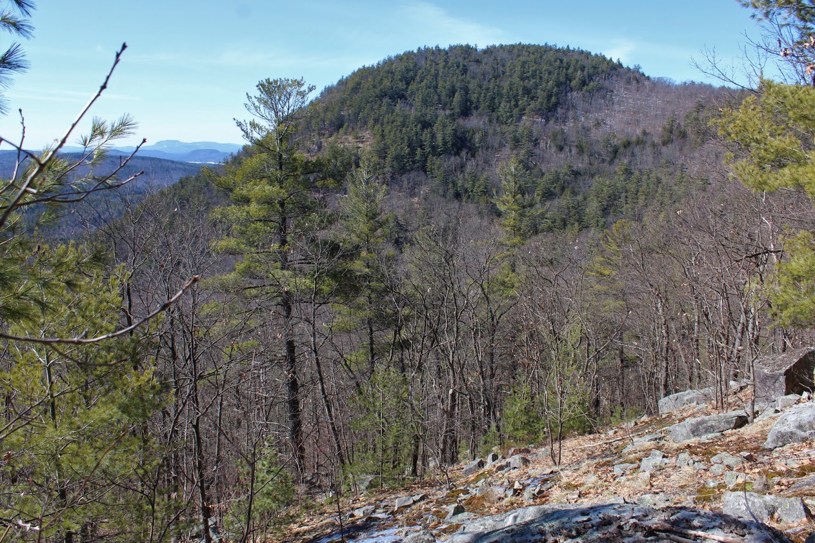
There were very few cliffs to negotiate, but the slopes were very open and rocky, leading to an abundance of views. Here is an early view I caught of neighboring Second Brother to the west.
As stated, there are a lot of good views on this approach, and I had a lot of fun exploring the open slopes, enjoying views like this back towards Second Brother and mostly frozen Brant Lake.
SE views opening up from another wide open view spot as I continued a steady, fairly steep climb.
Pushing up and over 1900 feet, the open rock was a virtual playground for a bushwhacker.
The 2003 foot summit was anti-climatic, fully wooded in spruce with about 8-10 inches of crusty snow underfoot.
Looks like the only other recent visitor to the summit was a moose. I spotted huge hoove prints, as well as a couple of large piles of moose poo.
Back down at the large south facing clearing, I enjoyed these views of the numerous peaks in the area west of Lake George.
The true money spot is an area of open rock just west and below the true summit. From the open slopes are spectacular views NW across the Pharaoh Wilderness. The peaks from left to right are Park, Number 8, and Little Stevens with Chub Pond the frozen body of water below.
A million dollar view of Second Brother, with a corner of Brant Lake poking out to the left. Gore Mountain's ski slopes are clearly visible to the right in the distance.
Way off in the distance, the High Peaks can easily be distinguished by their snow capped summits.
One more look west/ NW from the open rock below the summit. What a fantastic spot!
After enjoying the views up high, I dropped back down, heading more westerly towards the col between Second and Third Brother. The first 400 feet on this side of the peak were actually quite steep and slow going. I managed to find some last vestiges of winter on some of the rocky cliff bands. Once back down low, it was a nice and easy return back to the road and eventually my car.
An absolutely beautiful late winter day in a beautiful corner of the Adks. Amidst all the chaos in the world, it's nice to find a little solace alone in the woods. 4.6 miles RT with 1050 feet of ascent.
Red=Ascent Blue=Descent


No comments:
Post a Comment