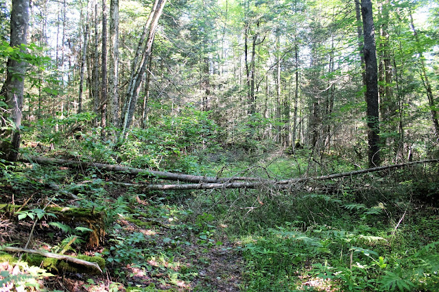
The trail heads generally south-southeast with very little elevation gain. It is primarily a snowmobile trail and doesn't see a lot of hikers, meaning there was quite a bit of blowdown and undergrowth along the trail.
About 2 miles in we spotted a small beaver pond about 30 yards off the trail so we made our way over to check it out. It was very picturesque in the early morning light.
A bit further down the trail, and only about .1 of a mile before the river, we came to a water crossing. It was a bit tricky because the water had flooded the trail as well as the surrounding woods. We had to get a bit creative and luckily lead us to this fine view of the backed up water only a few yards off the trail.
After 2.2 miles, we could hear the sounds of rushing water. We knew that meant we had arrived at the Boreas River. We headed first downstream, where we found a canoe. We also found that the water was pretty high after our recent rains.
I bushwhacked my way both upstream and downstream, looking for a nice place to stop for lunch. I didn't find too many clear spots, but did find some pretty decent river views. Here is a look downstream at the still water section of the river.
A bit upstream from the dam site, the river bends to the east. This is a very pretty spot, but the growth along the shoreline made it nearly impossible to get too close.
I spotted this rough shelter atop a small knob near the river. Looks like it was from a few years ago.
We picked out a small spot just downstream from the old dam site to try our hand fishing.
A careful eye can pick out some of the dam remains just below the water surface.
I clawed my way down to a rock near the dam for a better look downstream, where the water comes rushing along. This may be an easier spot to visit in low water, but was actually a bit unnerving today.
More old structural remains from the old dam.
After wandering around the river's edge for quite a while, we finally turned back(the deer flies were obnoxious and made our decision even easier). Passing by a beaver meadow where we had to leave the trail due to high water.
Arrived back at the truck, glad to be away from the deer flies and humidity. 4.4 miles RT.
After taking a breather, we decided to head down the remaining .2 of a mile down to Cheney Pond. It is a very beautiful location and looks like it would be a fun place to explore by canoe. There is a Lean To on the far eastern sandy shoreline that is only accessible by water. We were going to try to fish this, but the water was quite shallow along the shores so we opted to do it another time.
We really enjoyed this gorgeous, often forgotten section of the Adirondacks. Not surprisingly we didn't see anyone else the entire time.


No comments:
Post a Comment