Met up with my buddy Jim to do a traverse bushwhack hike from Mink Hollow up the unnamed 2883 foot summit just south of Twin Mountain and then continue north up to Twin's double summits, before dropping back down to Pecoy Notch and our spotted car on Roaring Kill Road. This was a special hike for Jim, as this would complete his quest to bushwhack all of the 35 Catskill High Peaks(which means taking a non traditional true bushwhack route on the untrailed mountains-no herd paths)
We parked at the Mink Hollow parking area(elevation of about 1500 feet) and began heading north on the trail until a very short distance in when we hit state land. Once on state land, we crossed the babbling Batavia Kill, which was an easy rock hop across today.
After crossing the creek, we headed up and over the extreme southern portion of Sugarloaf's long ridge, before dropping down to another creek crossing. This tributary of the Batavia Kill was chock full of fallen trees and limbs.
Immediately east of the creek, the ascent begins and is steady but not overly steep. We came upon several large patches of fern glades, including this large area where they were nearly as tall as Jim.
Ascending.
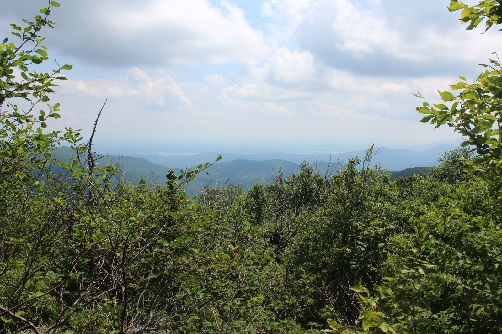
After a little more than 2 miles, we arrived at the 2883 foot unnamed summit. I climbed upon a large boulder in a clearing, where I found a view north towards Twin Mountain.
We stumbled across this pretty large rock cairn. The middle stone is about 5 feet high and looks like it is quite heavy.
We loved the open meadow by the summit. Very unique, especially at this lofty elevation.
Another shot of the open meadow near the summit.
After leaving the summit, we began a descent down to the saddle between the unnamed peak and Twin Mountain Elevation in the saddle was just about 2500 feet. From there we continued the bushwhack north, where we would be gaining over 1000 feet in less than .9 of a mile.
Although the ascent was tough, we took our time, enjoying the trip.
Once we neared Twin's south summit, we began to enjoy some of the views that the summit is known for.
From Twin's south summit is a nice view north towards Pecoy Notch.
Southwest views from Twin's 3520 foot south summit.
The summit area provides a great view west towards 3800 foot Sugarloaf.
We continued just over half a mile on the Devils Path to Twin's 3650 foot north(and true) summit, where there are decent views as well.
Continuing on the trail, it is a pretty steep descent down towards Pecoy Notch, where there are some pretty amazing views. Here is an up close shot of Sugarloaf.
A steady drop down.
A northwest view on the descent towards the East Jewett Range.
Twin Mountain across the beaver pond.
Sugarloaf across the beaver pond.
Continuing along the trail, we stopped briefly at the stream crossing, with a pleasant view of a small cascade.
With just about a mile left to the spotted car, we arrived at Dibbles Quarry, and its nice views. This made our final break spot.
From Dibbles Quarry, we enjoyed one last view towards Twin Mountain.
Arrived back at the car at about 5pm and saw only one other person all day. Just over 9 miles RT, with a little over 2700 feet elevation gain.


No comments:
Post a Comment