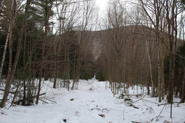
Decided to check out an old abandoned ski area in the far eastern area of the Berkshires after work today. The Berkshire Snow Basin served as a surface lift serviced ski area for nearly 40 years, closing for good after the 1989 ski season. The ski area opened in 1949 and was built on the north slopes of 2080 foot Bryant Mountain due to its reliable year in year out snow pack. Since 1994, the north slopes of this peak have been owned by the Commonwealth of Massachusetts and is open to the public.
For more information on this lost ski area, please check out https://www.newenglandskihistory.com/Massachusetts/berkshiresnowbasin.php for a wealth of information.
I parked in a small unmarked pull off on Route 9 in Cummington, just after passing Brown Ave on the left and just before West Cummington Road on the right. As I left the car, I crossed a fairly open meadow at the base of the old ski runs. From this vantage point and at under 1200 feet of elevation, Deer Hill's 1900 foot south summit stands impressively to the north.
From the bottom of the meadow, the slopes above you don't really resemble abandoned ski slopes as much as they appear to simply be an overgrown field. A little further up though, the ski runs are a bit more visible.
I headed straight up an old life line, ascending 550 feet in under half a mile.
Looking down on the steep slopes of the lift line, with Deer Hill towering above.
Near the top of one of the ski runs is a nice view north towards the small hamlet of West Cummington, tucked into the nearby hills.
Ski run view towards West Cummington.
A young pole stand grows where skiers once skied.
From almost all of the open slopes, Deer Hill is certainly the most impressive and dominating feature.
As nature continues to take over, anything man made gets buried further and further into the past...or into the snow.
From high up on one of the old slopes, I was able to capture a bit of a NW view towards the high ridges of Savoy State Forest.
Found an informal campsite in a clearing near a dark hemlock grove.
Stumbled across more random concrete near where the top of the old ski runs and lifts ended. The summit ridge can be seen through the trees beyond.
From the end of any visible ski runs, it was a straight bushwhack up to the summit. Open, mixed woods and a crusty snow made my ascent quite pleasant.
From the summit ridge, there were through-the-trees views to the north, but nothing of significance.
At the true 2080 foot summit sits a very large bubble, which is actually a Federal Aviation Administration Long Range Radar (Surveillance) station. The state forest ends just shy of this spot, so this was as far as I went.
On my descent, I tried to look around for any views, but really couldn't find much.
Back down on one of the eastern most ski slopes, I found another view towards Deer Hill.
On different spots on the mountain, I found pink flagging and hand made signs. Not sure if these are legit or not.
On my descent, I decided to hug the steep eastern slopes in hopes of finding some remaining equipment from the old ski days. As luck would have it, I did stumble upon some of th eold T-Bars and rope tows.
After nearly 30 years, I'm surprised the equipment looks as good as it does.
There was a smattering of equipment in wavering levels of despair.
In the classic battle of man versus nature, nature doesn't take long to win out.
Back down at the base of the eastern side of the ski slopes, I took one last look back up at a once glamorous location, that will soon be gone forever.
Hiked about 2.5 miles RT with over 900 feet of ascent. A fun little adventure from a forgotten page of the past.


Wow, that was interesting, like touring an old ghost town! Reminds me of when I stumbled upon the former Snow Valley ski resort near Manchester VT while hiking years ago, even went into the dilapidated lodge building!
ReplyDeleteThanks! Yes, it was really interesting. I always like to see the battle of man versus nature, and to see just how long it takes for mother nature to win out. Where exactly was the Snow Valley ski resort? Might be something I'd be interested in checking out sometime!
DeleteInteresting reading abouth the former resort: http://www.nelsap.org/vt/snowvalley1.html I think I took the trail across the road (Route 30) from the Bromley Mtn trailhead and stumbled upon the place, must have been 25 years ago...Just before Route 30 takes a hard right and Route 11 goes straight ahead. Apparently people still go there and hike up the former ski trails, it's all still there except it says the lodge burned.
DeleteExploring the charming Antique ski resort was like stepping back in time, a nostalgic adventure amidst breathtaking snowy landscapes.
ReplyDelete