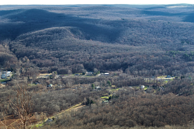
The trail is rugged and steep, on slick fallen leaves, so good footing is a must. I quickly gained elevation, and a nice through-the-trees view of Lambs Hill tot he south.
A descent brings you to a pretty stream crossing, before another steep climb up Lambs Hill's ridge.
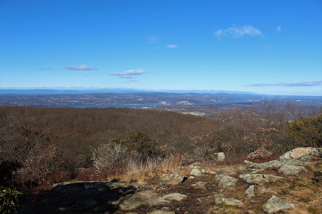
The next section of trail utilizes switchbacks to gain elevation, and after just over 1 mile of hiking, the first open views can be found. The view is NW and stretches all the way to the Catskills.
A closer look at the Hudson River, with the Shawangunks beyond, and the snow capped Catskills on the far horizon.
The open rock scramble up to the view.
The trail through this part of the hike is quite pleasant, with screened views almost the entire time.
Another sweeping viewpoint of the Hudson River valley to the west-northwest.
A great view of the Newburgh-Beacon bridge carrying traffic along I-84 over the Hudson.
After a brief ascent, the trail finally levels off at just over 1300 feet elevation, passing through abandoned orchards in a large, flat plateau area.
Rock walls line this flat section of the trail
After about 1000 feet of climbing and just before a trail junction, there is one more open vista to the NW to enjoy.
The view SW at the T intersection of the white blazed Fishkill Ridge Trail and the red blazed Overlook trail. I turned right here, leaving the red trail and starting towards the summit of Lambs Hill.
A relatively uneventful walk east along the ridge soon brings you to one last steep push towards Lamb Hill's summit.
Once atop the large rocky area, the woods drop off around you, and the trail heads up through an open meadow like area.
Ascending towards the summit area, where spectacular views are to be found.
From just below the summit, a look back SW towards North Beacon Mountain(Left-with its radio towers) and Lamb Hill's SW summit knob(R). A close look provides a glimpse of the Beacon Reservoir just to the left of North Beacon's summit.
Amazing views from an open area, just yards off the summit.
The trail climbs up to the true 1490 foot summit rock, with views just over the tree tops.
I continued along the white blazed trail SE off the summit, soon arriving at another trail intersection, this area known as Dozer Junction(presumably because of the large bulldozer found just yards away from the junction).
I continued on the white blazed trail, where a brief ascent brought me back up to more great views, this time looking directly above at the NE section of Scofield Ridge.
Beyond Scofield Ridge to the SE.
Nearing an open ridge on the far eastern part of Fishkill Ridge.
Continuing north along the ridge, I soon arrived at my favorite spot of the entire day. A wide open field with incredible views.
Directly below to the NE sits a large quarry and man made body of water.
Looking steeply below to the east at traffic rushing along on Route 9.
There is an array of spectacular vistas to be had from this location. While not the true summit, this spot is not to be missed.Looking to the north at Bald Hill's summit ridge.
Beginning my descent, with one last awesome view back to the SE. Ninham Fire Tower can be seen way off in the distance if you look carefully.
After a small drop, there is one more final, rocky climb up to Bald Hill's summit ridge.
From an open ledge just off the trail is a very nice view SE over Route 9 towards North Highland.
The wooded summit of Bald Hill sits just off the trail.
I found the summit marker for Bald Hill along the trail a bit further along, in an obvious lower location.
I descended north a short distance beyond the summit, soon arriving at a nice view to the north towards the village of Fishkill and into Dutchess county beyond. Honness Mountain is the small peak hovering directly over I-84 in the center of the picture.
Followed an unmarked trail all the way back to the car, cutting out a lot of mileage on the return, being extremely cautious on the slick fallen leaves. Hiked about 6 miles total, with 1800 feet of elevation gain.


No comments:
Post a Comment