After some steep climbing, I stumbled across a small fire pit located in a hemlock grove. Kind of seemed like an odd place to set one up, but it wasn't that far from the trail(or road) so wasn't all that shocking.
The dark softwoods soon gave way to open hardwoods, with some fall colors mixed in, especially in the underbrush.
The foliage is coming along quite nicely in spots and made for very pleasant conditions.
As I quickly gained elevation on the steep slopes, I circled around to a small set of ledges at about 1450 feet on the NW slopes, offering up some very nice framed views of the Catskills and Columbia County farmland.
I found the hiking to be very nice, with a lot of oak trees and sedge grass.
As I slowly made my way around to the south, I enjoyed many filtered views SW towards nearby Washburn Mountain.
There were a couple of good clearings with unobstructed views to the south and west, with Washburn(L) and the Copake countryside to the right.
I hugged the south slopes of the peak, where the terrain was the steepest, in hopes of finding some cliffs. As I climbed up and over 1750 feet, I found the beginnings of an impressive set of cliffs.
I climbed up to the top of the cliffs and then tried to make my way down to the ledges, but they were guarded by some gnarly mountain laurel, so the going was tough. I pushed my way down to several open ledges, where the views were almost a full 180 degrees. Absolutely spectacular! West facing views towards Copake Falls.
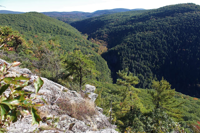
The jaw dropping view of the day goes to the view down into the Bash Bish Falls gorge! Wow!!
A neat look at the ledges from a spot just below them. These were tough spots to get to, with a vertical drop off only a few short feet away.
After enjoying the cliffs and ledges that literally go right up to the state line, I finally turned back, heading back down a slightly different route. For the descent, I tried to hug the steep southern ledges further down the mountain and find some more views. At about 1600 feet I lucked out, pushing my way through a thick stand of mountain laurel to a small clearing and viewpoint to the south to the deep saddle between Bash Bish Mountain(L) and Washburn Mountain(R).
From the same vantage point but looking due south, Bash Bish Mountain rises steeply above the Bash Bish gorge.
Enjoying one more nice view to the SW into southern Columbia County.
I took my time descending the steep slopes, enjoying what the mountain had to offer. A very enjoyable off trail adventure on a picture perfect early fall afternoon. 3 miles RT with 1200 feet of ascent. Unfortunately the summit sits just beyond public land, so I didn't hit the top.
My route below.
Black=Ascent Blue=Descent Red=parking


No comments:
Post a Comment